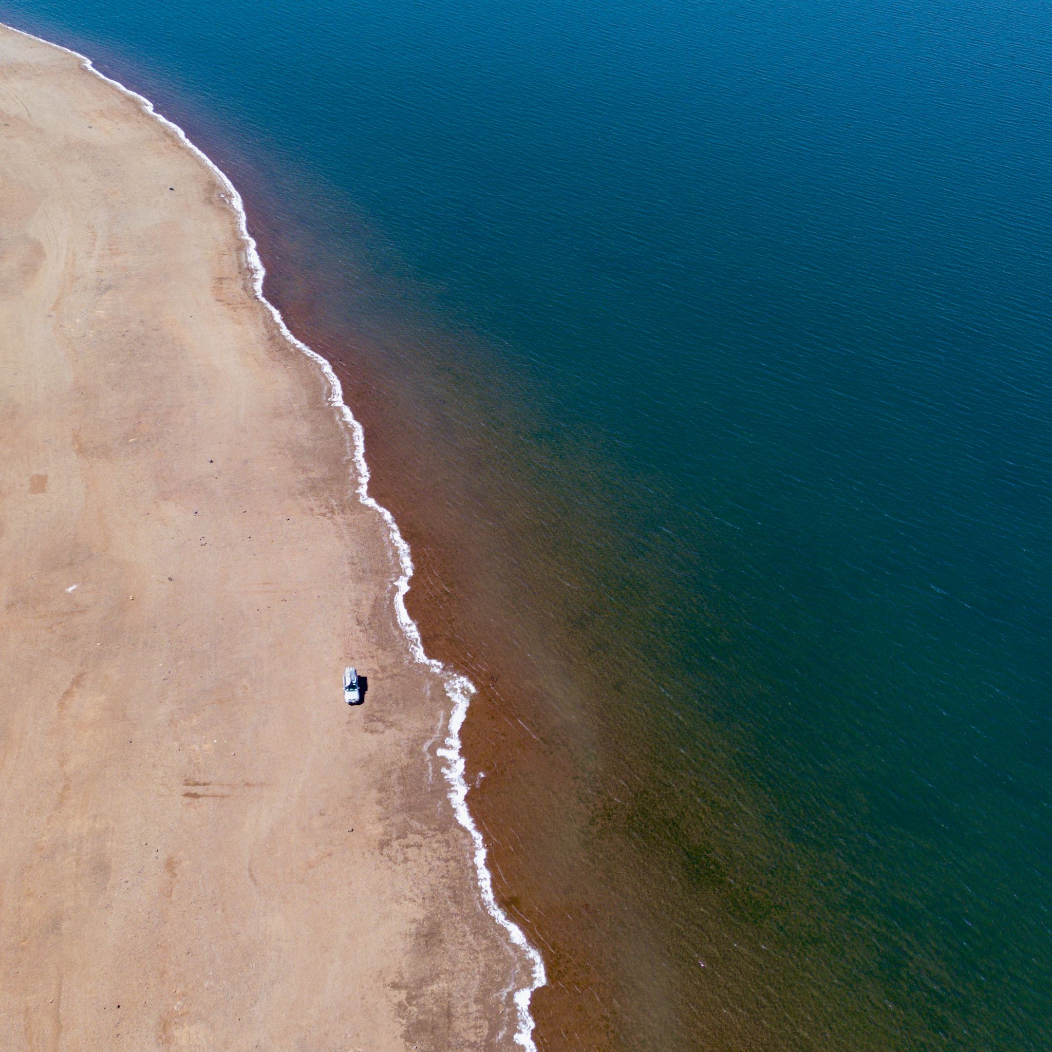
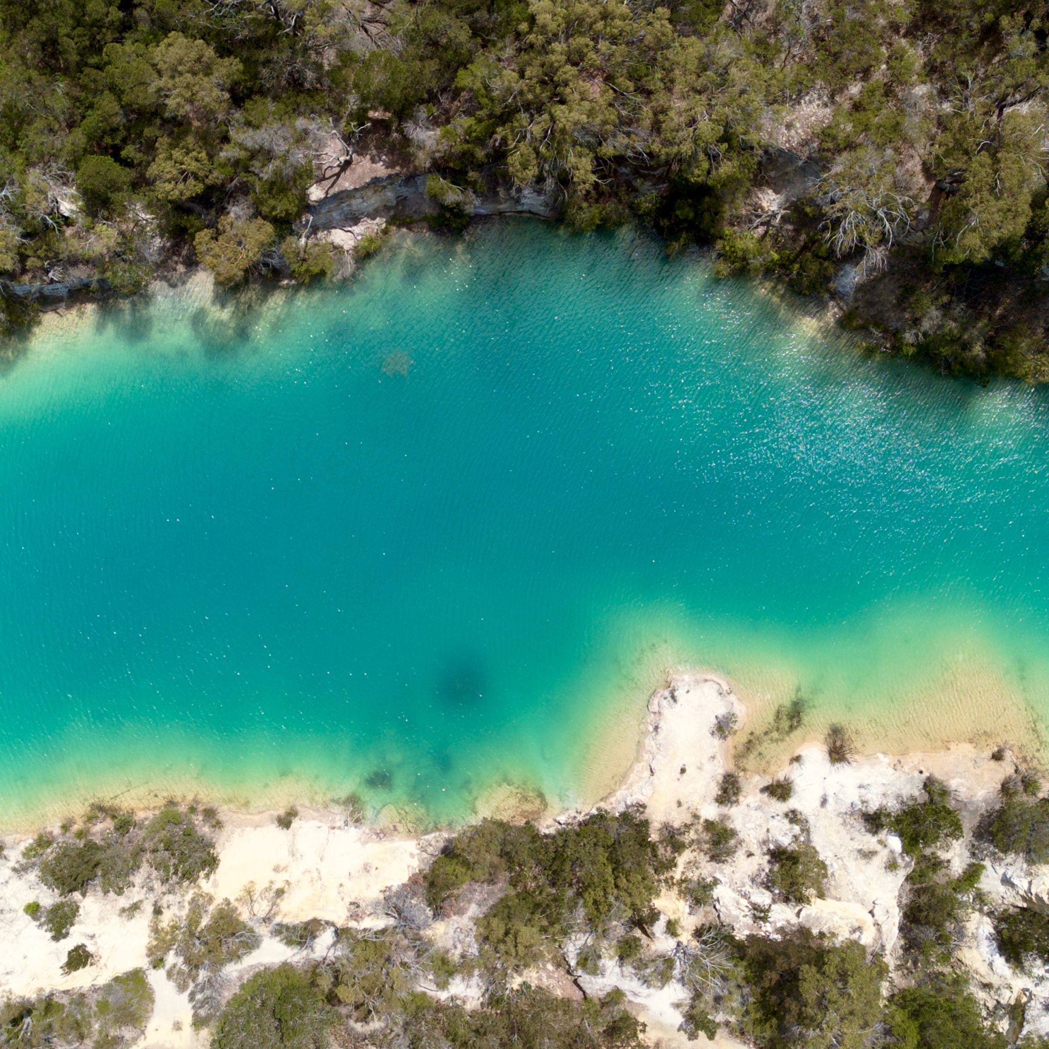
CORAL BAY, WA
KM 36,979
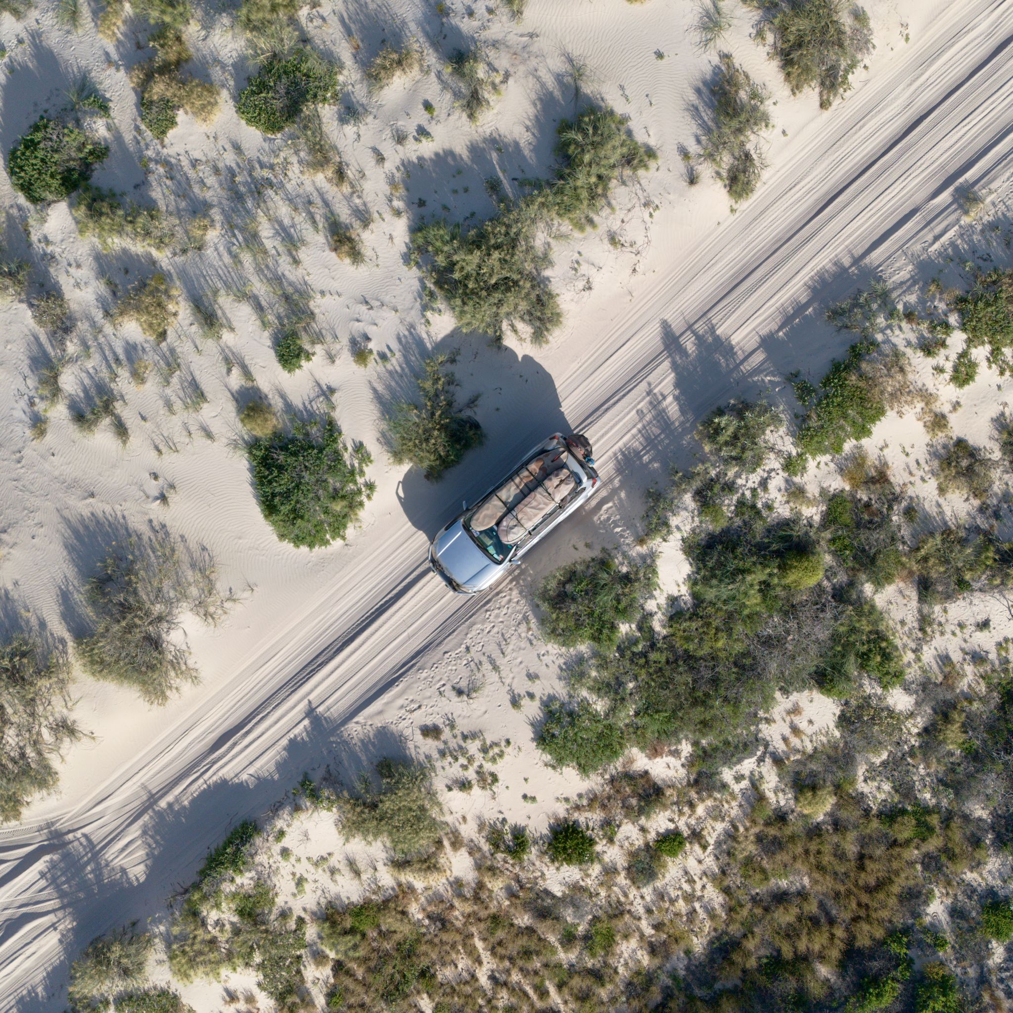
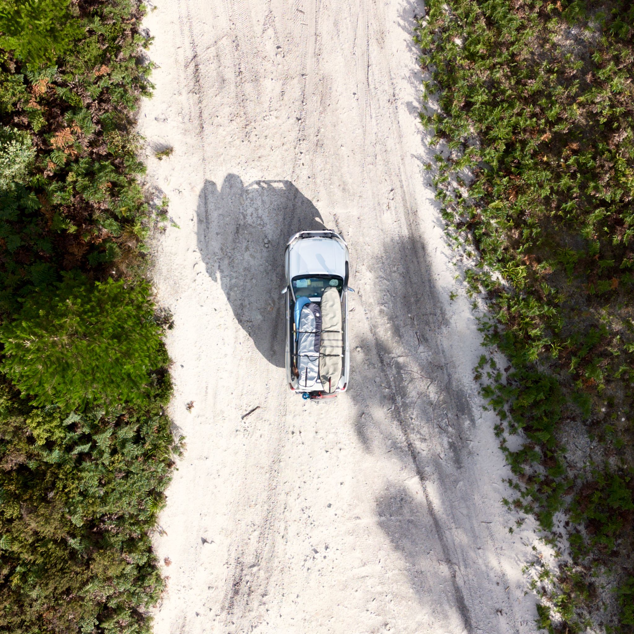
Leaving Exmouth behind, we follow the coast south to Coral Bay. We bypass the touristy town, its caravan parks, and its reef excursions for a more secluded spot. Sand dunes surround the area. A hidden track through soft sand leads us to a secret beach. We have the whole place to ourselves and get to swim with sea turtles.
EXMOUTH, WA
KM 35,750
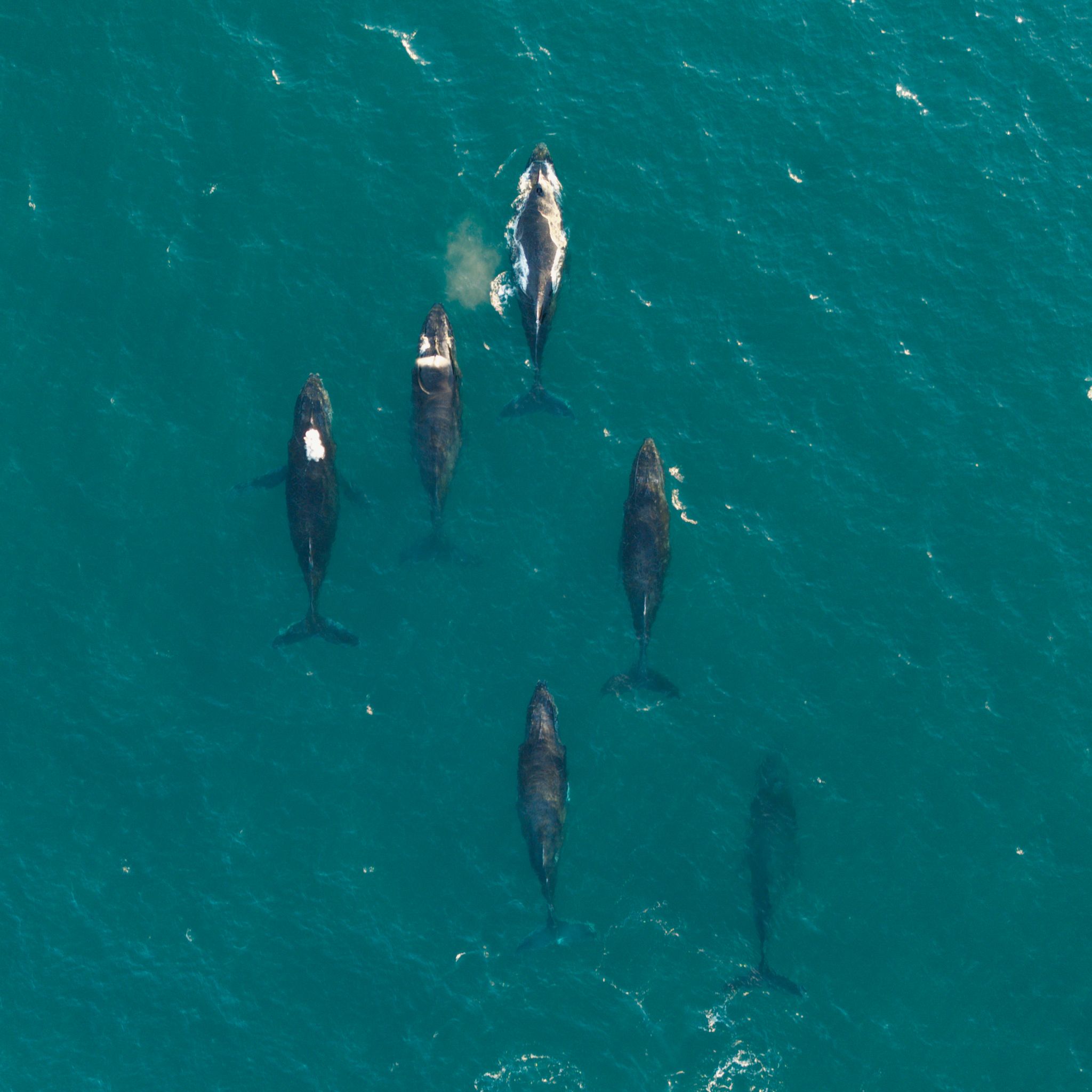
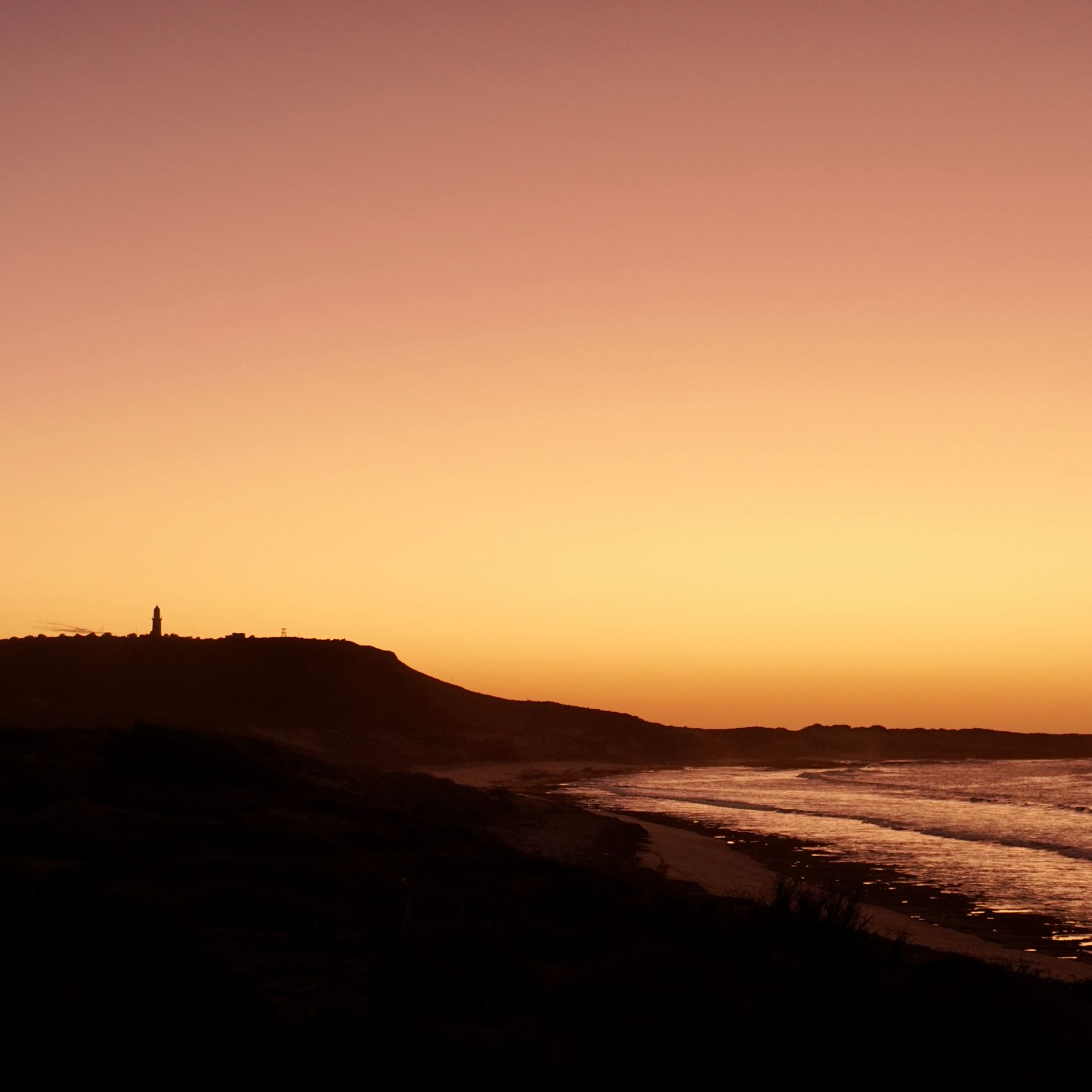
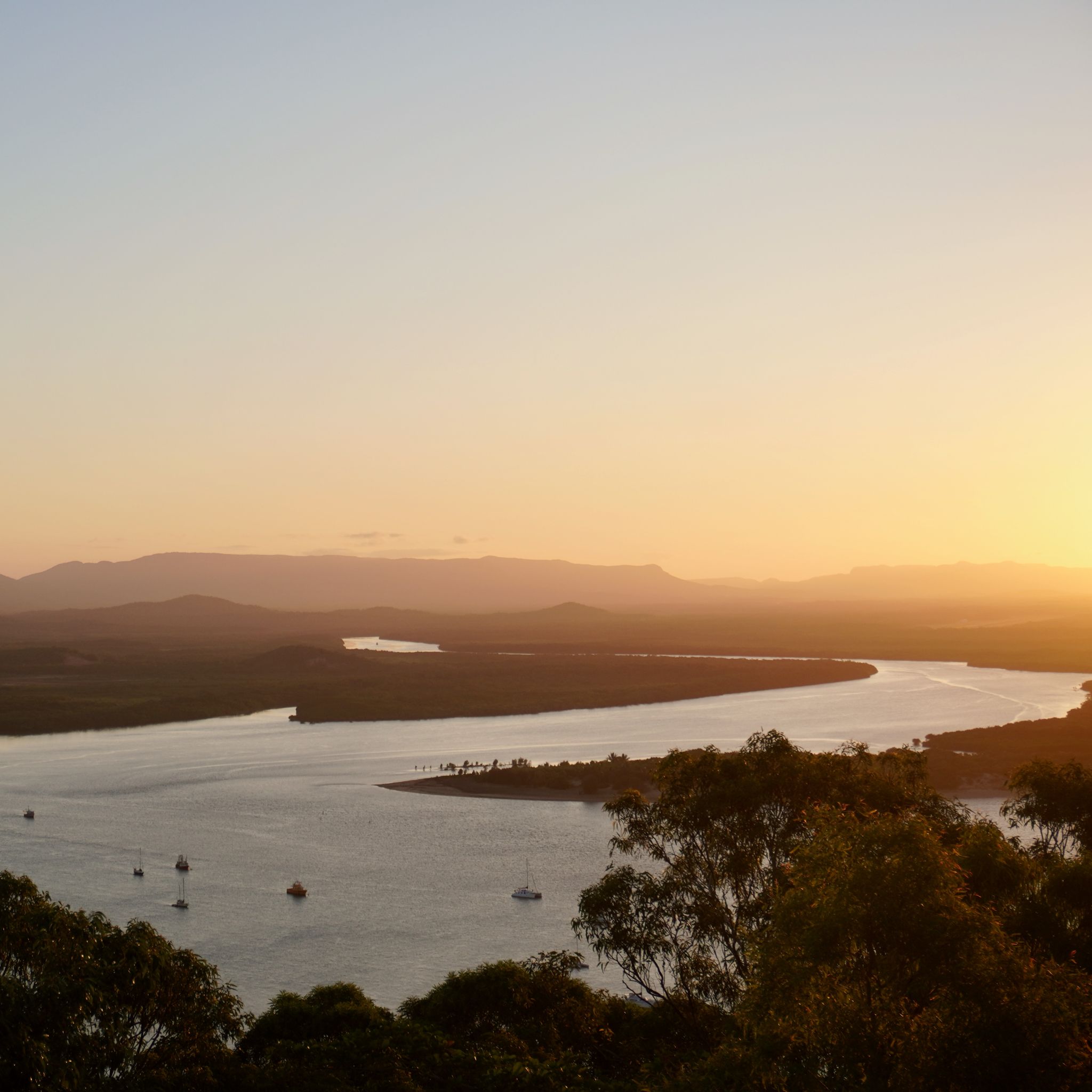
Last day in Exmouth. We finally decide to reach the Charles Knife viewpoint, where the dramatic canyon slices through the mountains to reach the ocean. As the sun begins to set, we dash to the lighthouse for a final look at the entire peninsula. The Harold Holt transmitter stands out amidst the rugged landscape. In the distance, beyond the reef, humpback whales put on a show, adding a touch of magic to our farewell.
EXMOUTH, WA
KM 35,173
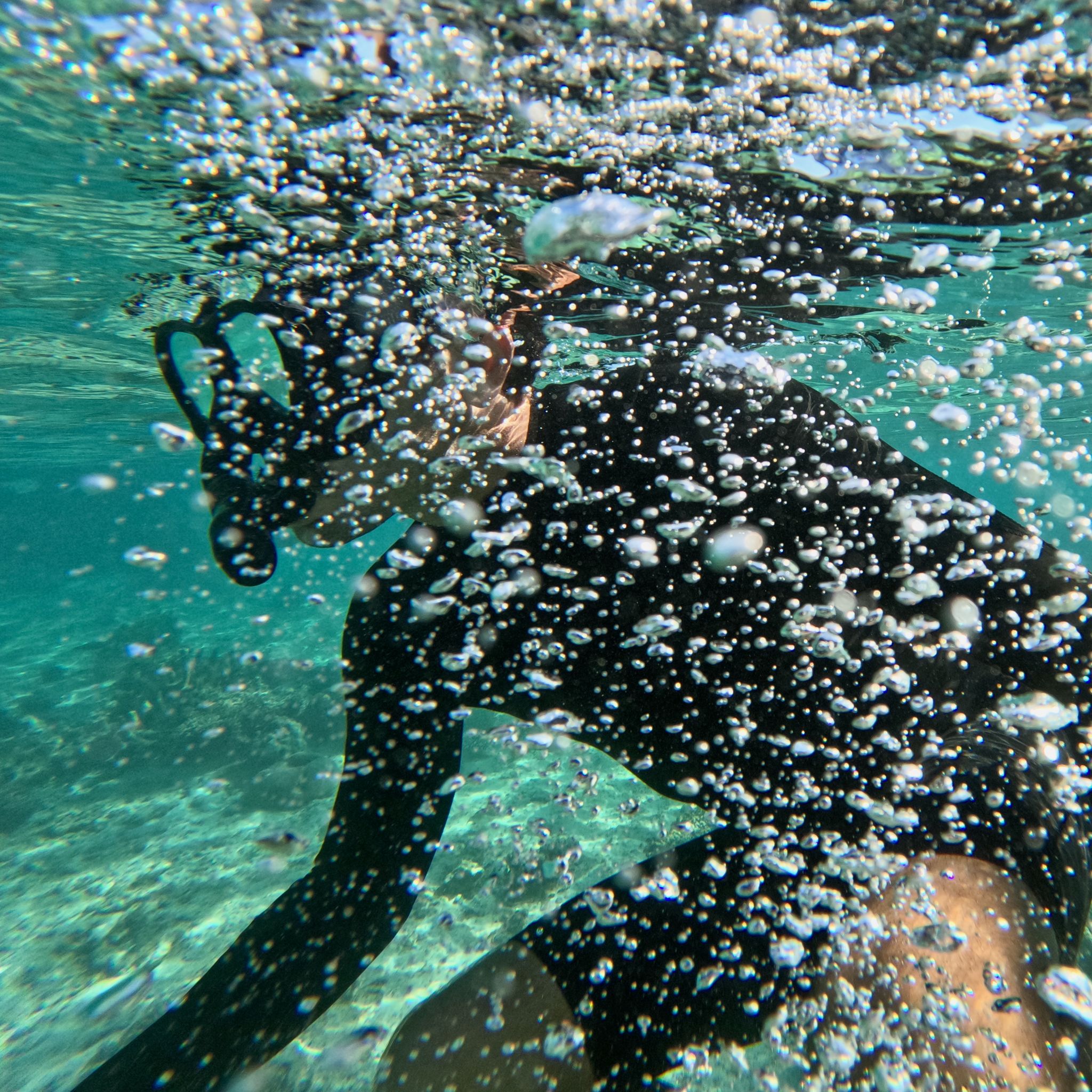
The excitement builds as we prepare for a snorkel. First stop, Lakeside, where strong current push us along the coast, following schools of colourful fish. Further south, Turquoise Bay, where the visibility is crystal clear and the coral vibrant. As night falls, we prepare to set up camp in the National Park. To reach our spot for the night, we must cross 300 metres of soft sand—and, of course, we get bogged right in the middle!
EXMOUTH, WA
KM 34,866
At last, the moment we've been waiting for. Surf’s up! We pull the boards from their dusty covers, a thick layer of red dirt coating the fibreglass. We're lucky to catch the last pulse of swell that's been hitting the area for the past week. The waves are perfect, and we waste no time paddling out.
BULLARA STATION, WA
KM 34,701
The sun beats down upon the dusty road. Through the dirty car's windows, a patchwork of red dirt and sparse vegetation stretches as far as the eye can see. The AC blasts but it does not stop us from sweating heavily. At last, we discern the gates of Bullara Station in the golden light of the late afternoon. The sight of the sunny terrace and the promise of a cold beer is enough to make us forget the long journey.
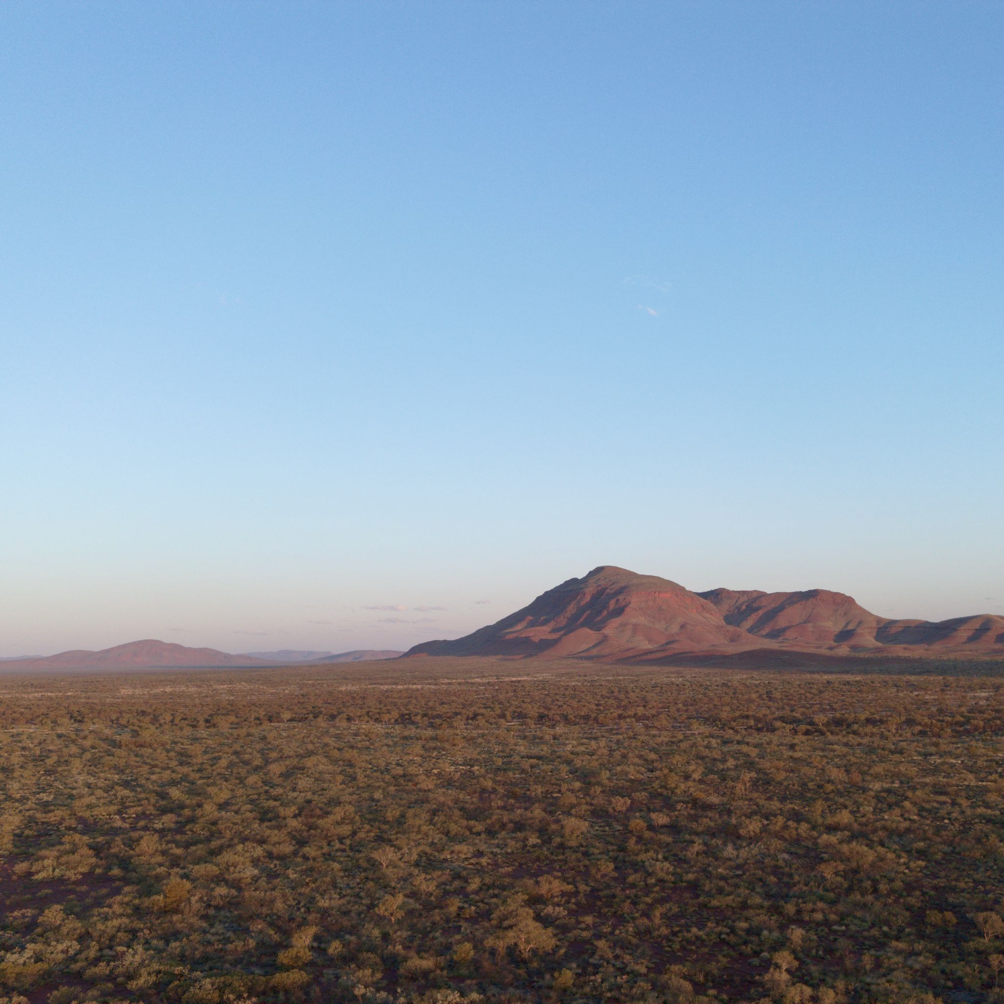
KARIJINI, WA
KM 34,082
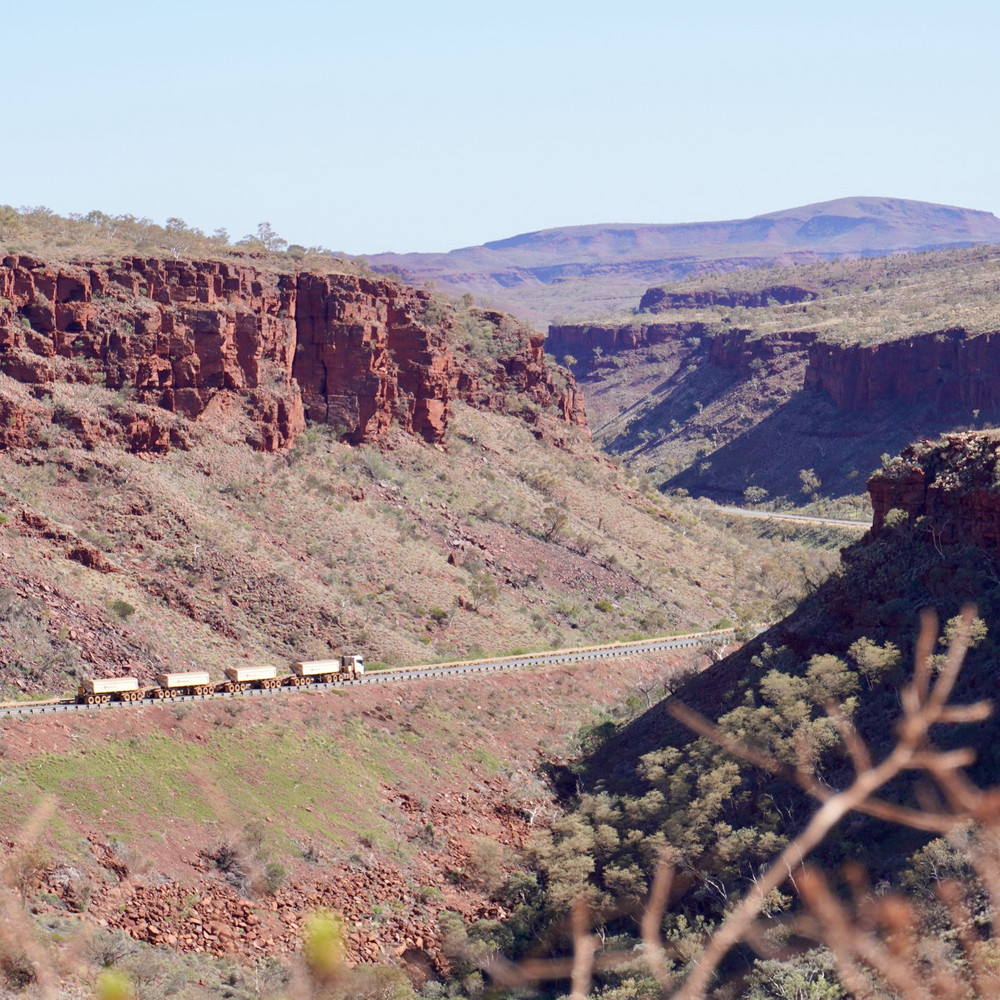
We journey through Karijini National Park in the Pilbara, where silver-rich mountains dominate the landscape. Road trains rumble past, hauling ore to Port Hedland. Hidden below the horizon, water flows through the many gorges and canyons of the area. One of the trails descends into a ravine, flanked by rocky red walls. We follow the river, chest-deep in the cold water, to reach the rock pool ahead.
BROOME, WA
KM 32,864
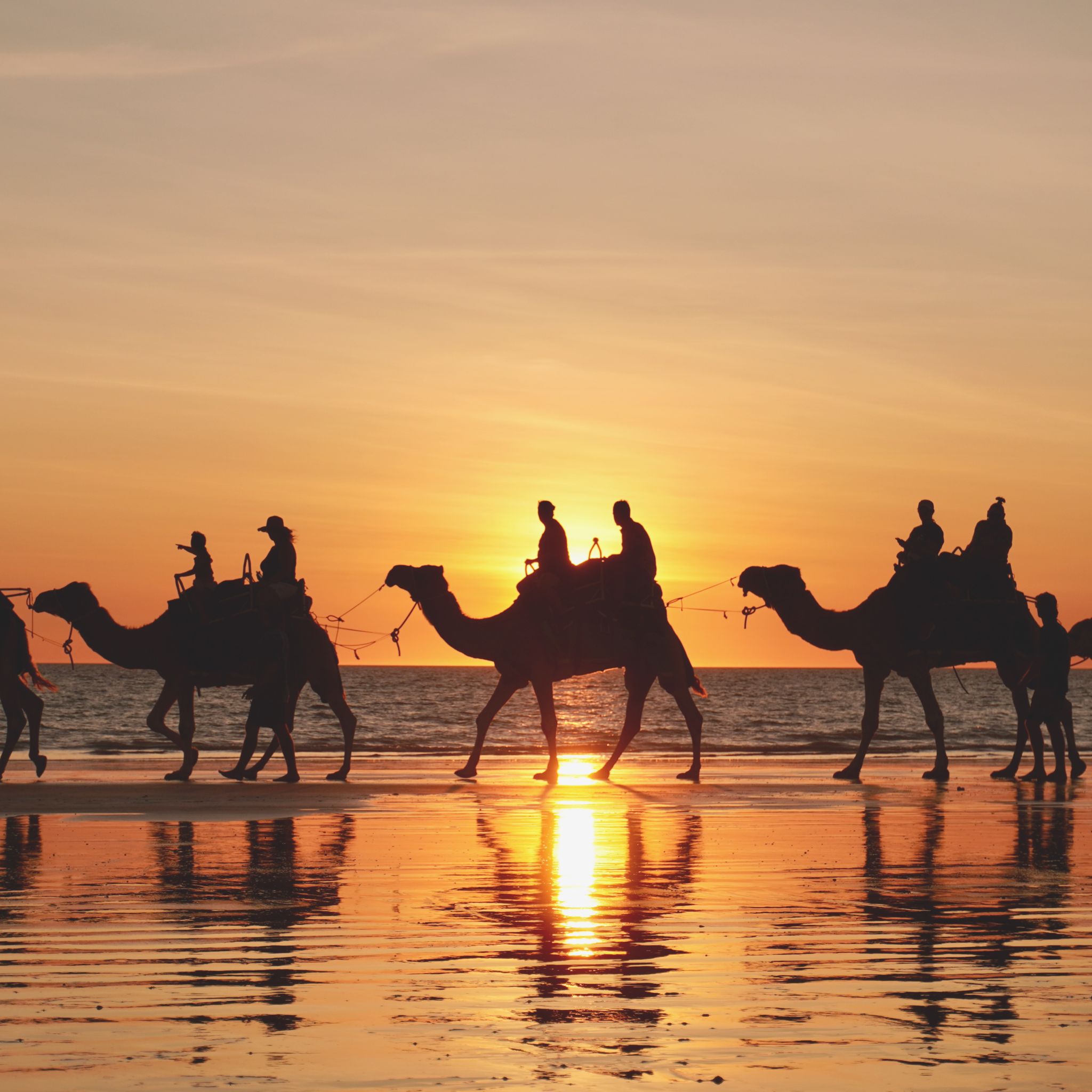
We reach Broome in the early afternoon and head straight for Cable Beach. The warm waves wash over us for our first ocean swim since the East Coast. At Gantheaume Point, where the red pindan cliffs meet the sea, we search for the fossilised dinosaur footprints. The sun starts to set and the sky transforms into a canvas of vibrant colours. Camel tours stroll along the rising tide, casting elongated shadows on the sand.
DAMPIER PENINSULA, WA
KM 32,269
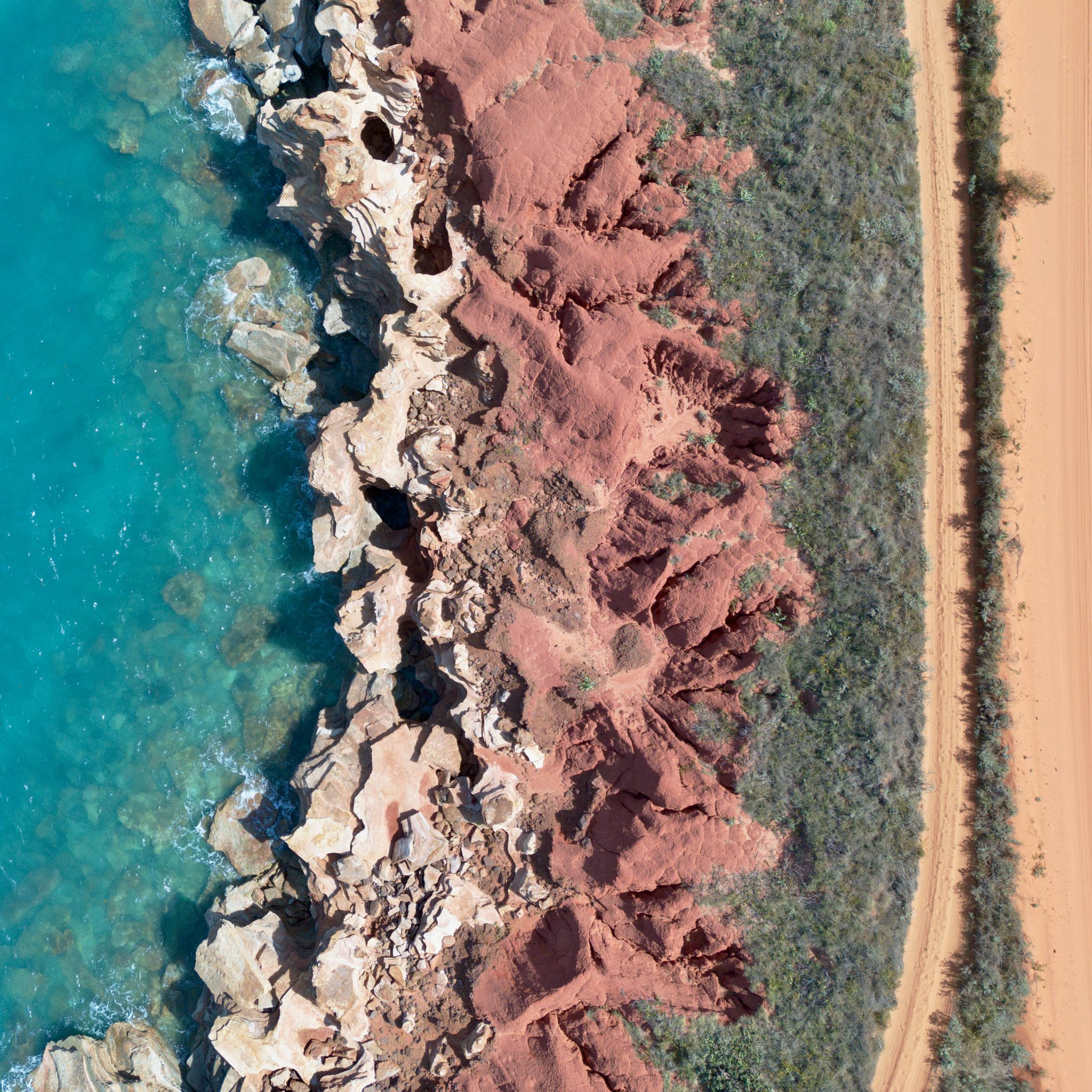
The cliffs are bright orange and the water deep turquoise. A light breeze creates white crests on the otherwise calm sea. Scattered green shrubs separate the dirt road from the littoral. The colours and the scenery are too perfect to feel real. It seems as if we were in a retouched photography taken directly from a touristic brochure.
DERBY, WA
KM 32,014
Tall boabs greet us as we arrive in Derby. These bulky trees are abundant throughout the town. They line the wide streets, adorn the gardens, and overlook the shoreline. Their fruits drop heavily to the ground with a soft thud, and we eat the tangy seeds contained within. And after weeks spent inland, we finally catch our first glimpse of the Indian Ocean from the jetty.
WINDJANA GORGE, WA
KM 31,812
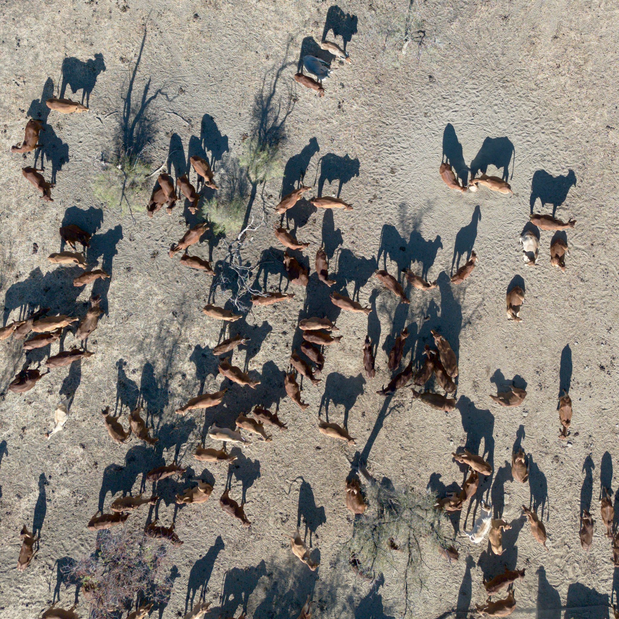
Forward on the Gibb River road. The last stretch no longer feels as remote as it once did. Here and there, we catch glimpses of the stations lining the roadside. Their entrances are marked by oversized tractor tyres cut in half, simple wooden signs with names engraved, or barrels of oil with faded paint. Oblivious to the flow of cars, trucks, and caravans, the cattle graze in their vast fields. In the distance, a cowboy rides his horse.
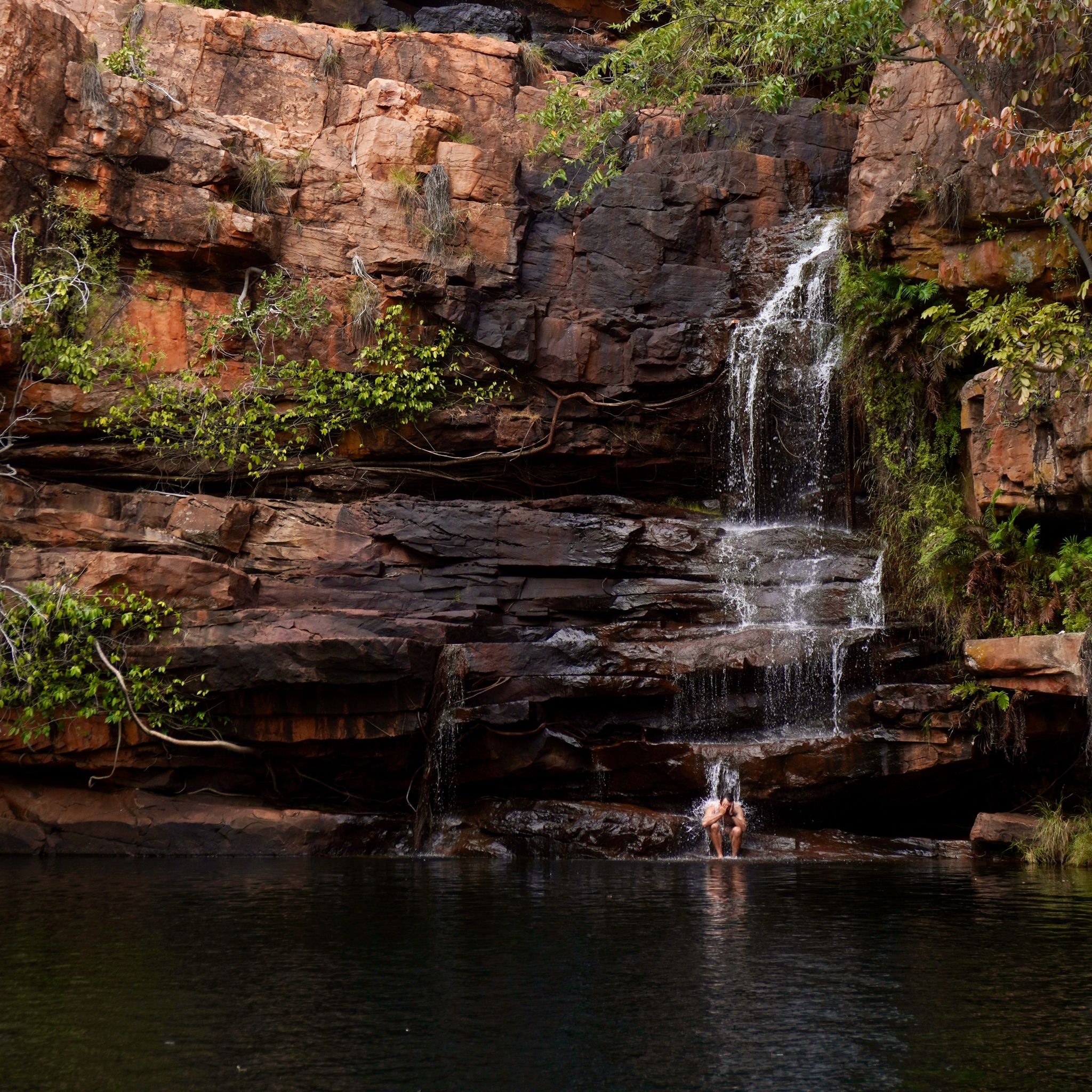
BELL CREEK, WA
KM 31,613
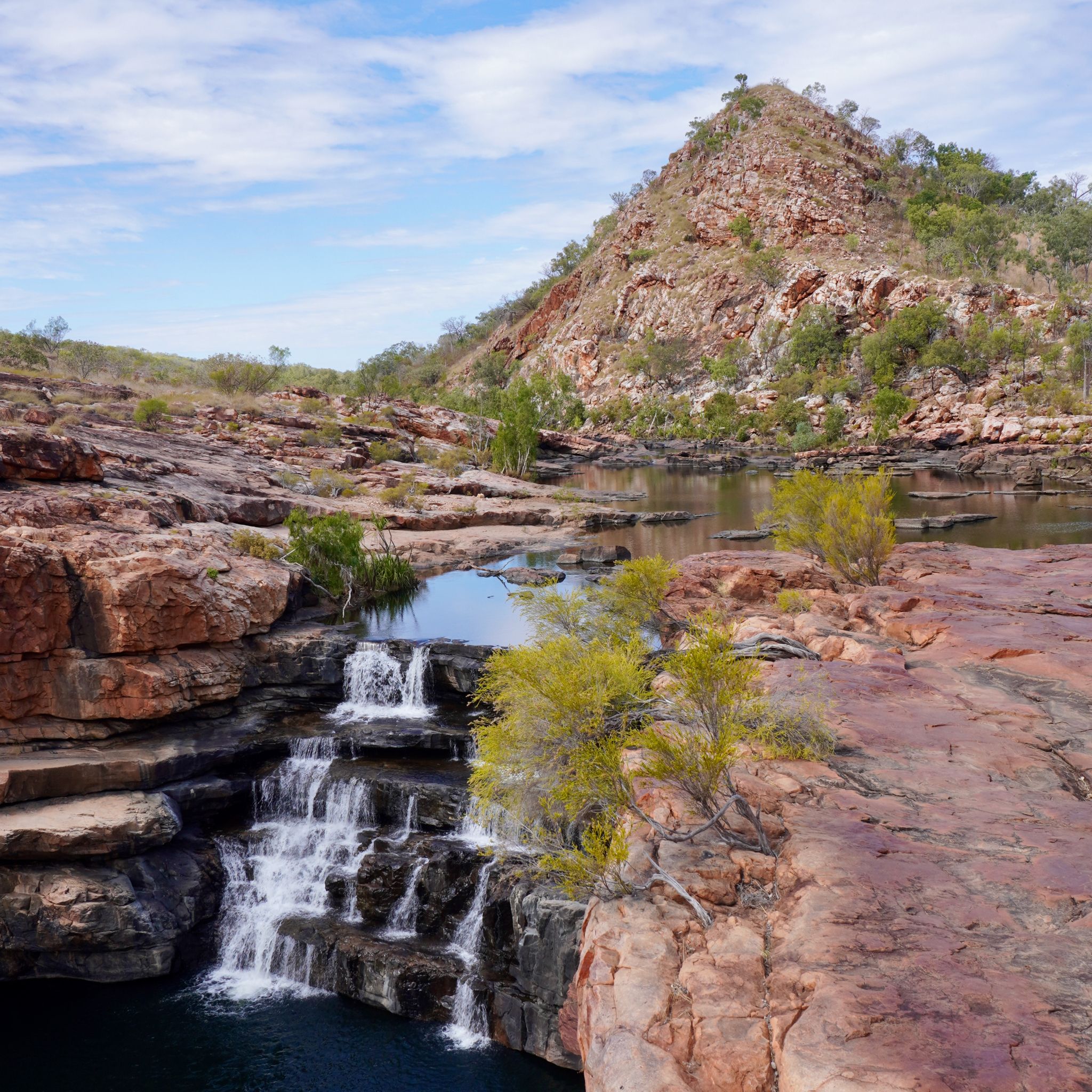
The landscape is bare, hostile, punctuated only by a few water sources scattered across the outback. The rivers, gorges, and creeks provide welcome stops after driving on the corrugated roads. At Bell Creek, the shallow river suddenly drops over a rocky ledge, plunging into a wide pool 50 metres below. We must scramble down the cliffs to reach the swimming hole. Once in the water, it’s an easy swim to the base of the waterfall.
GALVANS GORGE, WA
KM 31,499
The Gibb River Road is one of the most famous overland trips in Australia. From Kununurra, it winds through the Kimberley region before reaching the coast at Derby. Over 600 kilometres of dirt road traversing through arid savannahs, cattle stations and low limestone mountain ranges. The first challenge is to cross the Pentecost river. Fortunately, it is pretty shallow at this time of year.
LAKE ARGYLE, WA
KM 30,785
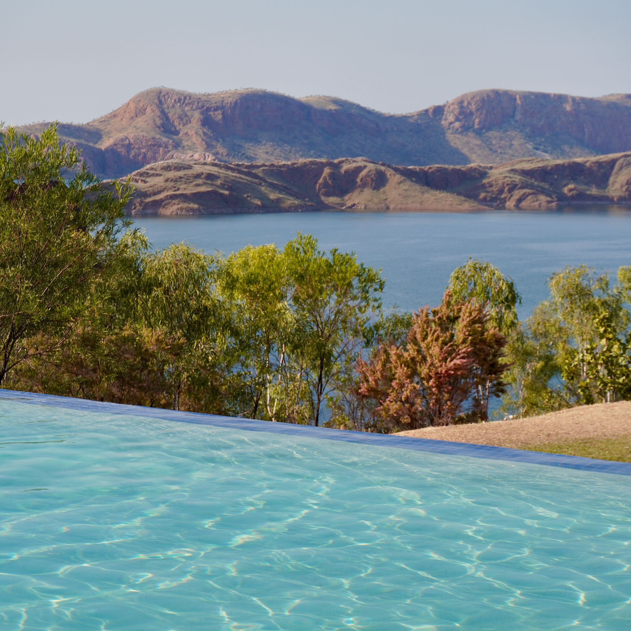
Lake Argyle feels like an oasis in the desert. The blue lake reflects the cloudless sky, surrounded on all sides by pink mountains. In the distance, a ute kicks up a cloud of orange dust. In the water, anglers prepare their boats for a fishing adventure. Meanwhile, in the pool overlooking the lake, we watch the sun go down, mesmerised by the changing colours.
KUNUNURRA, WA
KM 30,664
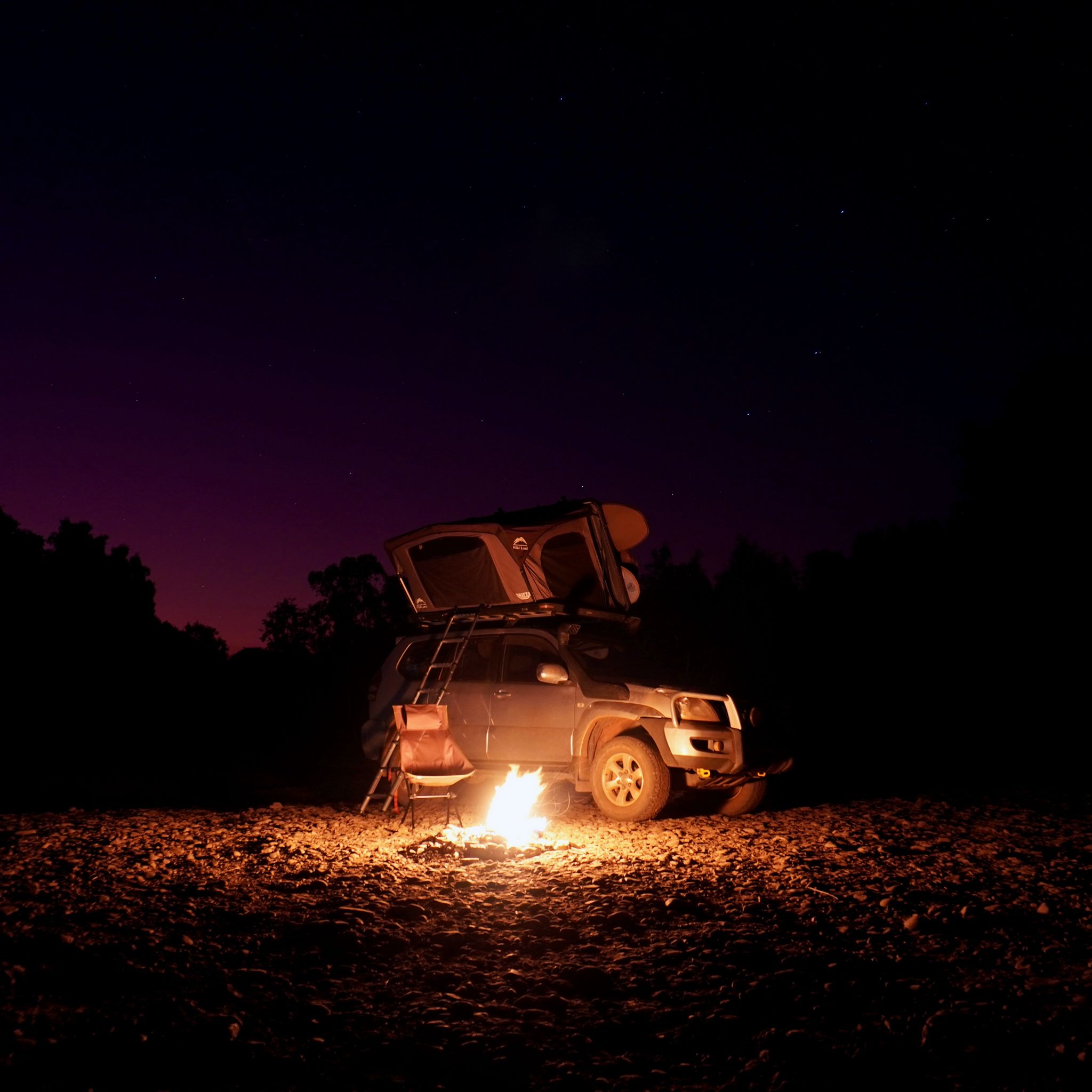
Leaving the Northern Territory behind, our journey continues westward. After a few days of driving, we cross the border into Western Australia. Kununurra is the first major town we encounter after entering the state. It’s a tranquil place with several mechanics and 4WD shops, perfect for equipping travellers eager to tackle the Gibb River Road. Tonight, we find a quiet spot on the banks of the Ord River to sleep under the stars.
UBIRR, NT
KM 29,643
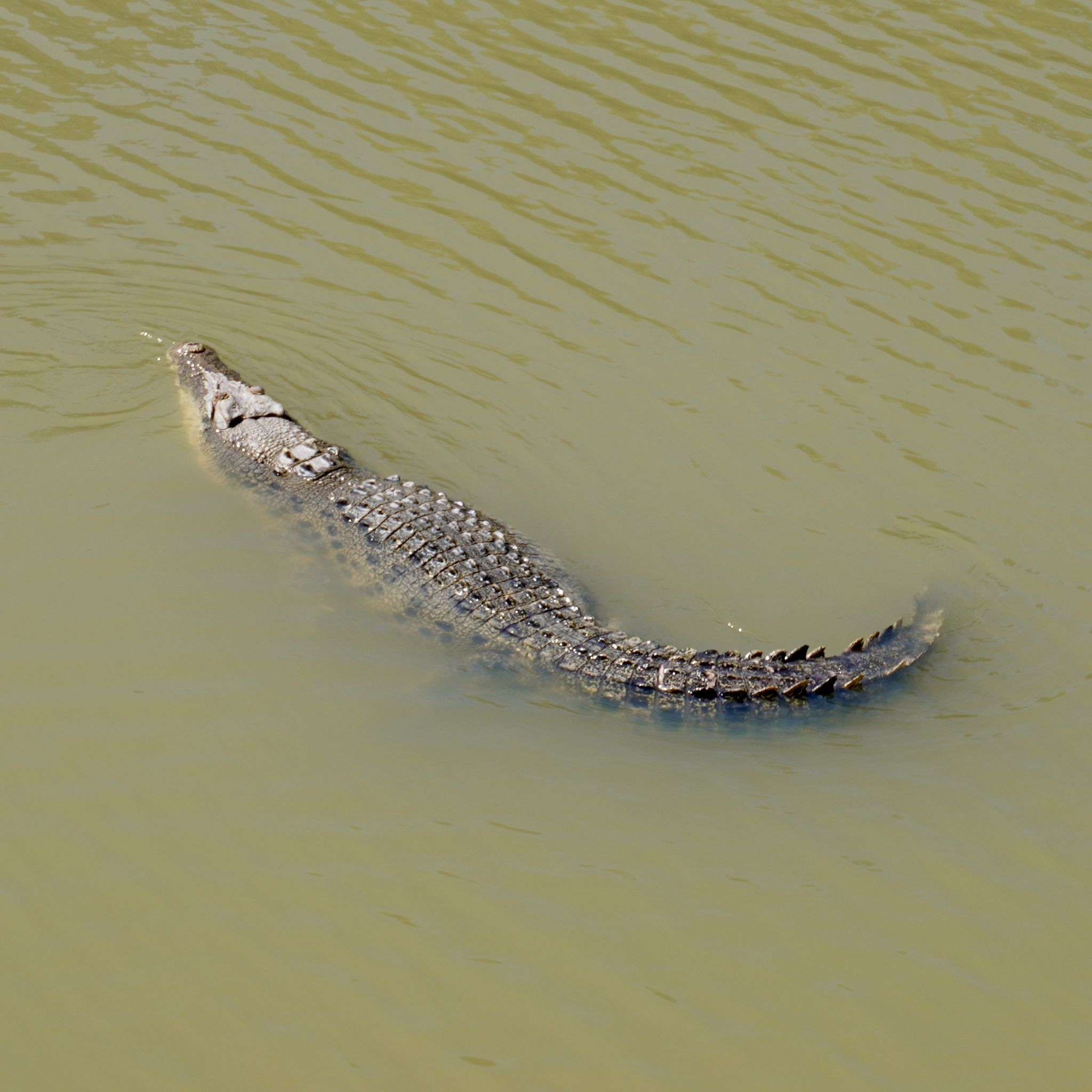
The area is aptly named the East Alligator region. We are deep in croc territory and must remain vigilant at each water crossing. Often, we wonder whether the brown shapes floating on the water are merely logs or something far more dangerous. But this time, there can be no mistake. A large saltwater crocodile, nonchalantly drifting in the murky waters, is preying on something, and we hope it is not us.
UBIRR, NT
KM 29,629
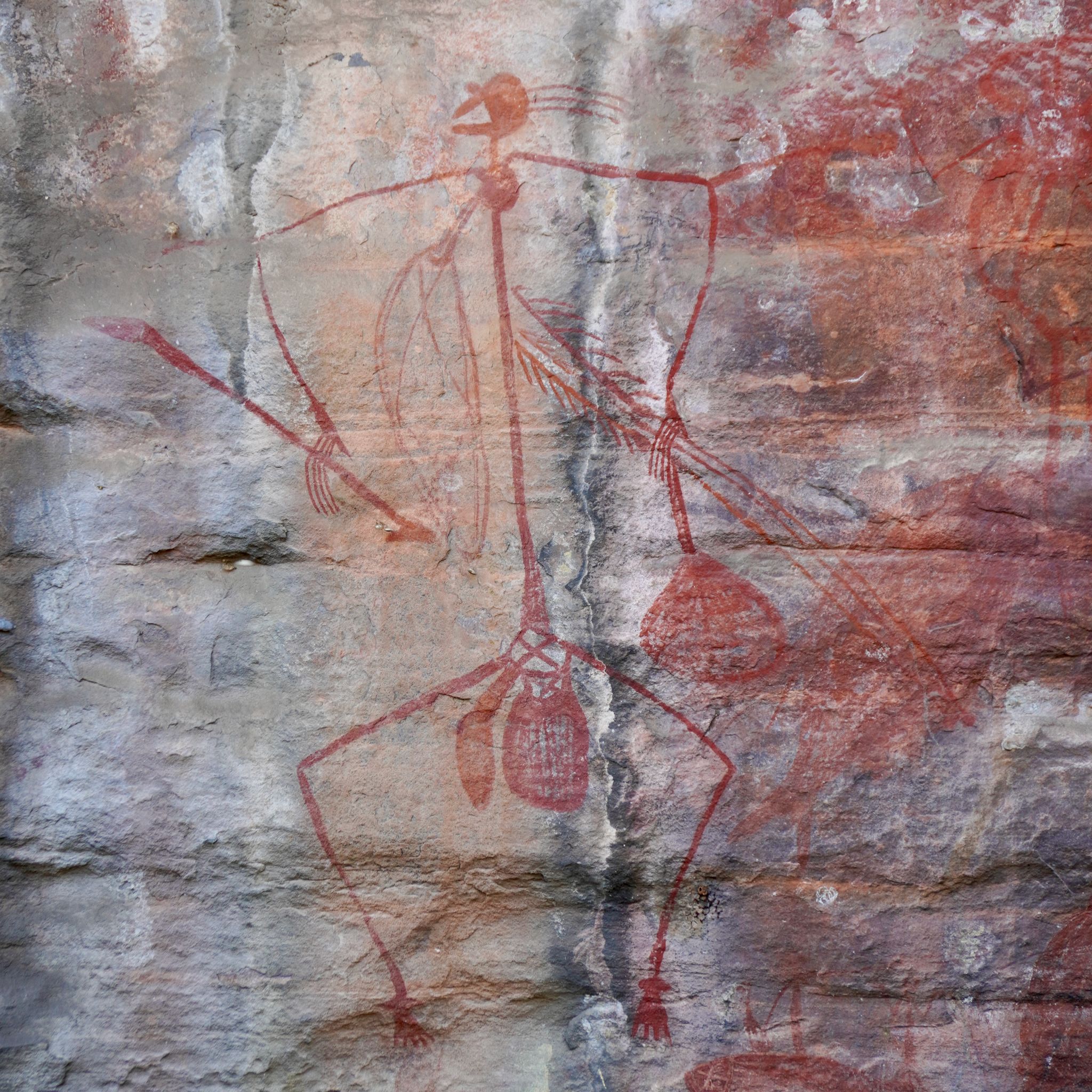
We distinguish colourful patterns on the rocky edges of the natural shelter. The shapes come to life when we get closer. Various animals, fantastical creatures, and human figures are depicted on the walls. For more than 2,000 years, they have been used by the elders to record history, tell stories, and teach younger generations. The ochre pigments withstand the passing of time without losing their brightness.
LITCHFIELD NATIONAL PARK, NT
KM 29,035
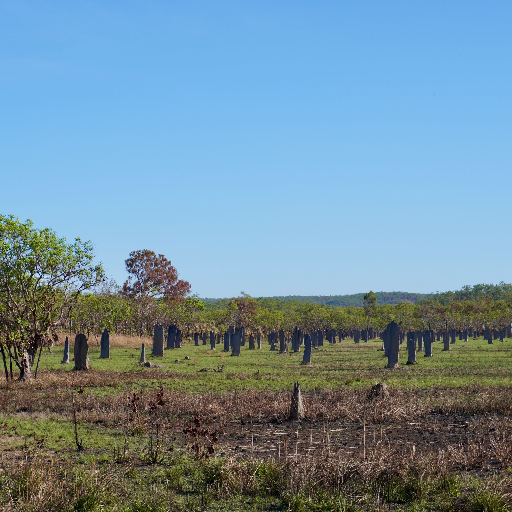
As we drive through the driest parts of the country, we see pop up on the plains tall mud towers. These are termite mounds, hosting colonies of millions of insects. It’s hard to gauge their size from a distance, but as we get closer, we realise that some of them are well over three meters tall. The most spectacular are the ones built by magnetic termites. They get their name from the thin mounds they create, all pointing north.
LITCHFIELD NATIONAL PARK, NT
KM 28,857
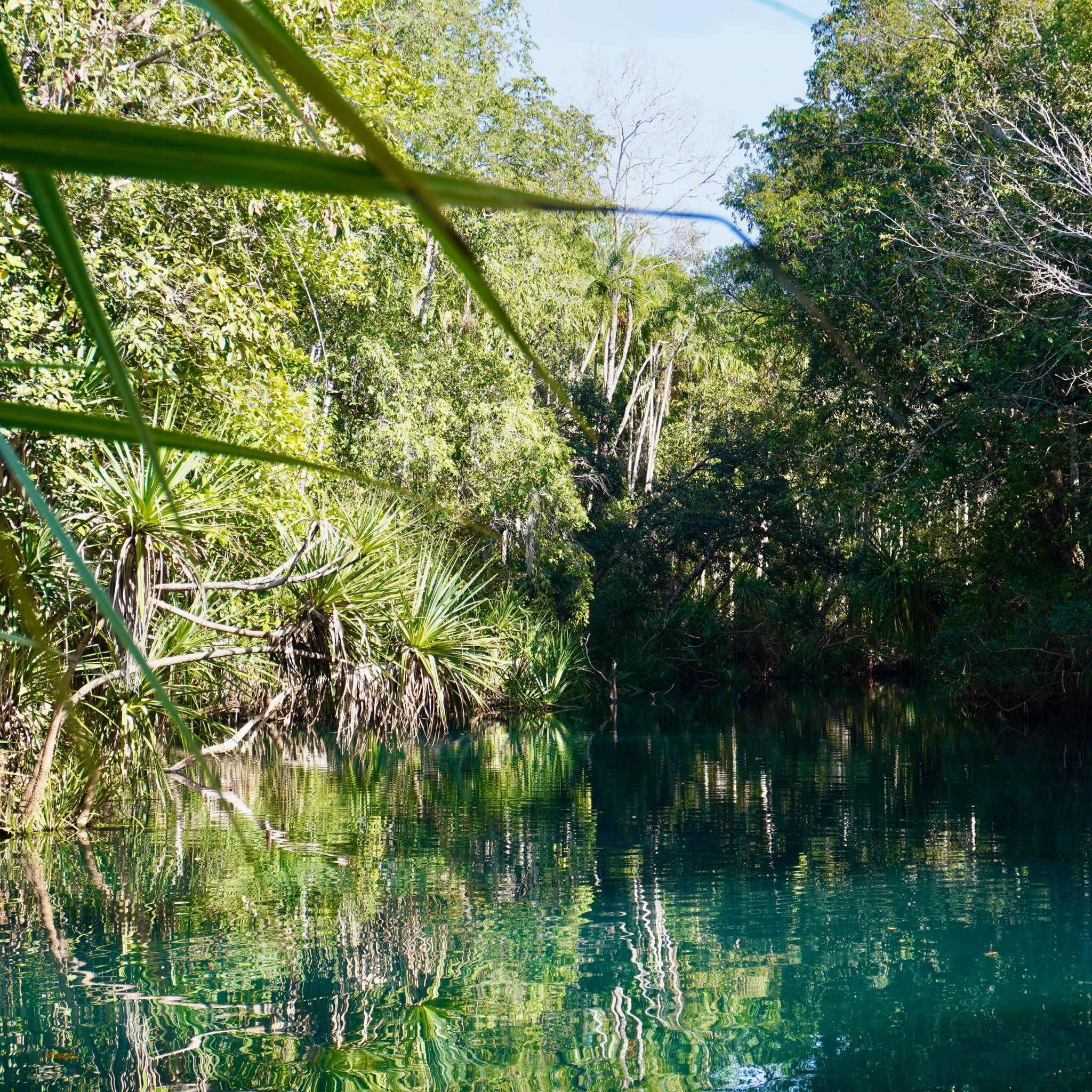
The blue water of Berry Springs flows quietly between the pandanus palms. The river’s curves create three natural pools that spread the influx of visitors. And on a hot afternoon like today, many come here to cool down. It is also one of the few croc-safe swim holes in the area. How good it feels to jump in and let the slow current carry you downstream from one pond to another.
MINDIL BEACH, NT
KM 28,802
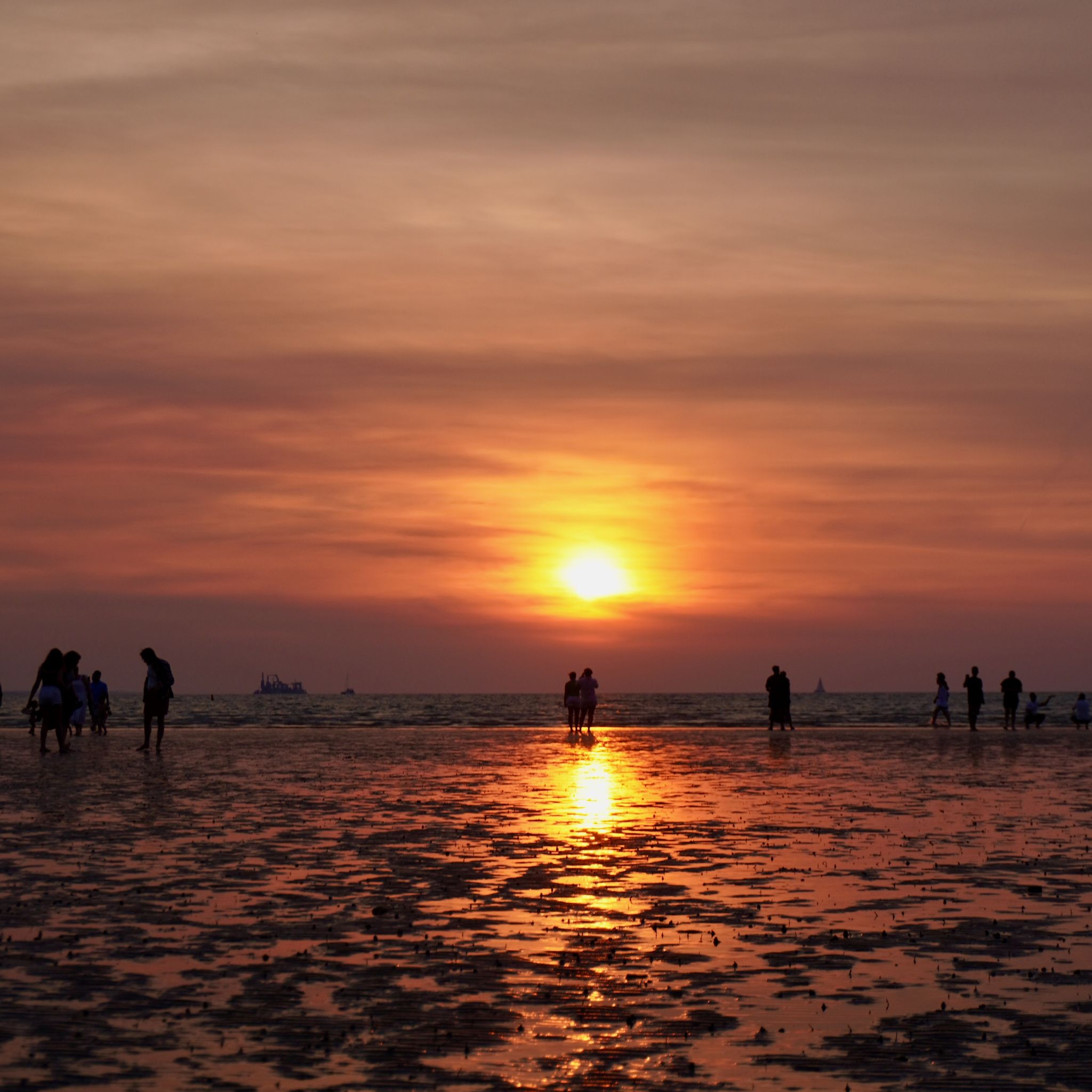
On a Sunday evening, all of Darwin comes together at Mindil Beach. The night market draws in tourists and locals alike. The esplanade is lined with live music, handmade jewellery, artisan products and hundreds of food stalls. After months of eating in the back of our car, we can't resist treating ourselves. We pick up a pizza and a lamb curry, which we enjoy on the sand while watching the sun dip below the horizon.
DALY WATERS, NT
KM 28,071
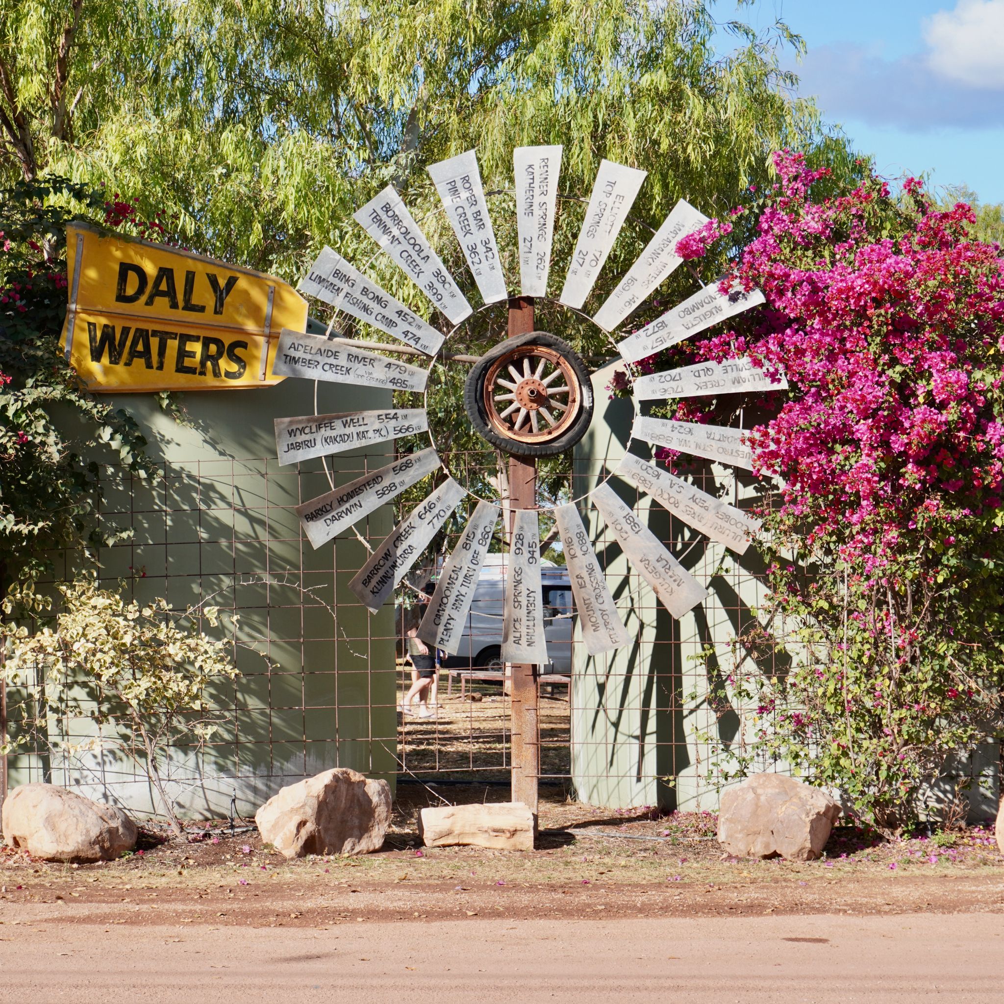
Far from everything, Daly Waters only has 55 inhabitants, but it boasts Australia’s most famous outback pub. Tonight, we are at least 200 sitting in the beer garden, curious to understand what this fame is about. Oxen, horses, and donkeys roam between the tables while a folk band plays on stage. Behind the bar, colourful bras and banknotes are pinned to the walls. We can imagine the wild parties that take place here, far from everything.
DEVILS MARBLES, NT
KM 27,141
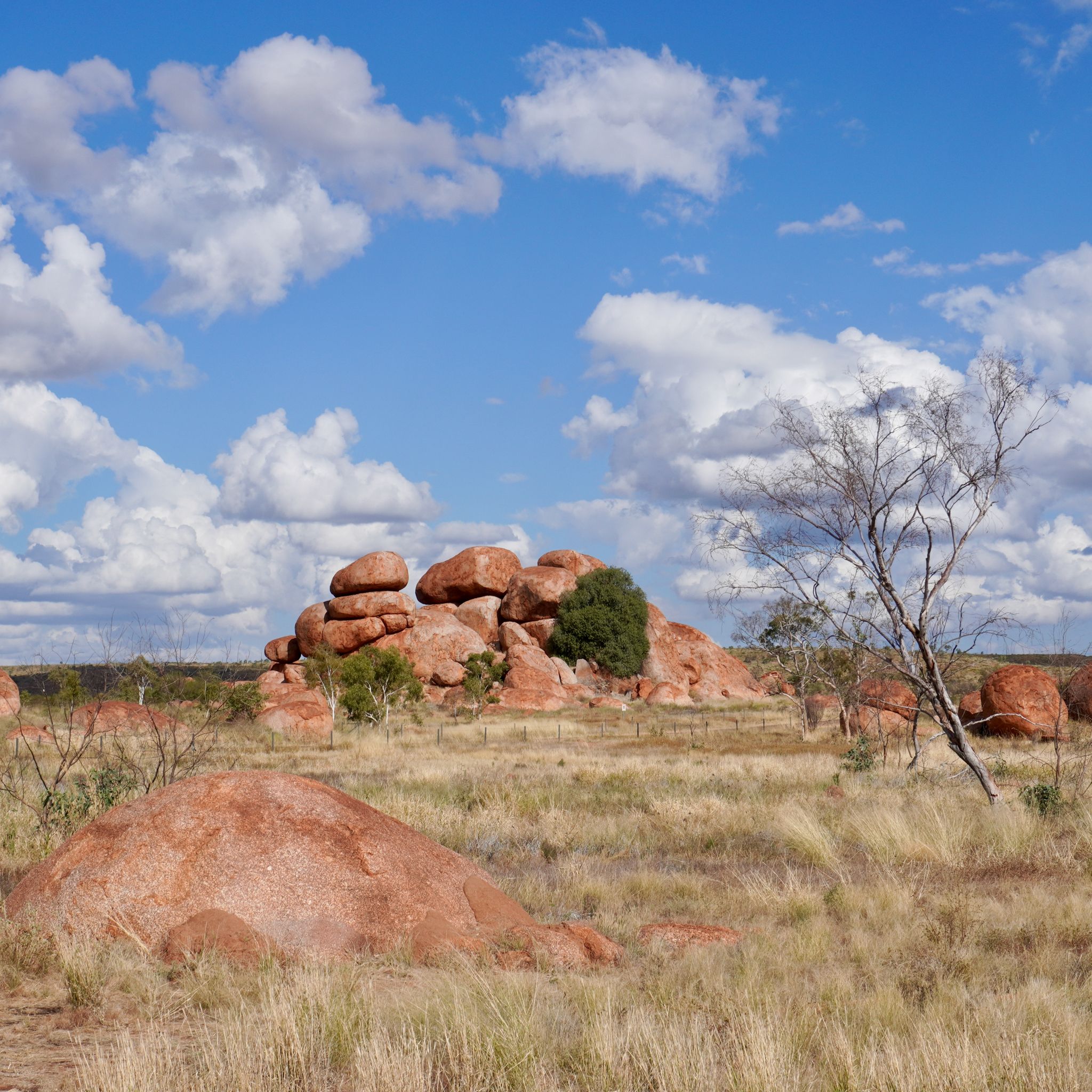
“This is the Devil’s country; he’s even emptied his bag of marbles around the place!” describes 1870’s explorer John Ross. The round boulders of Karlu Karlu, Devils Marbles, stand proudly. Hundreds of these rocks are scattered across the valley. They are precariously balanced, defying gravity, yet have remained here for millions of years. The custodians of the land believe they are the fossilised eggs of the Rainbow Serpent.
SIMPSONS GAP, NT
KM 27,141
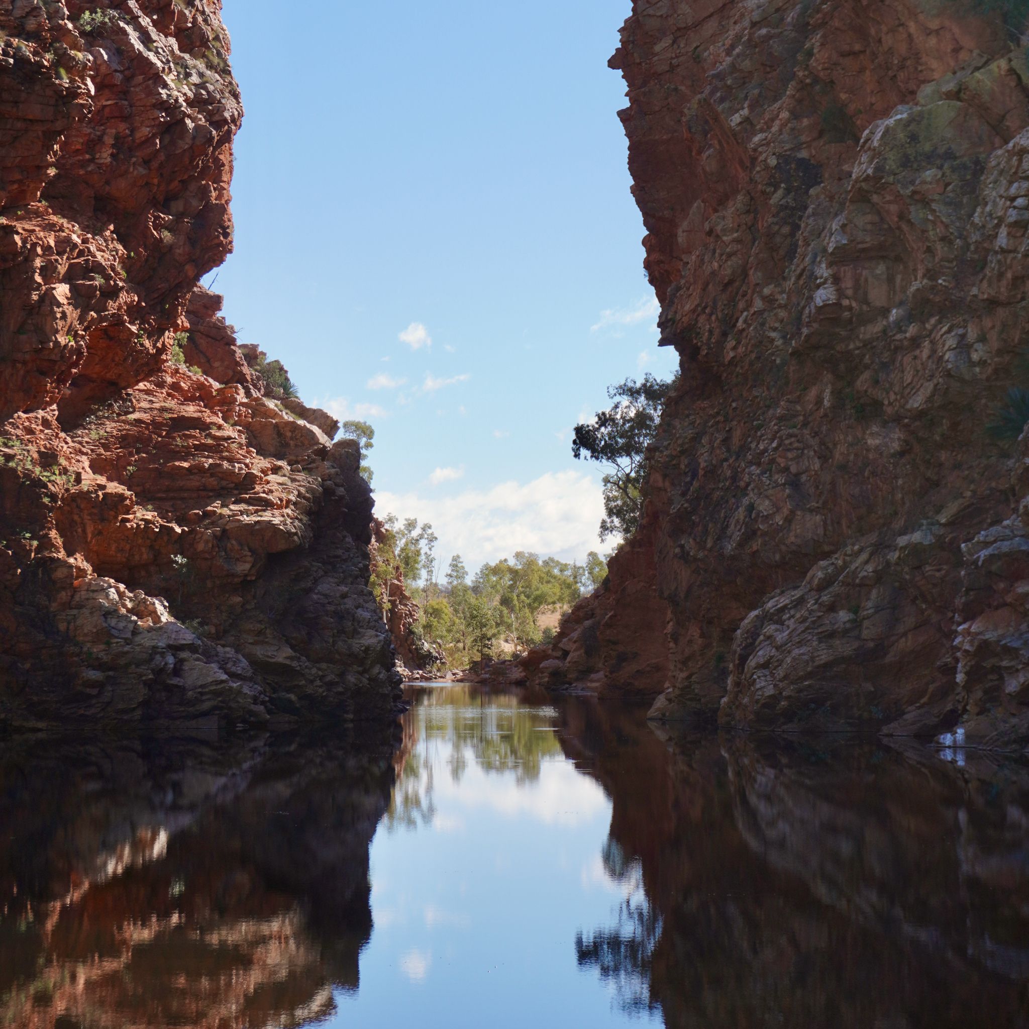
The mountain range splits abruptly. On either side, large mulga trees bloom with bright yellow flowers. At the bottom of the chasm, a waterhole provides a drinking source for the nearby birds and black-footed rock wallabies. The water is cold, too cold to swim. But it is the perfect weather for climbing Cassia Hill and taking in the views from above.
TJORITJA, NT
KM 27,001
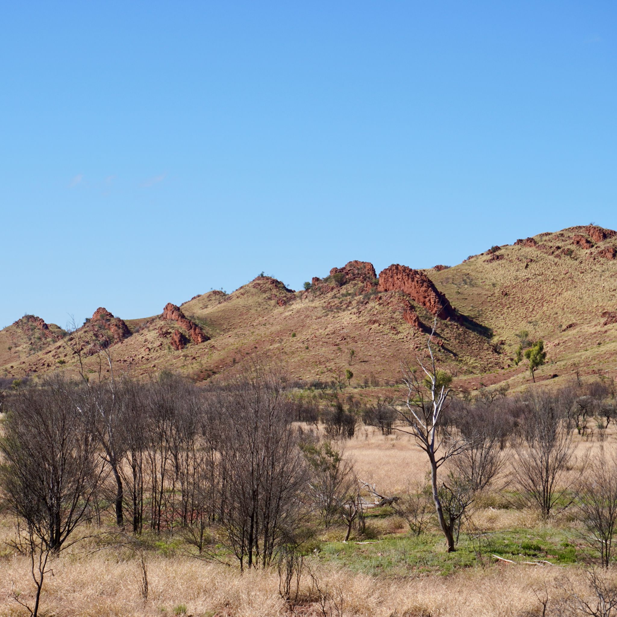
The straight road continues toward Alice Springs, going over the hilly landscape. The low mountains run parallel to the road, following the terrain's curves. The light ochres of the sedimentary layers brighten the scene, contrasting with the muted hues of the vegetation. The cold water stagnates at the bottoms of creeks, providing a refreshing source for the wildlife. The lone eagle circles the sky, hunting for prey that keeps escaping.
PALM VALLEY, NT
KM 26,793
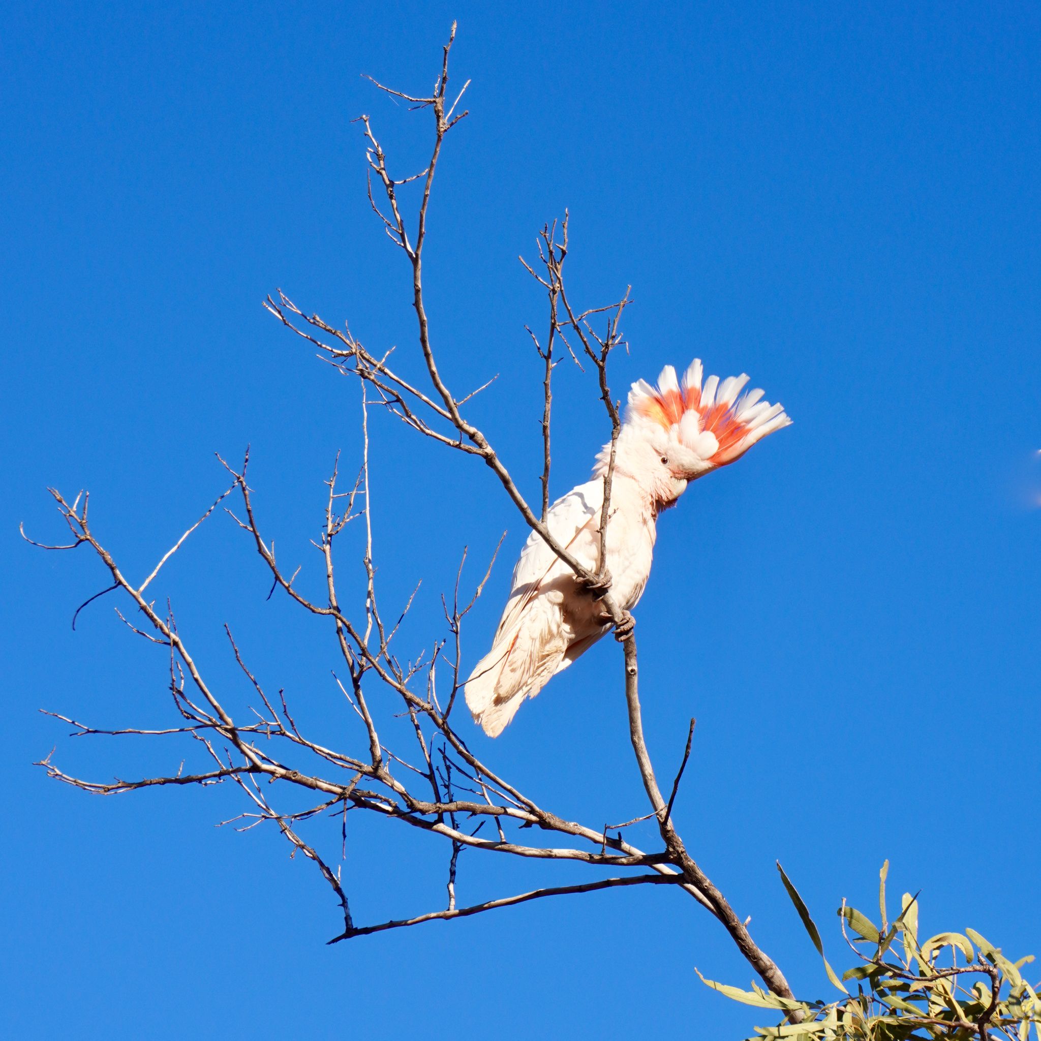
Palm Valley is located 20 kilometres south of Hermannsburg. The 4WD track follows the dry Finke river, crossing sandy shores and rocky creeks. This area, named after the Red Cabbage Palms, is the only place within a thousand kilometres radius where this species survives. The unique ecosystem attracts a wide variety of colourful birds. In the morning, the sound of pink cockatoos wakes us up as the sunrise warms our tent.
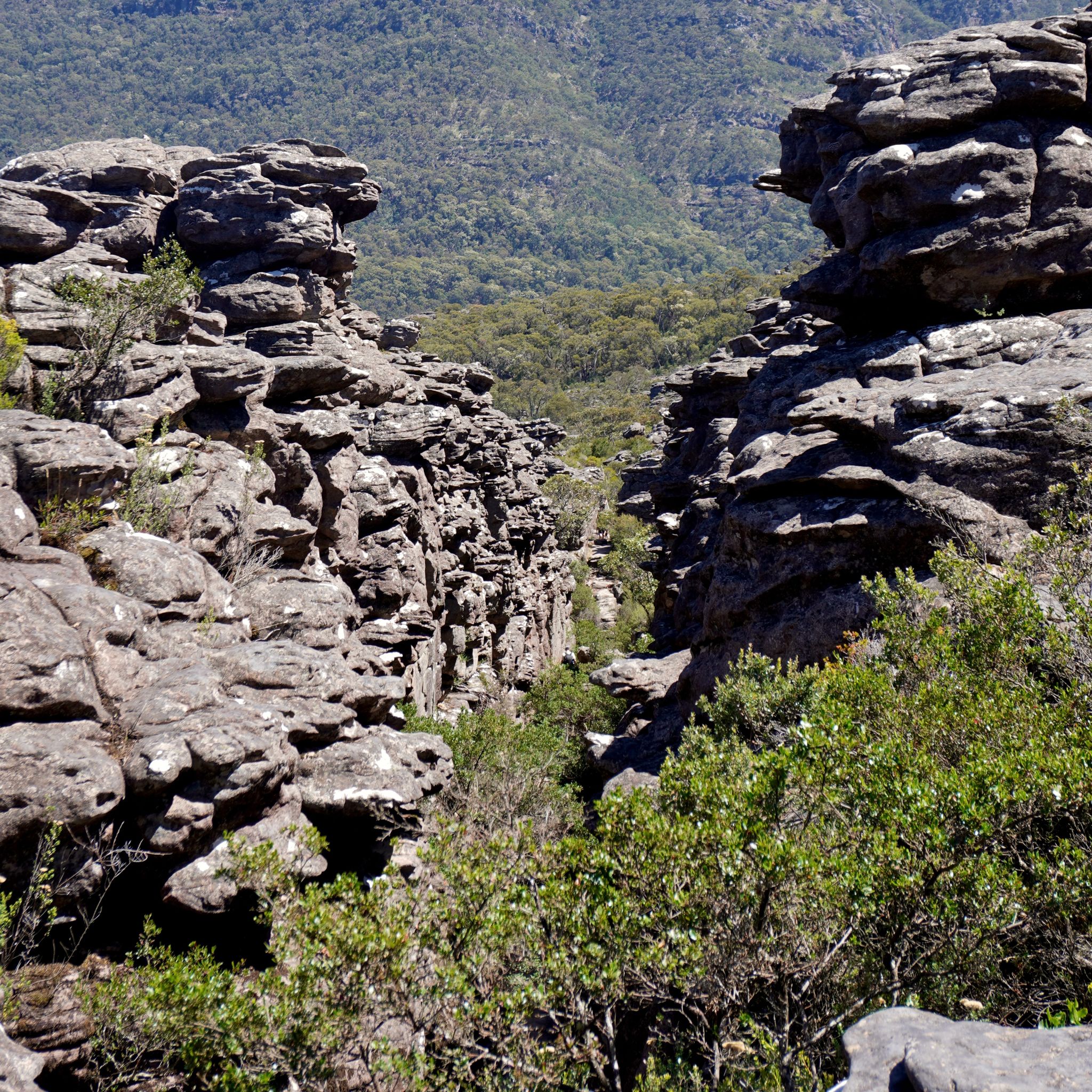
KINGS CANYON, NT
KM 26,571
A thousand steps greet us at the base of Kings Canyon. The climb is steep, yet every hiker we encounter assures us it is worth, typical of it. They did not lie. From the summit, we can follow the deep scar carved by the river in the landscape. On either side, green shrubs, palms and bushes flourish in the shadows of the towering red cliffs that surround us.
ULURU, NT
KM 26,071
The air is crisp in the Red Centre. At night, the temperature drops below zero, and we wake up to find a thin layer of frost on our tent. But during the day, when the sun is high and the wind stops, it’s the perfect weather for exploring the area on foot. Uluṟu is even more impressive from up close. The rock formations creating abstract patterns on its facade are the protagonists of Dreamtime stories told by the elders.
ULURU, NT
KM 26,026
The crimson silhouette of the sacred rock appears on the horizon. Its gigantic shape seems out of place in the otherwise flat landscape. We must be 50 kilometres away, but we can clearly see the edges and crevices of its rocky face. As the sun sets and shadows stretch across its jagged facade, Uluṟu dons a cloak of purple. It is a humbling experience and we imagine how the First Nations people must have felt upon first seeing it.
BARROW CREEK, NT
KM 25,187
We pull over near Barrow Creek roadhouse for the night. 250 kilometres from Tennant Creek and 300 from Alice Springs along the Stuart Highway, it really is the middle of nowhere. As the sun slowly dips behind the horizon, a gradient of oranges light up the sky. The cloudless sky, the dry air, and the featureless landscape produce a breathtaking show. Sunsets in the outback are something different.
MOUNT ISA, QLD
KM 24,274
We exit the Savannah Way before reaching Burketown. We leave the bitumen for another dirt track. It is quieter when you follow the road less traveled. Further south, the tall chimneys of Mount Isa Mines rise on the horizon. Known locally as 'The Isa', this mining town is one of the most prolific in the world, producing lead, silver, copper, and zinc.
NORMANTON, QLD
KM 23,644
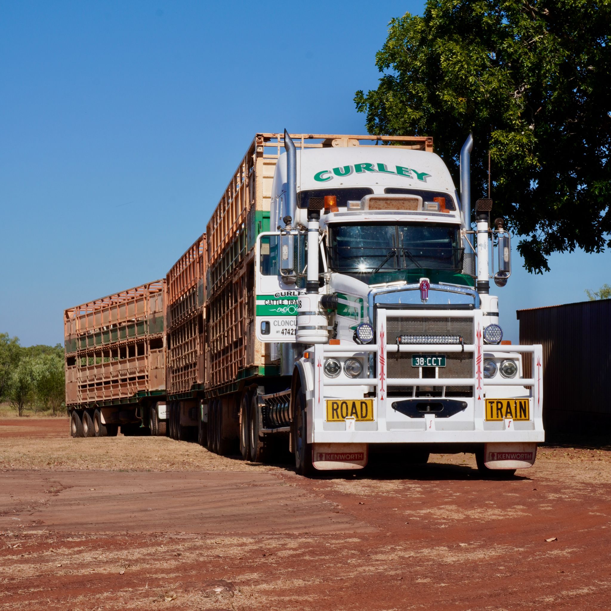
Across the Gulf of Carpentaria, along the Savannah Way. There is little traffic on this part of the continent, except for the occasional road train. These gigantic trucks, towing three or more trailers, are capable of traversing any road, whether it be bitumen, dirt, or a deep water crossing. They cross the country, supplying even the most remote locations. And we marvel at the ability to find fresh products in the middle of nowhere.
FORSAYTH, QLD
KM 22,993

Leaving the rainforests of Far North Queensland behind, we embark on the Savannah Way, heading due west. The dry grasslands stretch endlessly across the horizon. Cowboys on horseback, Akubra on the head, round up cattle on the stations. The towns are few and far between, and the monotony of the landscape invites daydreaming. Forsayth’s police station offers a subtle warning to those who threaten the peace of the area.
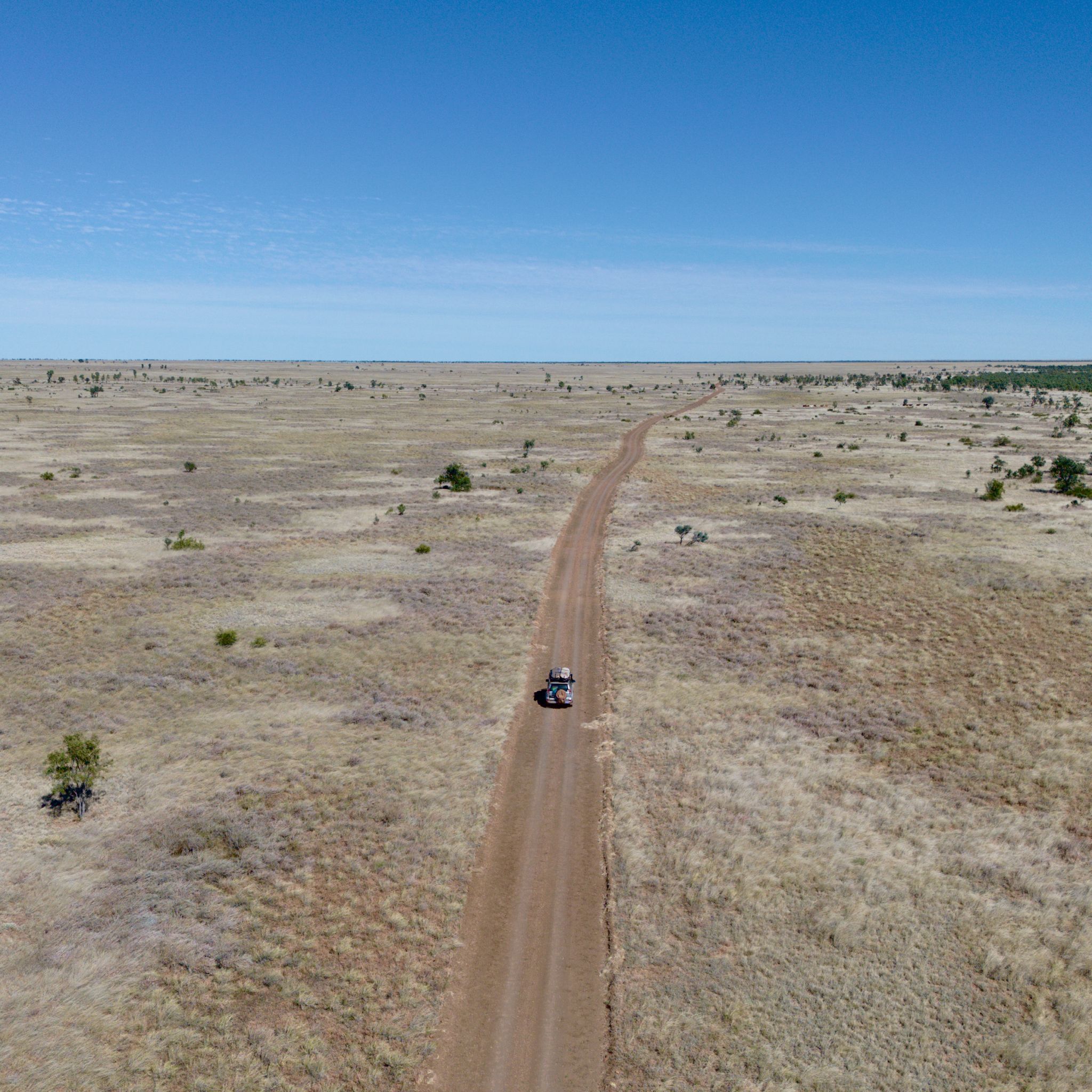
CAPE YORK, QLD
KM 21,519
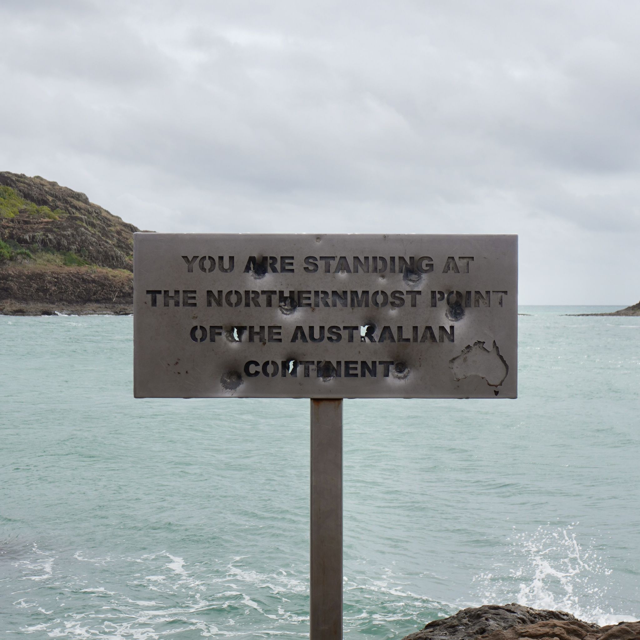
Once again, we put our car on a barge to cross a body of water. The Jardine River is the last obstacle standing between us and The Tip. On the other side, the dirt road passes through Injinoo, Bamaga, Seisa, and Punsand. These communities, spread across the top part of the peninsula, are the most isolated we have seen so far. Finally, we reach the northernmost point of the continent, where we can catch a glimpse of the Torres Strait Islands in the background.
FRUIT BAT FALLS, QLD
KM 21,233
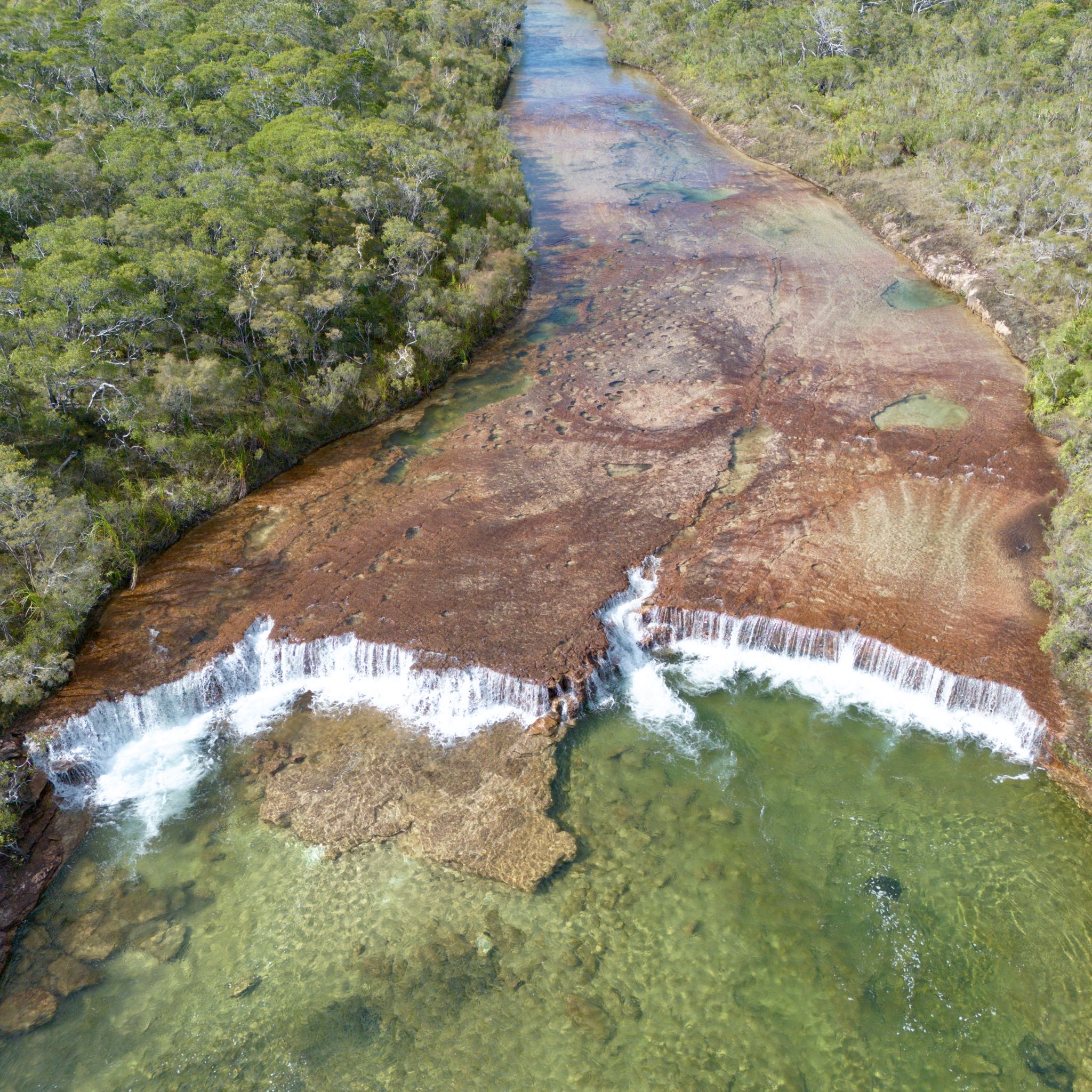
The Peninsula Development Road (PDR) is the primary route across Cape York Peninsula. It features hundreds of kilometres of corrugated unsealed roads connecting various stations and towns. We can easily spot road trains approaching us, their heavy loads kicking up gigantic clouds of red dirt in their wake. When they pass, we must stop, as the dust is so thick that we can barely see anything. Luckily, nearby waterfalls and rivers offer a refreshing chance to wash off.
COOKTOWN, QLD
KM 20,068
The small fishing town at the mouth of the Endeavour River is named after Lieutenant James Cook.It was here that the captain beached his ship for repairs in 1770 after damaging its hull on a nearby reef. Cooktown officially marks the beginning of the Cape York peninsula. It is also the last outpost of civilisation before embarking on a trip to the Tip. Which means we can stock up on diesel, under $3 per litre.
CAPE TRIBULATION, QLD
KM 19,691
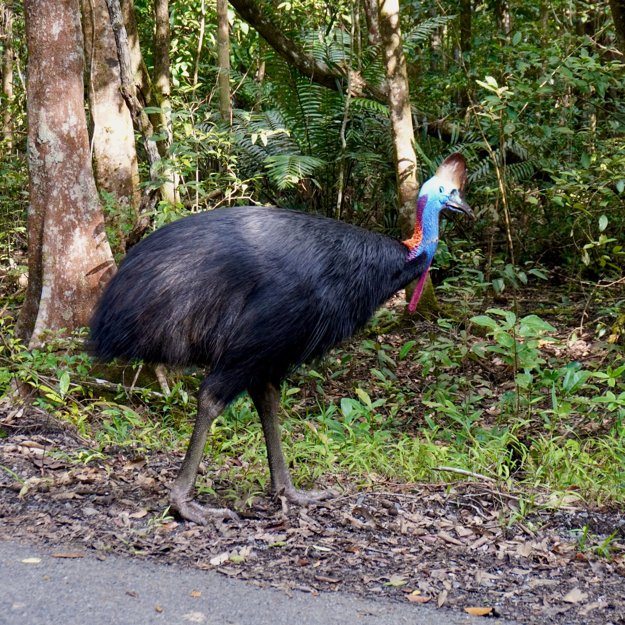
On the road out of Cape Tribulation, yellow signs warn us about cassowaries in the region. The colourful bird, with its blue head, red wattles and amber eyes, is one of the most recognisable icons of the Wet Tropics. However, they are hard to find as they lead a solitary life foraging for fruit deep in the forest. After four days of searching for the 'dinosaur bird' without luck, we are on our way out of the Daintree Forest when we notice some movement on the side of the road. We pull over and patiently wait for the shy cassowary to leave the bush and nonchalantly cross the road.
CAPE TRIBULATION, QLD
KM 19,595
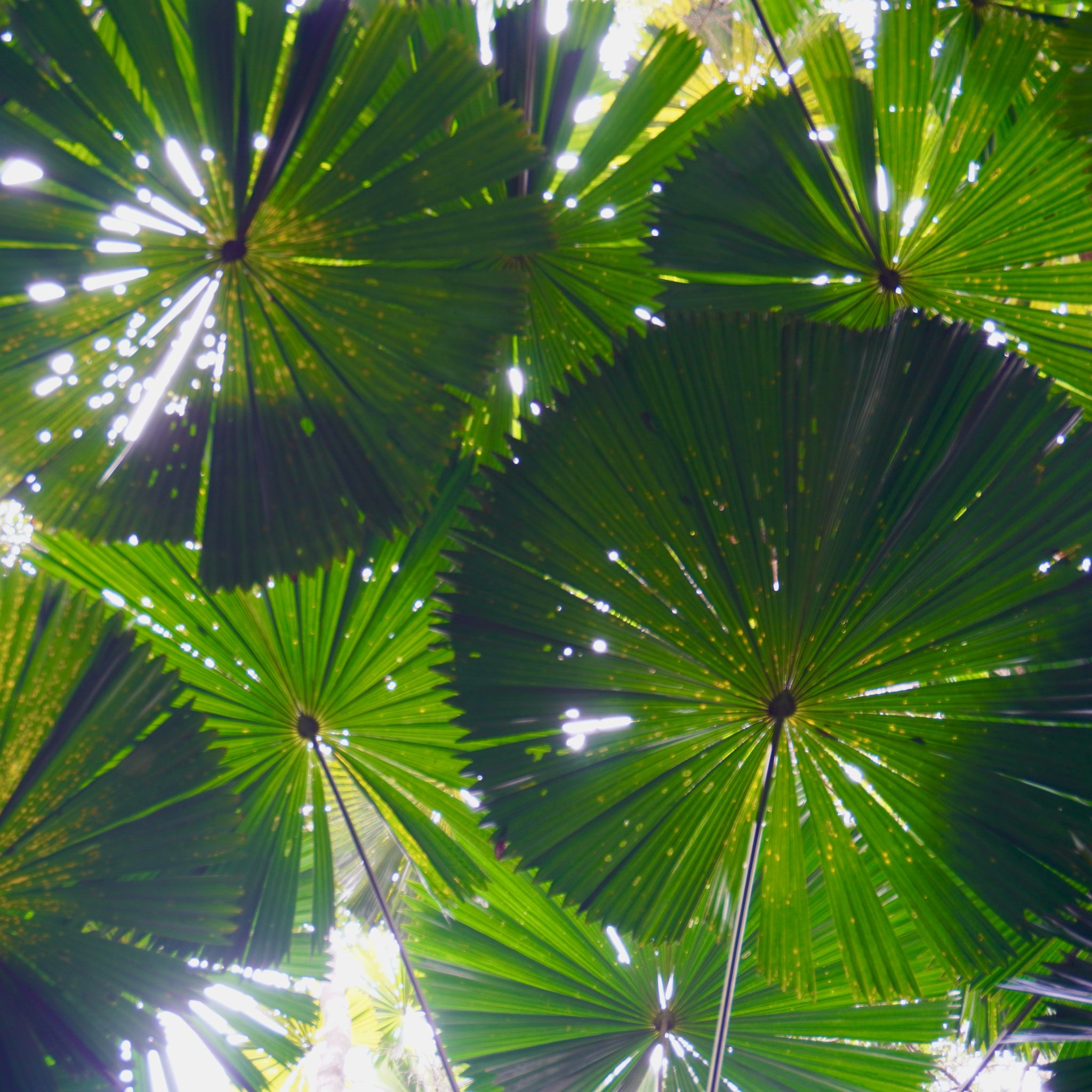
We reach Cape Tribulation at the end of the winding sealed road north of the Daintree River. This frontier village is lost in the middle of the Queensland Wet Tropics, where the rainforest meets the reef. With many species endemic to the region, the flora of the Daintree Forest seems to have emerged directly from the Jurassic period. The wild mangroves strive to conquer the sea, their network of roots sprouting from the ground to mark their advance. Inland, the fan palms create a leafy canopy that filters the sun's rays and casts green shadows.
PORT DOUGLAS, QLD
KM 19,508
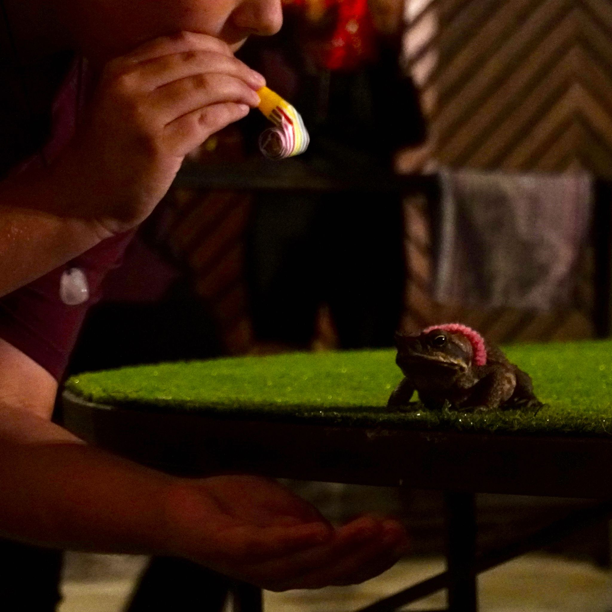
It is almost 6 PM, and a queue begins to form in front of the pub. Tonight is race night! Everyone is here to bet on Queensland’s most infamous pest: the cane toad. Punters select their favourites, and the highest bidders receive a party horn to direct their picks. The rules of the game are simple: the first frog to jump off the table wins.
PALM COVE, QLD
KM 19,464

North of Cairns, the highway follows the curves of the coastline. Zigzagging between the Wet Tropic Rainforest and the Coral Sea, this stretch of bitumen is one of the most scenic drives of our big lap. At each turn of the road, we discover a new beach that we have all to ourselves. The worry-free crowds of Palm Cove stroll under the shady palms or sit for a drink on the terrace of a beachfront restaurant. A local group of anglers meet on the jetty at sunset, the golden light stretching Double Island’s shadow over the calm water.
KURANDA, QLD
KM 19,242
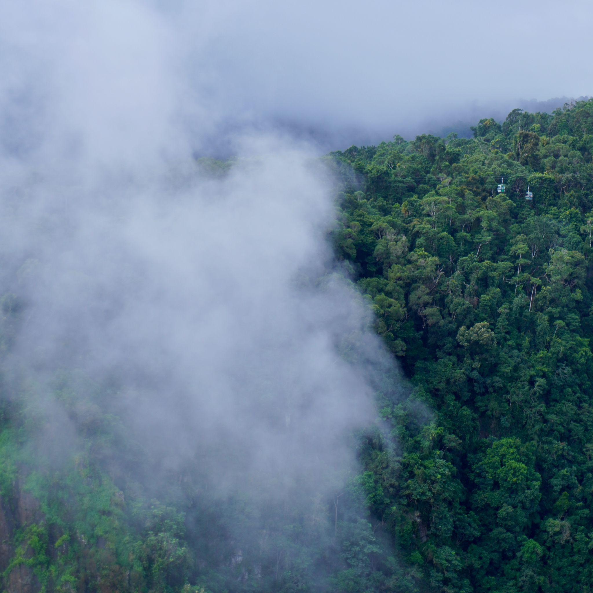
Kuranda, the hippy village, offers a radical contrast to Cairns, only 25 kilometres away. Up on the Atherton Tableland, the turquoise waters of the Coral Sea give way to the green canopy of one of the oldest living tropical rainforest. We say goodbye to the warm sun, drop ten degrees, and find ourselves enveloped in a light mist. This little town is the gateway to a cableway that glides over the Baron Gorge and its falls. From up there, the views would be spectacular if it were not for the thick fog surrounding the gondolas.
MISSION BEACH, QLD
KM 18,851
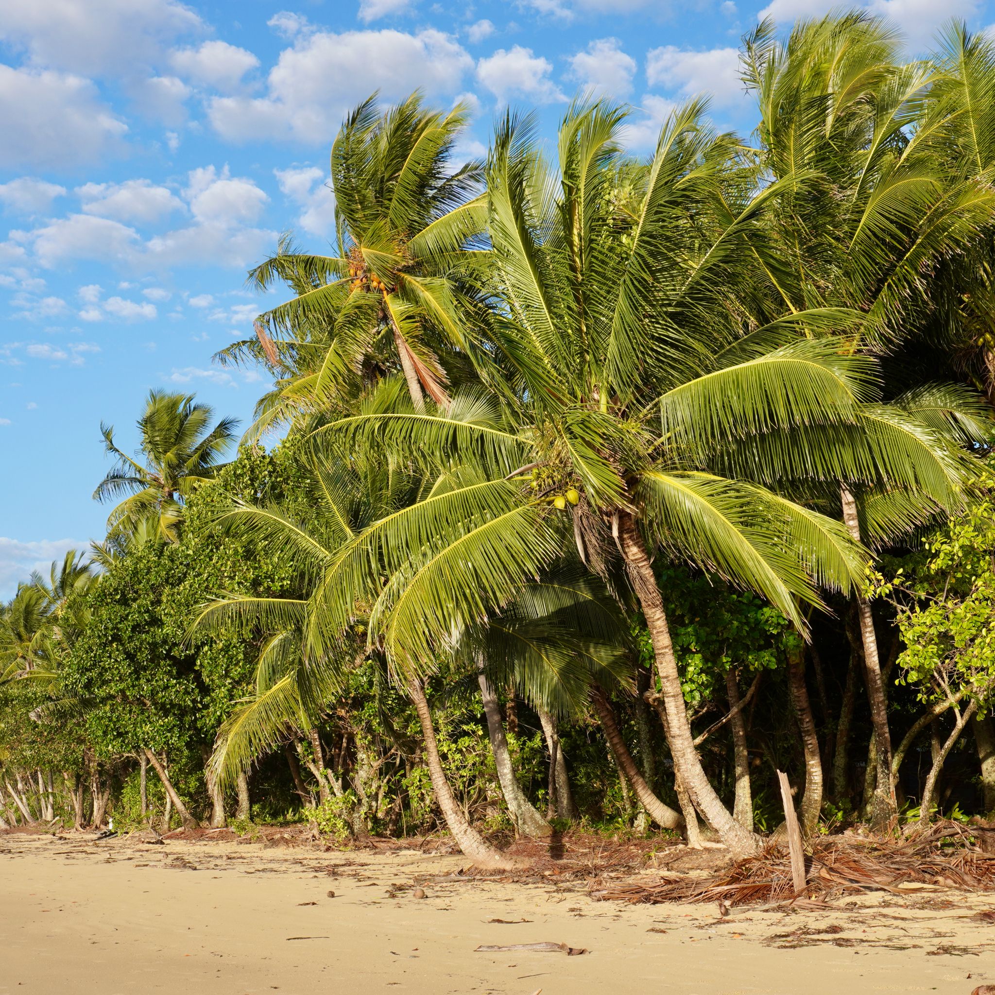
Mission Beach offers our first glimpse of the picture-perfect beaches that have made Tropical Queensland famous. Rows of coconut palms follow the long stretch of golden sand. In the background, the rainforest descends from the hills to meet the Coral Sea. This laid-back tourist hotspot is dotted with beach shacks, seafood restaurants and souvenir shops. On Sunday morning, we stock up on fresh tropical fruits and vegetables at the grocer's market on the beach.
LITTLE CRYSTAL CREEK, QLD
KM 18,723
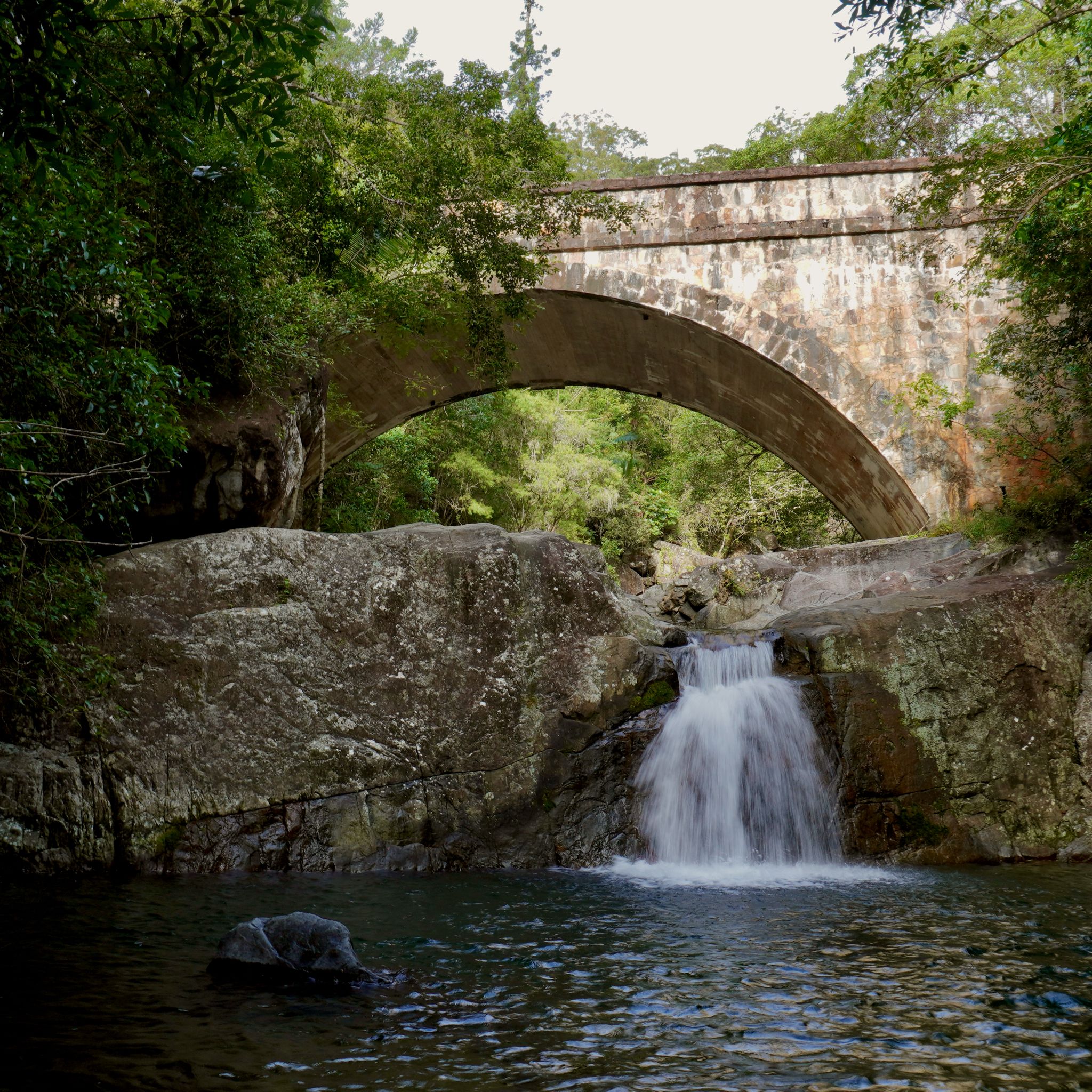
The dirt road darts through vast, flat plains before winding up the Paluma Range. A gentle breeze sways the feathery tops of the tall sugar canes surrounding the road on both sides. It is quiet this time of year; we barely see any other vehicles on our way. The stone arch bridge over Little Crystal Creek seems out of place here. If it were not for the exotic birds singing, we could be mistaken for thinking we were in Europe.
THE WHITSUNDAYS, QLD
KM 18,136
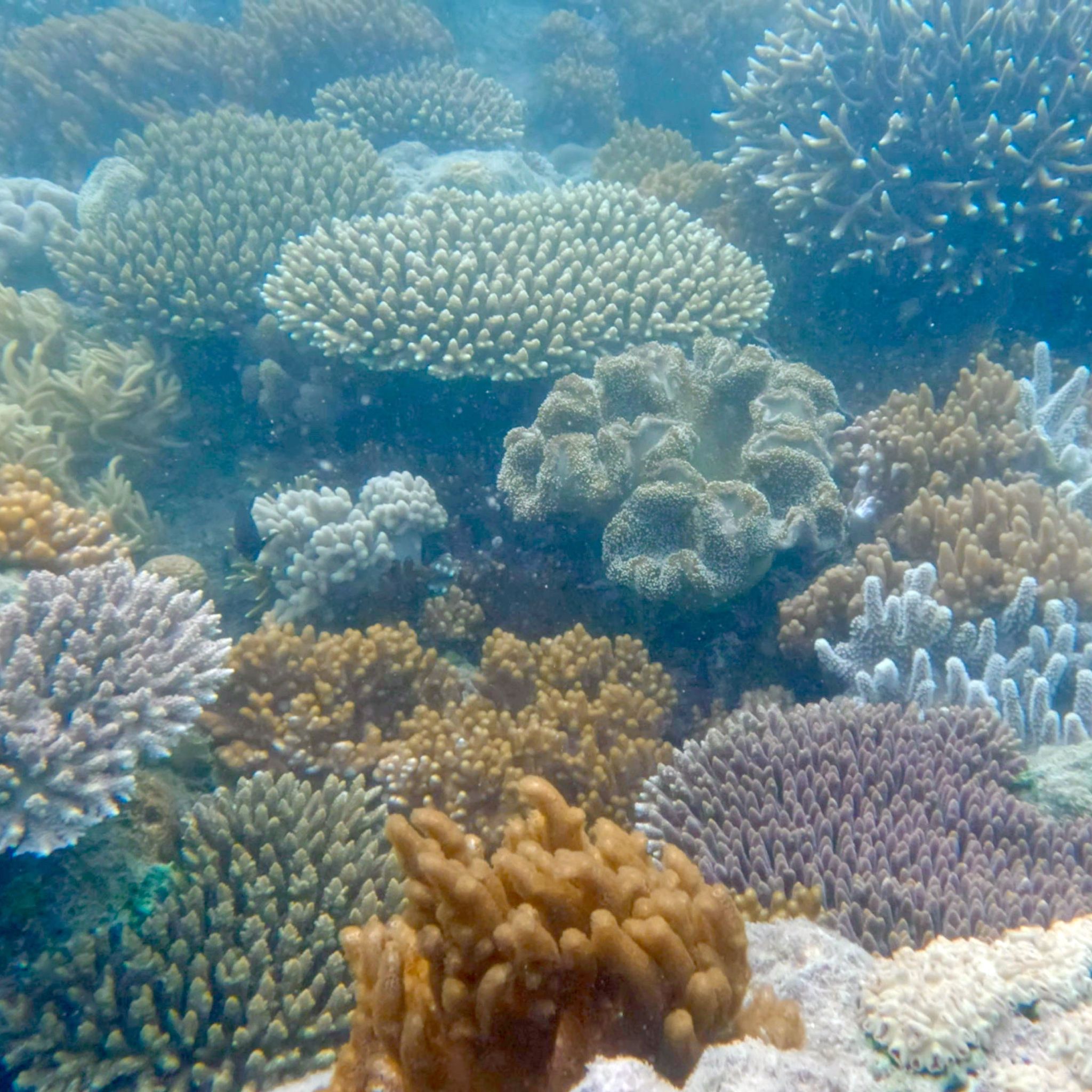
After 128 nights of sleeping in our rooftop tent, it is time for a change. We park our four-wheel drive and set off on a three-day sea adventure. Sunny weather and a light breeze, the forecast looks promising. Aboard a 60ft yacht, we set sail towards the Whitsundays, a group of islands located in the Great Barrier Reef. The program is packed with sunbathing on white sand beaches, island hopping, and snorkelling among sea turtles, tropical fish, and colourful coral.
CAPE HILLSBOROUGH, QLD
KM 17,995
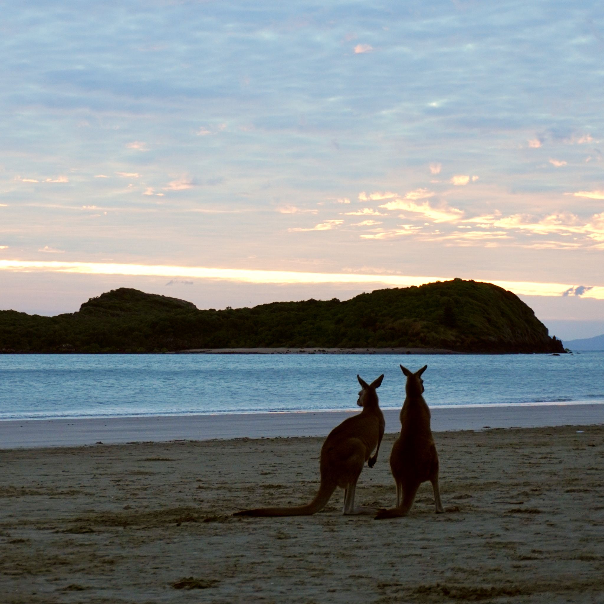
Leaving Mackay behind, we take the Yakapari Seaforth exit off the Bruce Highway. The road winds along the bottom of low mounts and hills, palm trees on both sides. The rocky hills of the Yuwi Nandhi, land of the Yuwi people, were shaped by an ancient volcano active 34 million years ago. Although the sunset is spectacular, the main attraction awaits us in the morning. At dawn, kangaroos and wallabies come to the beach to feed on the seed pods that have washed ashore.
YEPPOON, QLD
KM 17,624
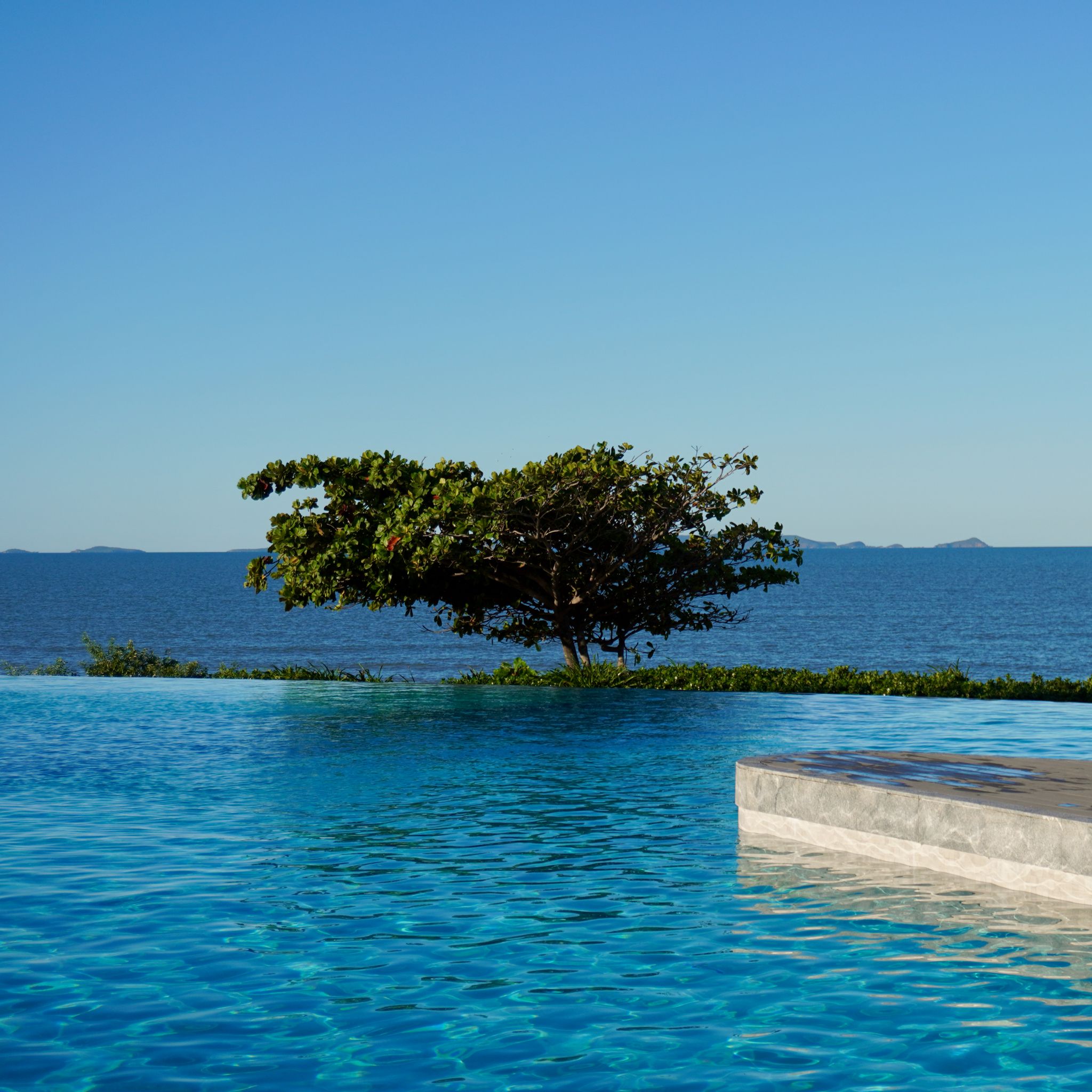
As we journey on our Big Lap north and cross the Tropic of Capricorn, the colours starts to change. The deep green eucalyptus bush slowly gives way to vibrant palms. To our right, the ocean takes on a lighter hue of blue marking the beginning of the Great Barrier Reef. While the Bondi Icebergs may be Australia’s most renowned pool, Yeppoon Lagoon deserves to be a close second. With the Keppel islands as a backdrop, the infinity pool overlooking the Coral Sea could easily be mistaken for a feature of a five-star hotel.
ROCKHAMPTON, QLD
KM 17,576
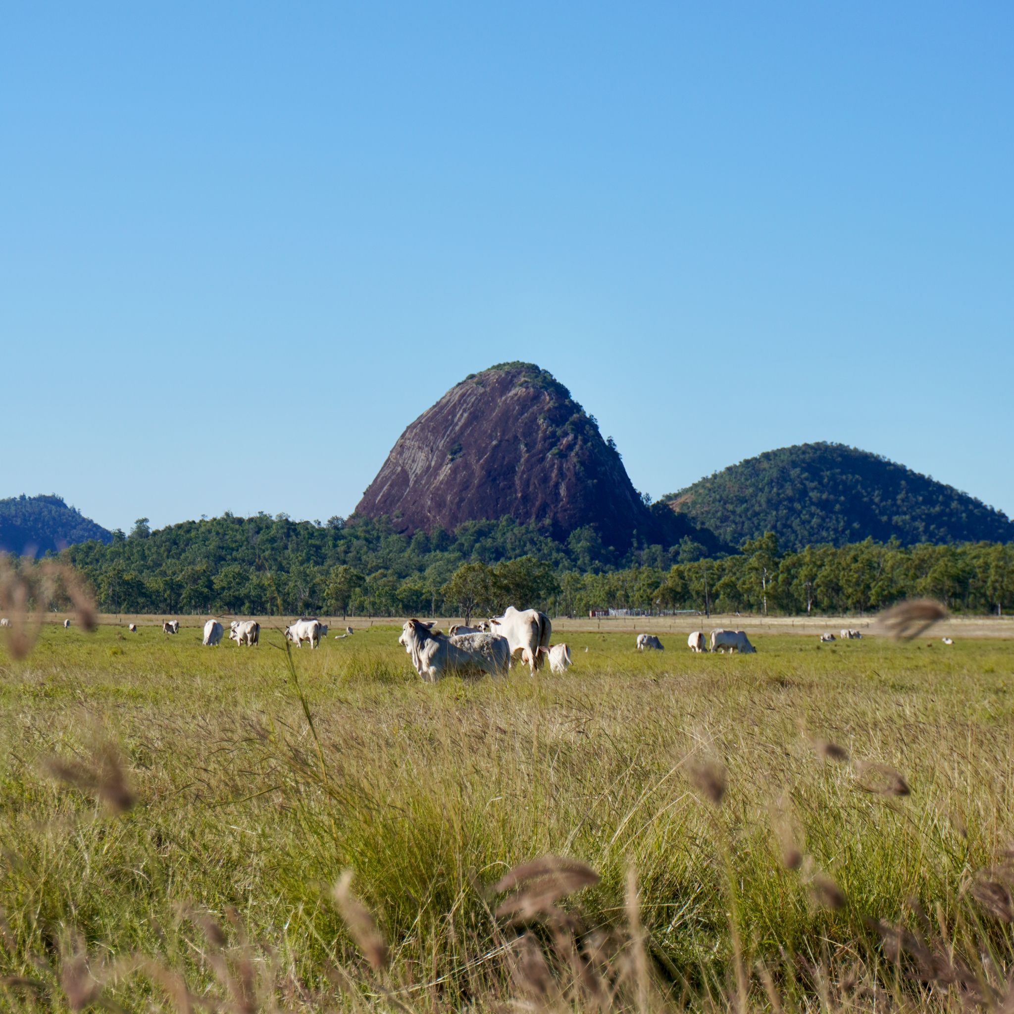
Welcome to Rockhampton, the Beef Capital of Australia reads the sign at the foot of a massive bull statue. With over two million cattle in the region, the title holds true. Thanks to its thriving farming industry, the city is rich and it shows.The clean, wide streets are lined with tall trees and white-washed heritage buildings. The museum showcases an interesting mix of quirky contemporary art alongside traditional Aboriginal paintings. And a free zoo offering some much-needed shade on that blistering hot afternoon.
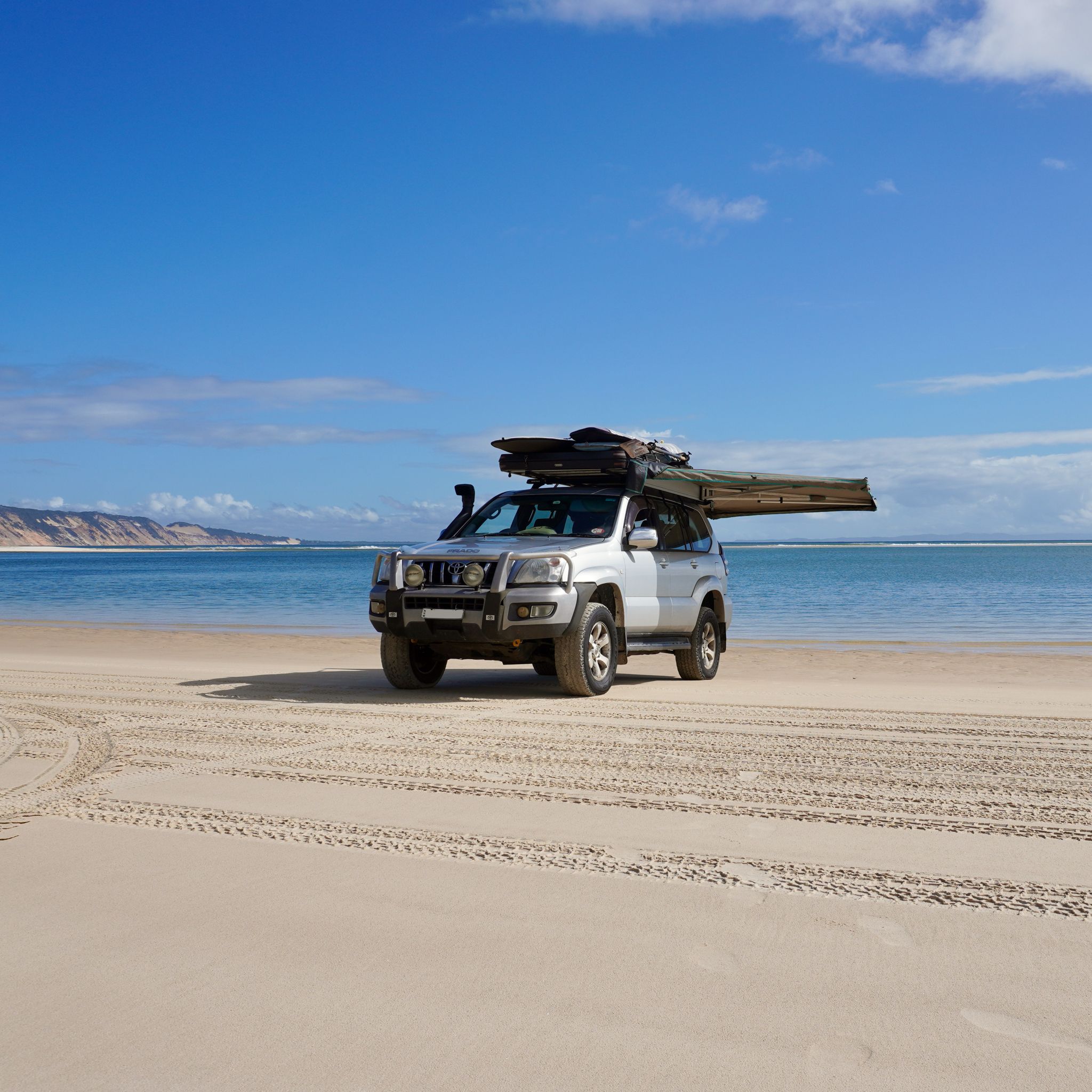
K’GARI, QLD
KM 16,902
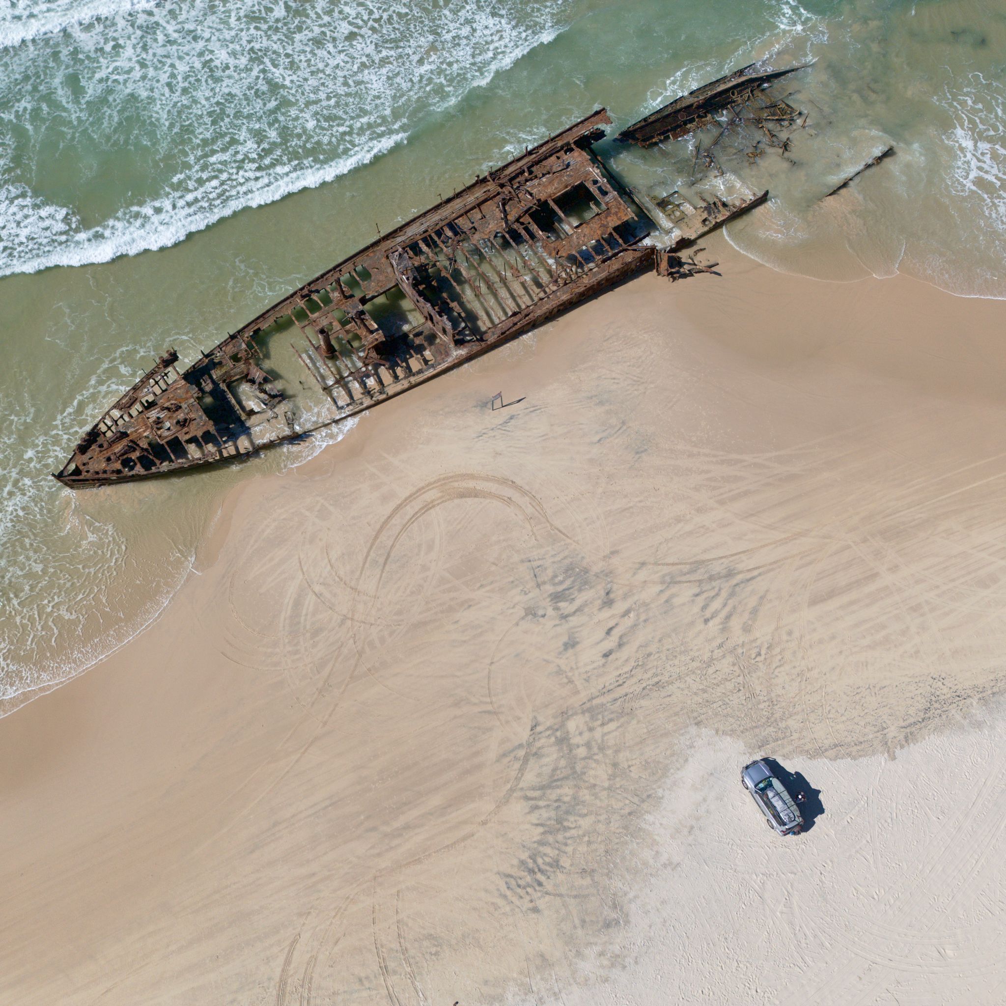
There are no paved roads on K’gari. A 4WD is required to navigate the inland tracks and the beach roads on the island’s outskirts. As we cruise on 75 Mile Beach, a dark silhouette emerges through the sea spray. The S.S. Maheno was once a luxury cruise liner sailing between Sydney and Auckland, then served as a hospital ship during the First World War. The rusty shipwreck now lies on the sand, losing a hopeless fight against corrosion and the assault of the waves.
K’GARI, QLD
KM 16,776
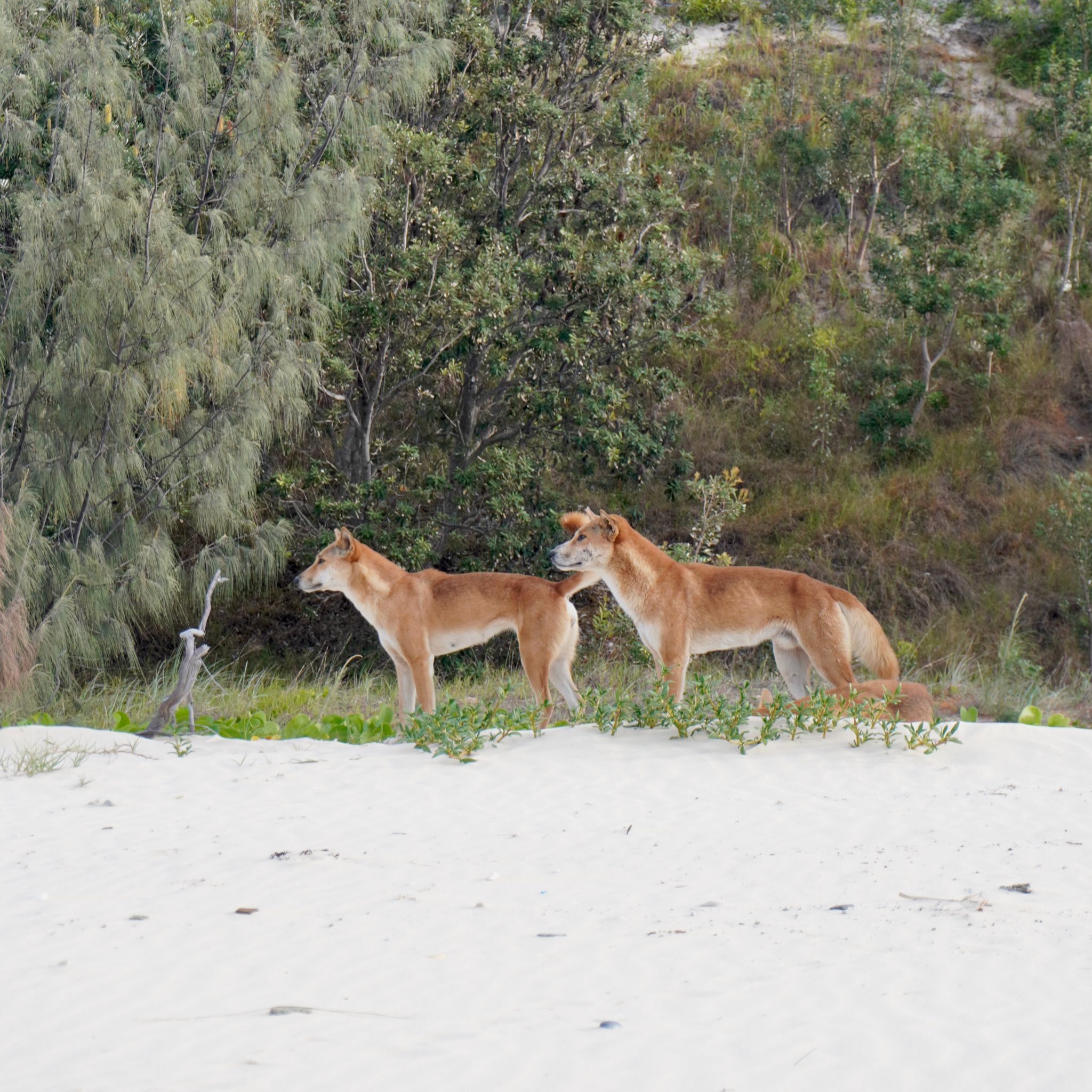
Formerly known as Fraser Island, the world’s largest sand island reverted to its traditional name in 2023. K’gari was a goddess who fell in love with the earth and never wanted to leave. We must admit it is impossible to resist the many charms of this place. Long stretches of white sand, lush creeks, crystal-clear inland lakes, dunes meeting rainforest – its natural beauty and wilderness are unparalleled. And everywhere, wongari, the wild dingoes that reign as apex predators, roam the land.
DOUBLE ISLAND, QLD
KM 16,530
A short ferry ride across the Noosa River from Tewantin and we reach Noosa North Shore. The remote community marks the beginning of the Great Sandy National park. We lower our tyre pressure to 18 PSI before merging onto the Cooloola highway: more than 50 kilometres of beach driving towards Double Island Point. With sand dunes on our left and the waves crashing on our right, we comfortably cruise at 80 km/h on the empty stretch. Oh, what a feeling!
NOOSA, QLD
KM 15,924
Our road trip north finally reaches the crown jewel of Queensland’s Sunshine Coast - Noosa at last. The touristic hotspot and family-favorite deserves its fame. Surrounded by national parks, golden white sand, pristine waters, and pleasant weather year-round, Noosa is the ideal place to unwind. Amidst this picturesque paradise, the multiple points and coves produce world-class waves. A surfer’s wet dream.
GLASSHOUSE MOUNTAINS, QLD
KM 15, 582
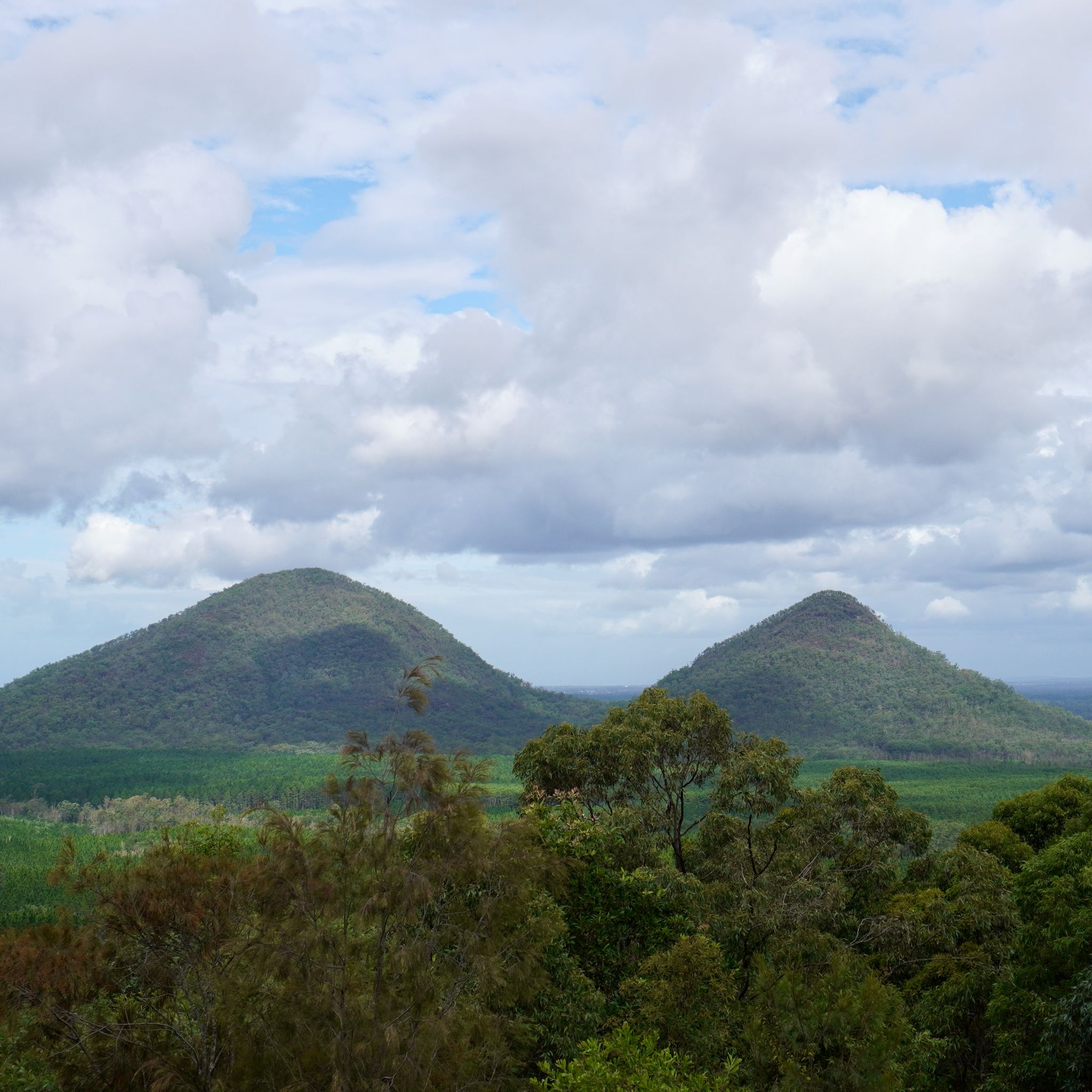
We continue our Big Lap heading north through vast grass plains towards the Sunshine Coast. Rounded mountains emerge from the ground as if by magic, scattered across the otherwise flat landscape. The Glasshouse Mountains stand as a testament to past volcanic activity in the region. Millions of years of erosion have shaped them. The Gubbi Gubbi and Jinibara people, the custodians of this land, have strong cultural and spiritual connections to these geological features.
SCENIC RIM, QLD
KM 15,056
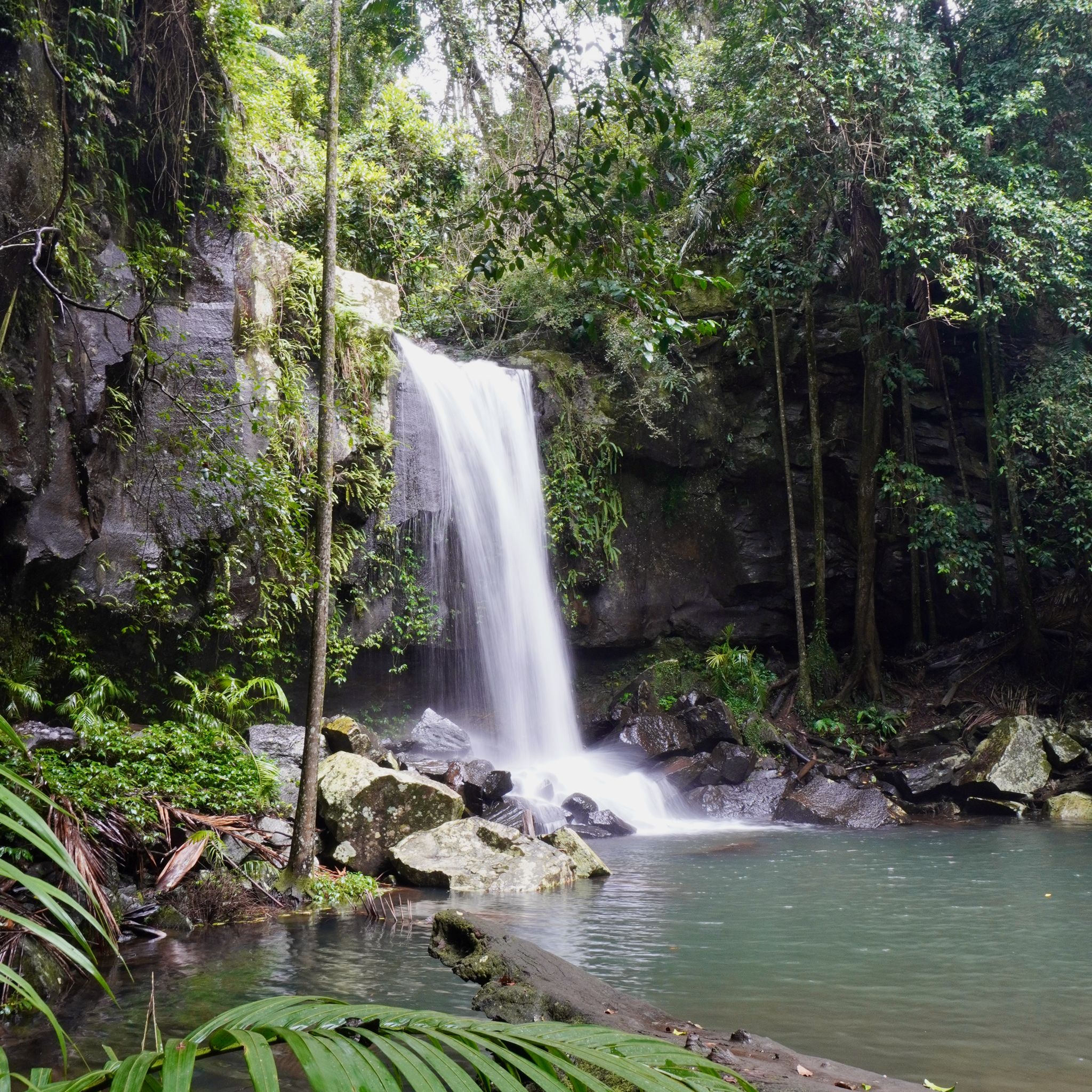
With the sunny Gold Coast in our rearview mirror, we start our ascent towards the Scenic Rim inland from Brisbane. The winding dirt road leads us through a creek that should be easy to cross in drier weather, but with the rain from the previous days, the bed is not visible. To gauge the depth, I cross it on foot first: the current is strong and the rocks below are slippery. As night falls, we are too far along to turn back, the only option is to move forward. Engaging the low range, we start the slow crawl through the water, making it to the other side, safe but scared.
BURLEIGH HEADS, QLD
KM 14,581
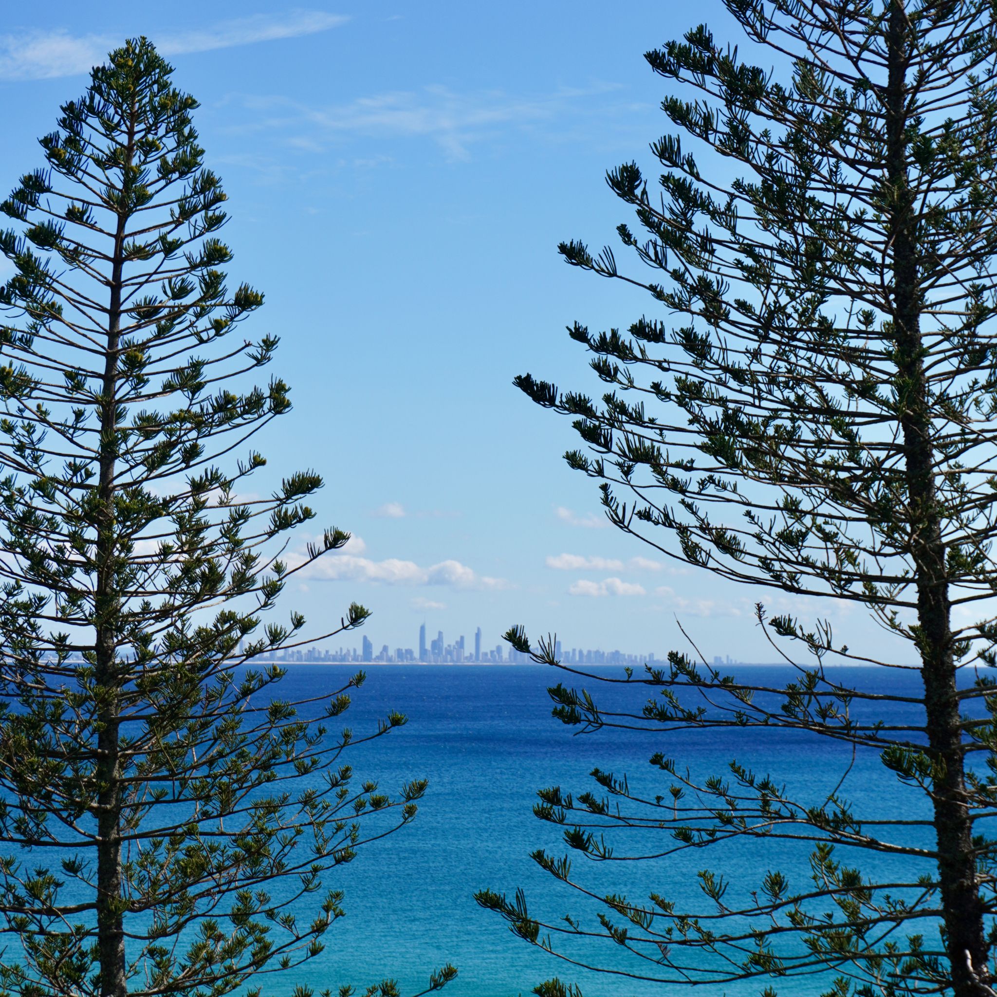
With nearly 15,000 kilometres on the clock, our trusty Prado is due for servicing. After dropping our car off at the mechanic, we set out to explore the Gold Coast on foot, eager to experience the area beyond its reputation. Surfer's Paradise, with its towering high-rise buildings and neon-lit nightclubs, certainly lives up to its party-hard image. But beyond the glitz and glamour, we discover a more laid-back side to the Gold Coast, with tree-lined beaches stretching as far as the eye can see, hip restaurants and designer stores. The relaxed vibe fades off quickly as we pick up our car, we will need to fix a few expensive parts before we can resume our journey.
CABARITA BEACH, NSW
KM 14,247
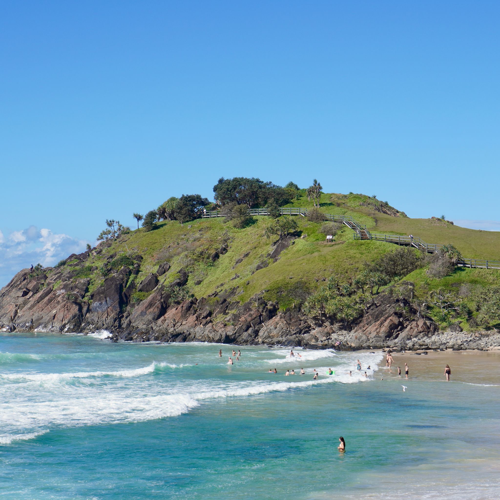
The North-East coast of New South Wales is blessed with amazing surf spots. Almost every headland along this coast transforms the swell into clean, right-hand waves: Angourie Point, Yamba, Lennox Head. And Cabarita is no different. A short walk through a grove of pandanus and eucalyptus, a set of wooden stairs, and we reach the sand. The vibe is relaxed, and the water is crystal-clear, making this the perfect place to spend the day.
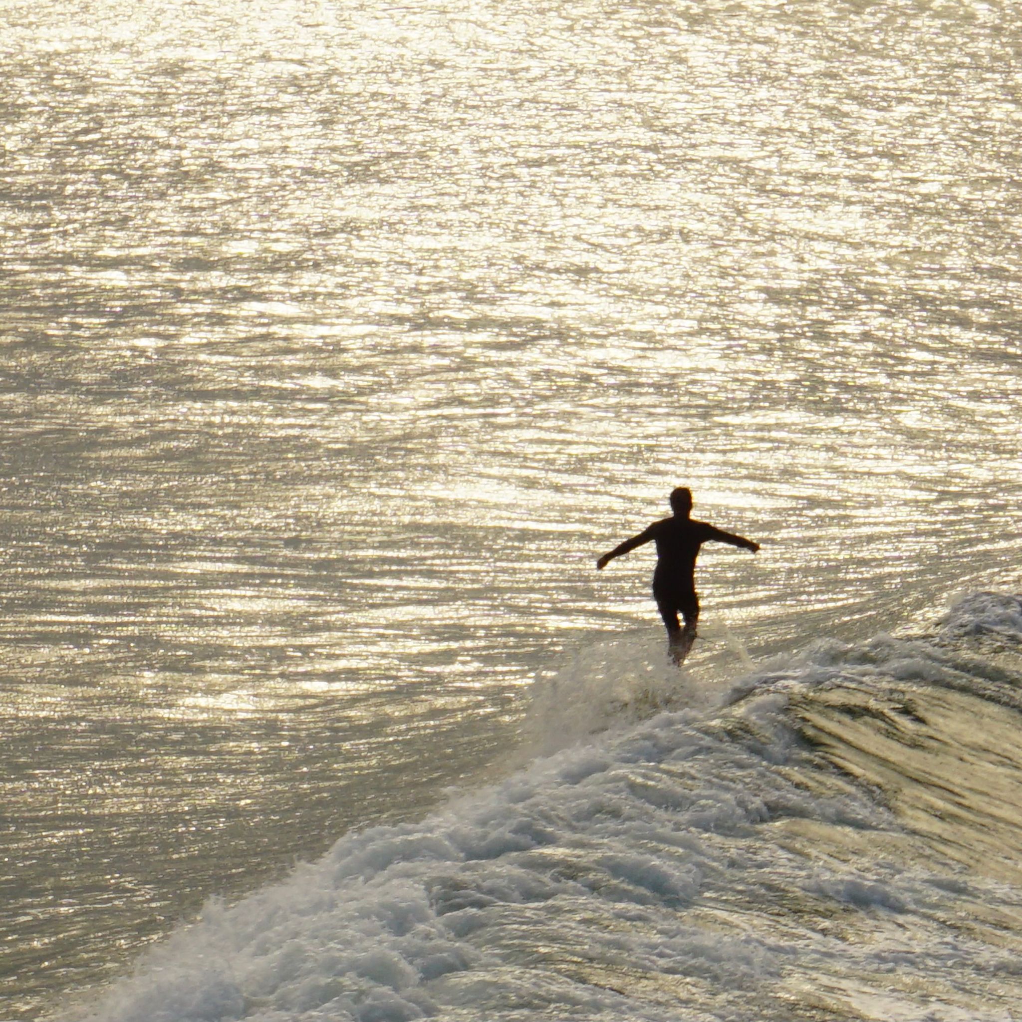
BYRON BAY, NSW
KM 13,832
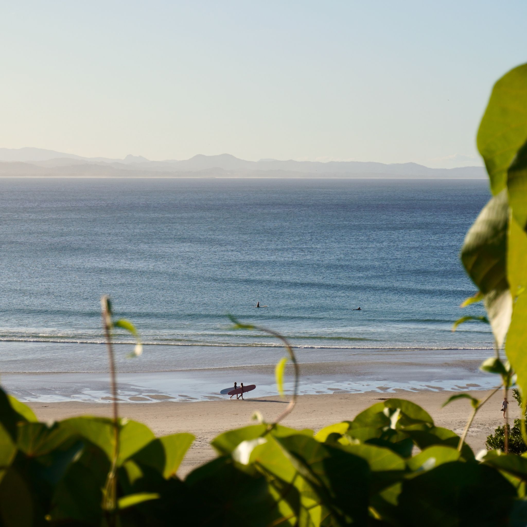
During our ten-day stay in Byron Bay, we spend most of our time in the ocean. The Pass, the renowned point break north of town, produces a a long, gentle wave perfect for relaxed surf sessions. Nonchalant longboarders and groups of tourists taking their first lessons share the sea with pods of dolphins and sea turtles. The sun shines brightly, and the water is warm. Every day in Byron Bay is a great day.
BYRON BAY, NSW
KM 13,425
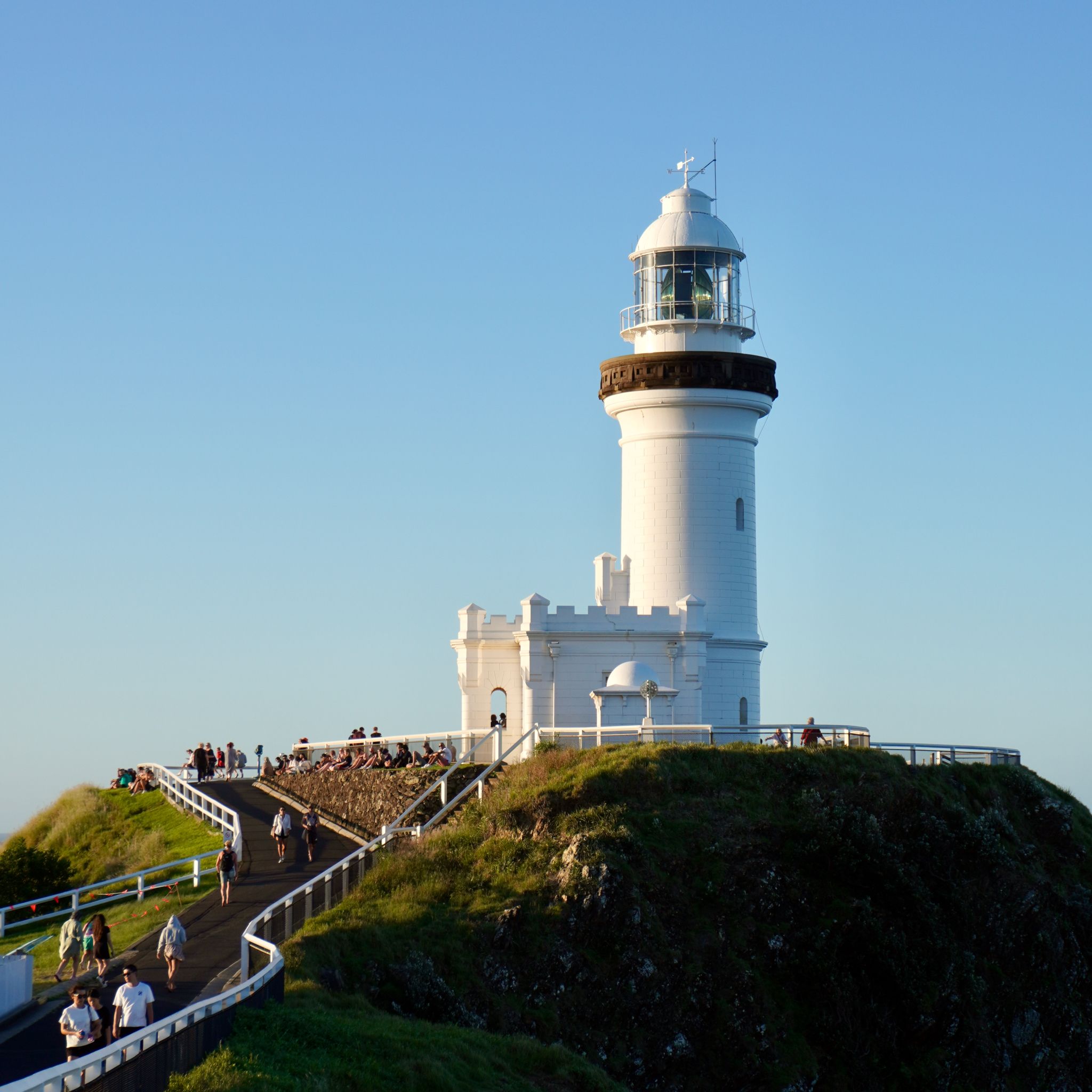
The infamous Cape Byron Light illuminates the night sky with a beam stronger than two million candles. Situated on Bundjalung land at the easternmost point of mainland Australia, it offers a prime vantage point for observing whales during their annual migration. We follow the boardwalk out of town along the beach, through a dense bushland of eucalyptus and tea trees, to reach the viewpoint. Hundreds of other visitors have gathered to witness the sun setting beyond the horizon. The gold light irradiates Wategos beach below.
SCOTTS HEAD, NSW
KM 12,132
Scotts Head has always been our favourite destination for a long weekend getaway. It is close enough to Sydney for a day trip, yet far enough to deter large crowds. It has long been a dream of mine to visit during a random weekday and have the surf spot to myself. This time, we are in luck: no long weekends, no school holidays, and a promising surf forecast on the horizon. All the ingredients for a great couple of days.
CRESCENT HEAD, NSW
KM 11,611
As we exit the Pacific Highway at Kempsey and turn towards Crescent Head, I cannot contain my excitement. We came here before, we know exactly what we are in for. This small coastal town is globally renowned for its right-hand wave, one of the longest and most consistent on the Australian East Coast. It is busy on this random mid-week morning, with a few dozens people waiting at the peak. Fortunately, other secluded beaches nestled in the nearby National Park also offer fantastic waves, minus the crowds.
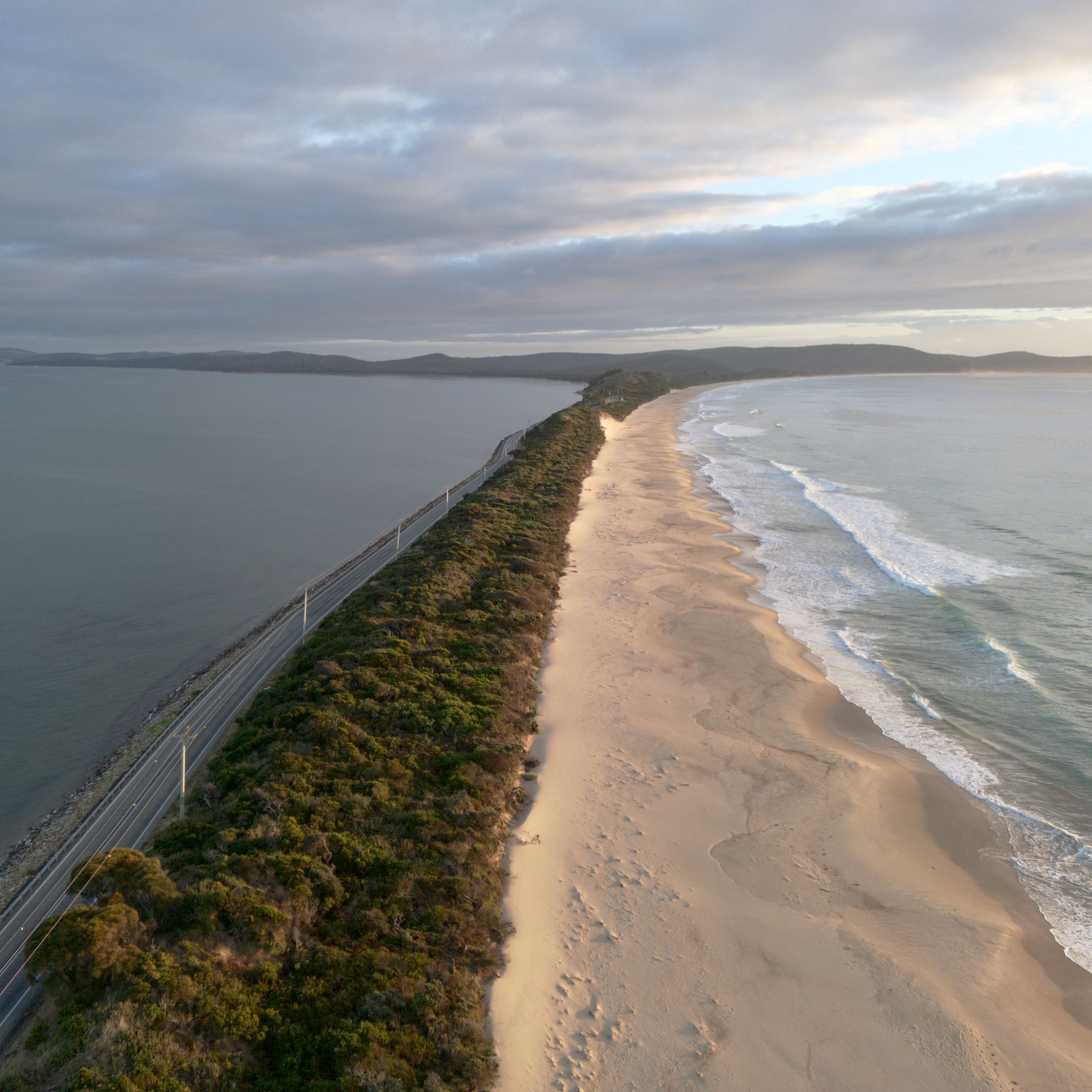
HONEYMOON BAY, ACT
KM 10,744
Shortly after the Australian Constitution was signed in 1901, Melbourne and Sydney, the largest cities at the time, couldn't agree on which should become the capital of this new country. A compromise was found, and Canberra was established in the middle of New South Wales, between the two major cities. To avoid a landlocked situation, the Australian Capital Territory was also given a piece of land on the east coast. It's there, in the midst of picturesque tourist villages and military bases, both surrounded by the whitest sand in Australia, that we set up camp for the night. This prime location offers a perfect spot to watch the sun set over the tranquil waters.
PEBBLY BEACH, NSW
KM 10,524
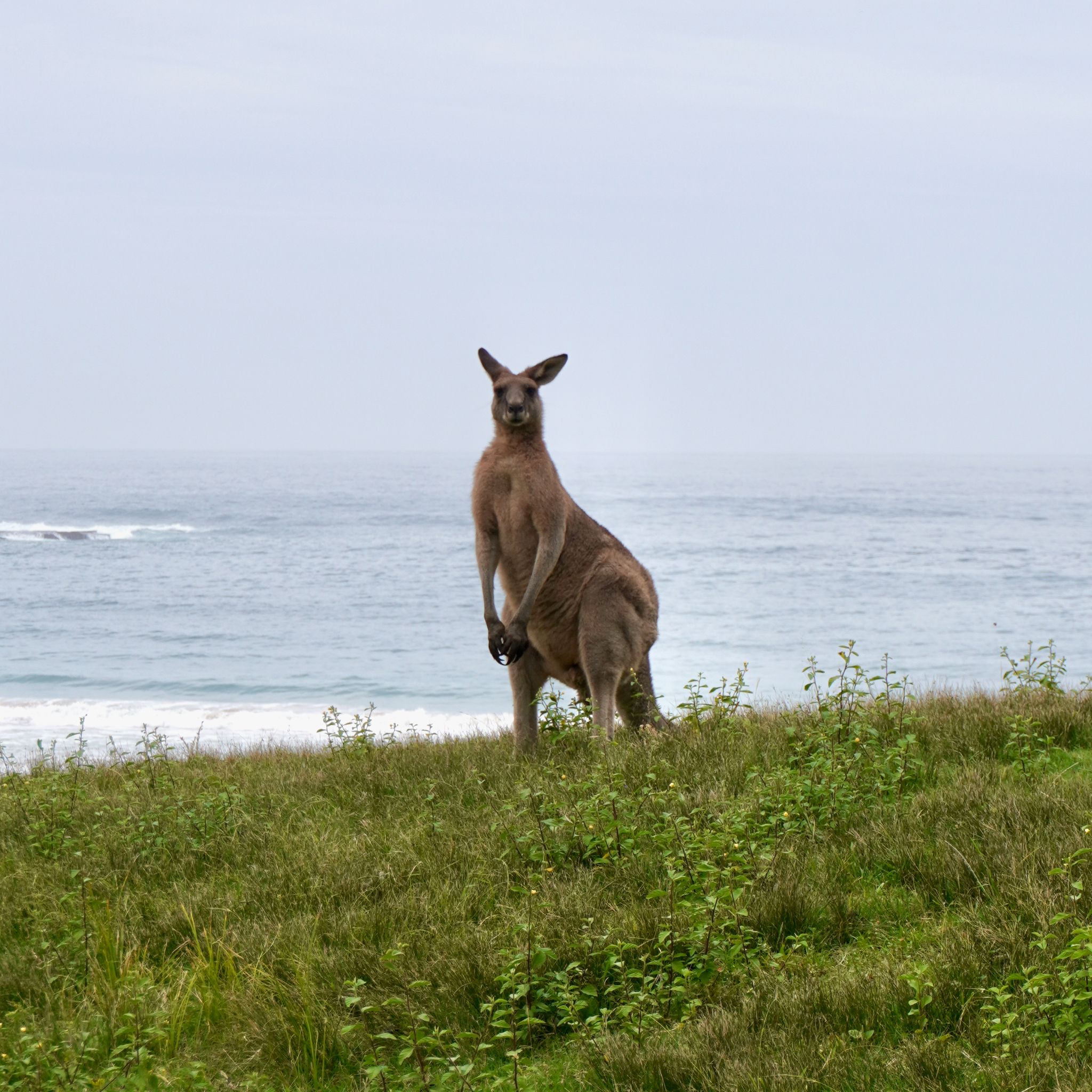
The weather changes quickly. The wind shifts onshore and the dark clouds loom on the horizon. The sea is getting more chaotic, the groomed swell lines turn into a mess of foam. At last, the rain starts. And everywhere around us, kangaroos remain unbothered by the storm coming our way.
BERMAGUI, NSW
KM 10,277
On the Sapphire Coast, any road east of the Princess Highway leads to a peaceful coastal town with an exotic name: Pambula, Merimbula, Tathra, Ulladulla. Each of these places is a little paradise - crystal clear waters surrounded by verdant bushland. We daydream about how life must be easy here as we continue our road trip North. Bermagui’s Blue Pool, the 50 metre-long seawater swimming hole, is almost deserted when we arrive in the middle of the afternoon. We have the luxury of having the whole place to ourselves.
BEOWA NATIONAL PARK, NSW
KM 10,145
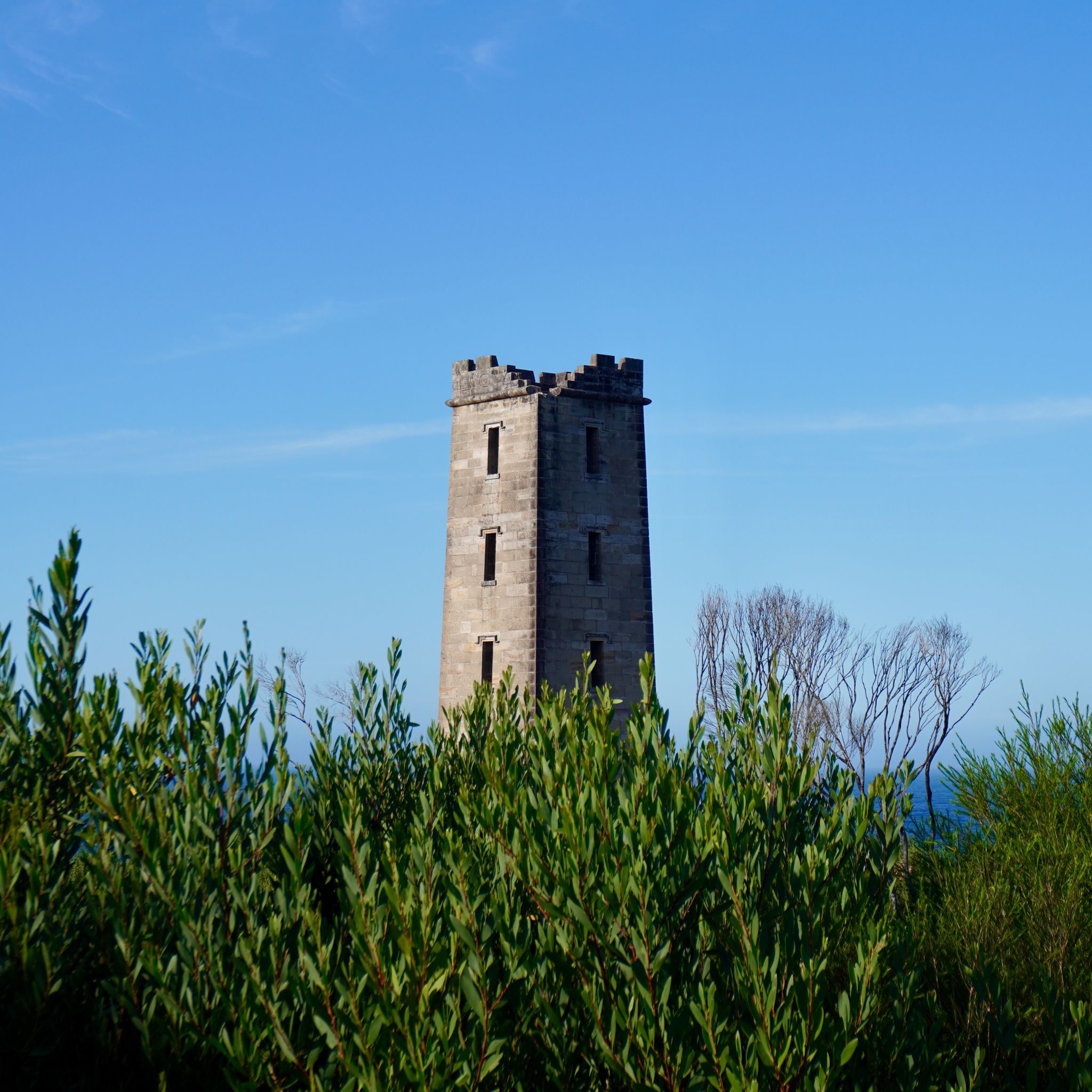
Just outside of Eden lies Beowa National Park, spanning 45 kilometres of jagged coastline. We drive along winding dirt tracks to reach the rocky Bittangabee Bay. The secluded creek exudes a peaceful stillness, its turquoise waters reflecting the untouched landscape that surrounds it. In the distance, the iconic Boyds Tower stands watch over the ocean, a remnant of the park's whaling heritage. It is now the perfect vantage point to spot whales during their annual migration.
EDEN, NSW
KM 9,846
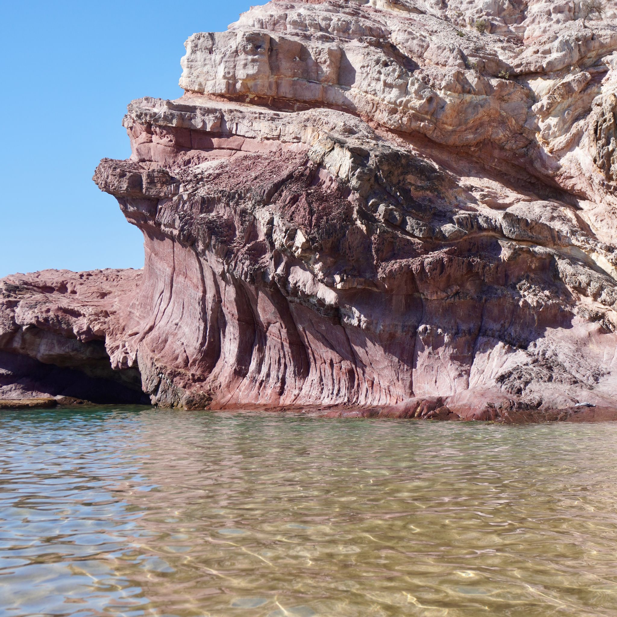
We continue our journey and cross the border to reach New South Wales’ southernmost outpost. Once a vibrant whaling station, Eden is now a sleepy coastal town. Surrounded by state forests, national parks and turquoise waters, the landscape is striking. We stroll through the historic streets, lined with buildings from a bygone era, until we reach the beach below. The man-made rock pool, nestled at the foot of the striking pink cliffs, provides the perfect place to cool down on our road trip.
WILSONS PROMONTORY, VIC
KM 9,290
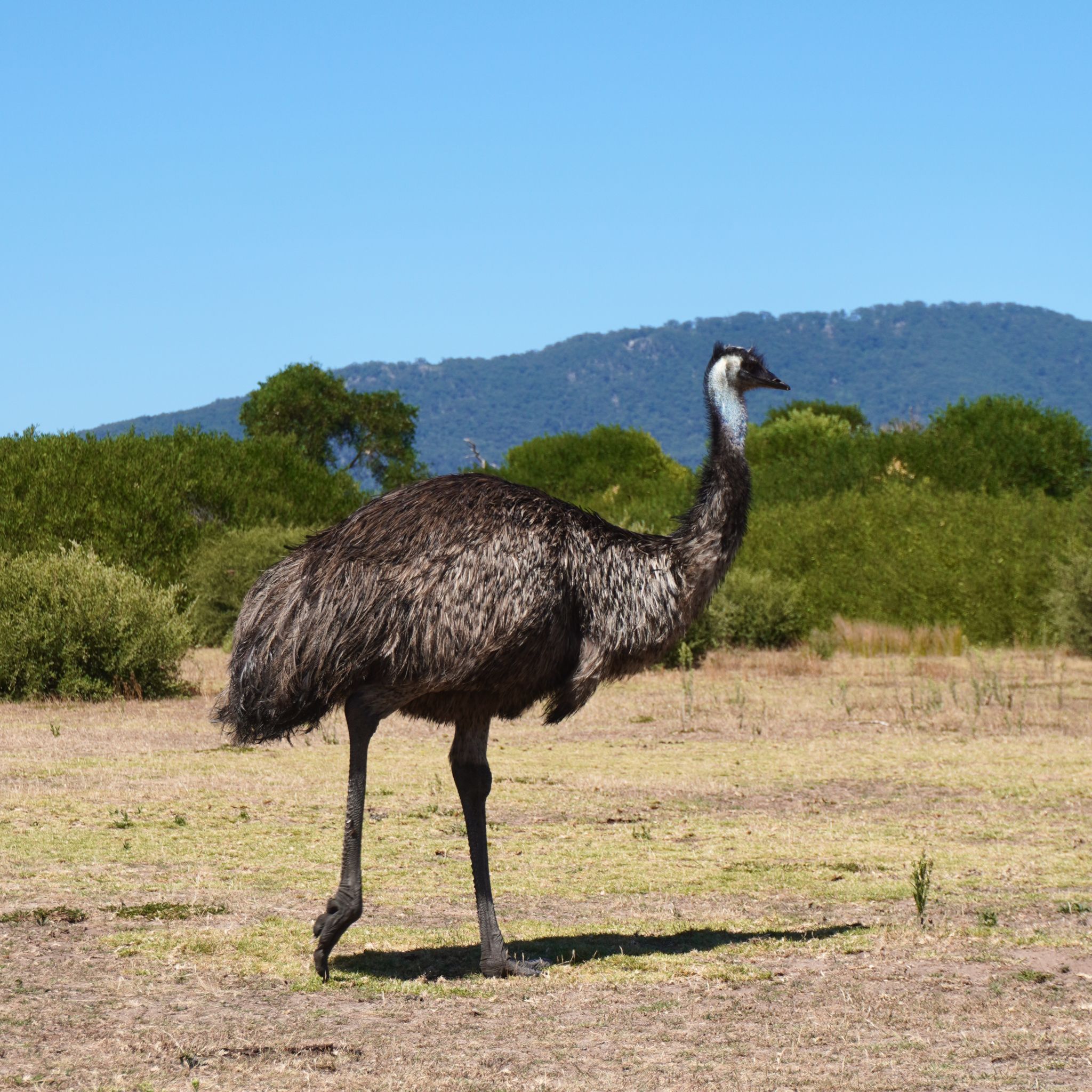
We keep driving eastward, hugging the Victorian coast's rugged curves as we near Wilsons Promontory. Towering grey granite boulders emerge, scattered across secluded sandy coves. We can get a glimpse of the round summit of Mount Oberon through a thick veil of clouds. The National Park teems with wildlife and we need to pause on several occasions to let wombats unhurriedly cross the road. An emu even stops by to say g’day.
PHILLIP ISLAND, VIC
KM 9,132
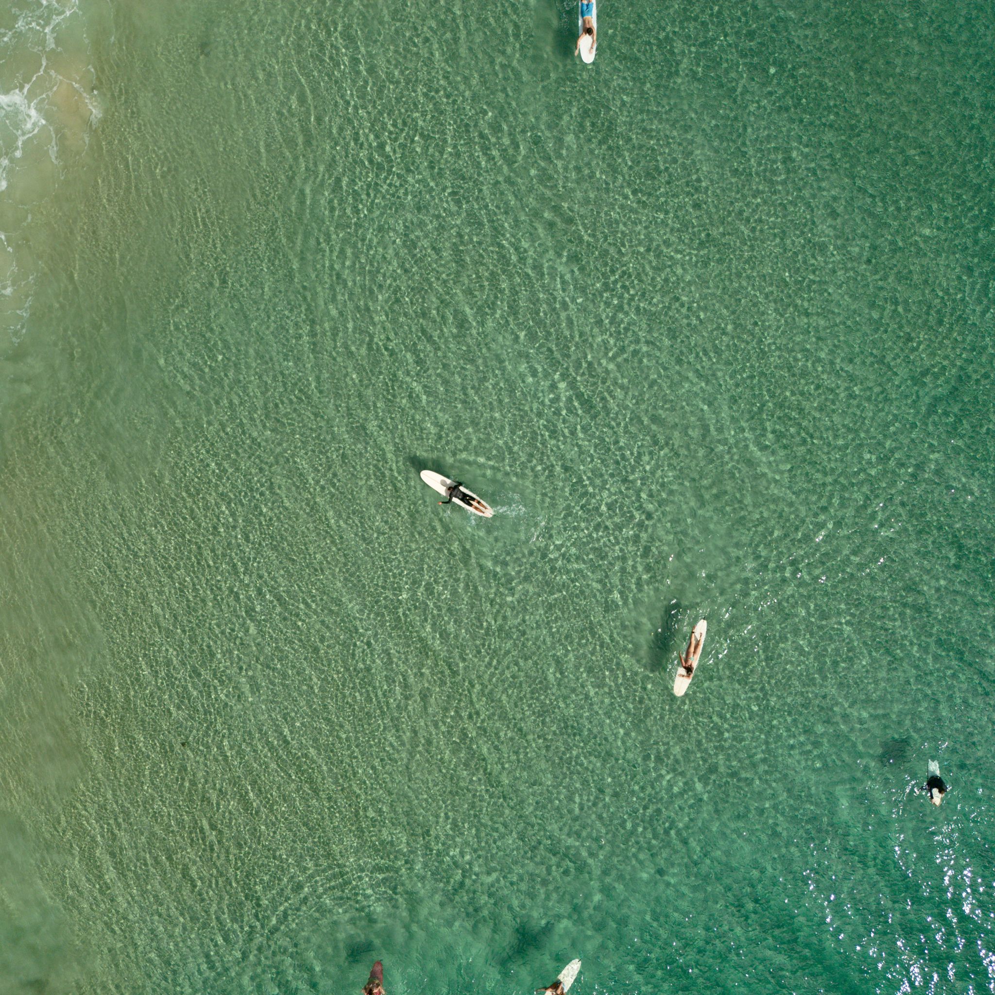
A short 90-minute drive away from Melbourne lies a surfer’s paradise. With its rugged coastline creating beaches and reefs facing different directions, no matter the wind and swell of the day, there will be a spot working on Phillip Island. From the moment you cross the bridge linking it to the mainland, you know you are on an island - the pace is a little slower, the people a little nicer. The locals are so welcoming and I have never experienced such a relaxed lineup in the surf. Everyone is cheering each other on and happy to share waves - a true surfer’s paradise.
SORRENTO, VIC
KM 8,719
Sorrento has to be one of Victoria’s best-kept secrets; coming from Sydney, we never heard of it before. This coastal village, located at the western tip of the Mornington Peninsula, is surrounded by water. On one side sits Port Phillip with its calm waters, while on the other lies the Bass Strait with its cliffs and ocean swell. The town centre is filled with historic limestone buildings, upscale shops, and trendy restaurants. But the highlight is Millionaire’s Walk - the path along the waterfront where grand mansions overlook the sea.
CRADLE MOUNTAIN, TAS
KM 8,263
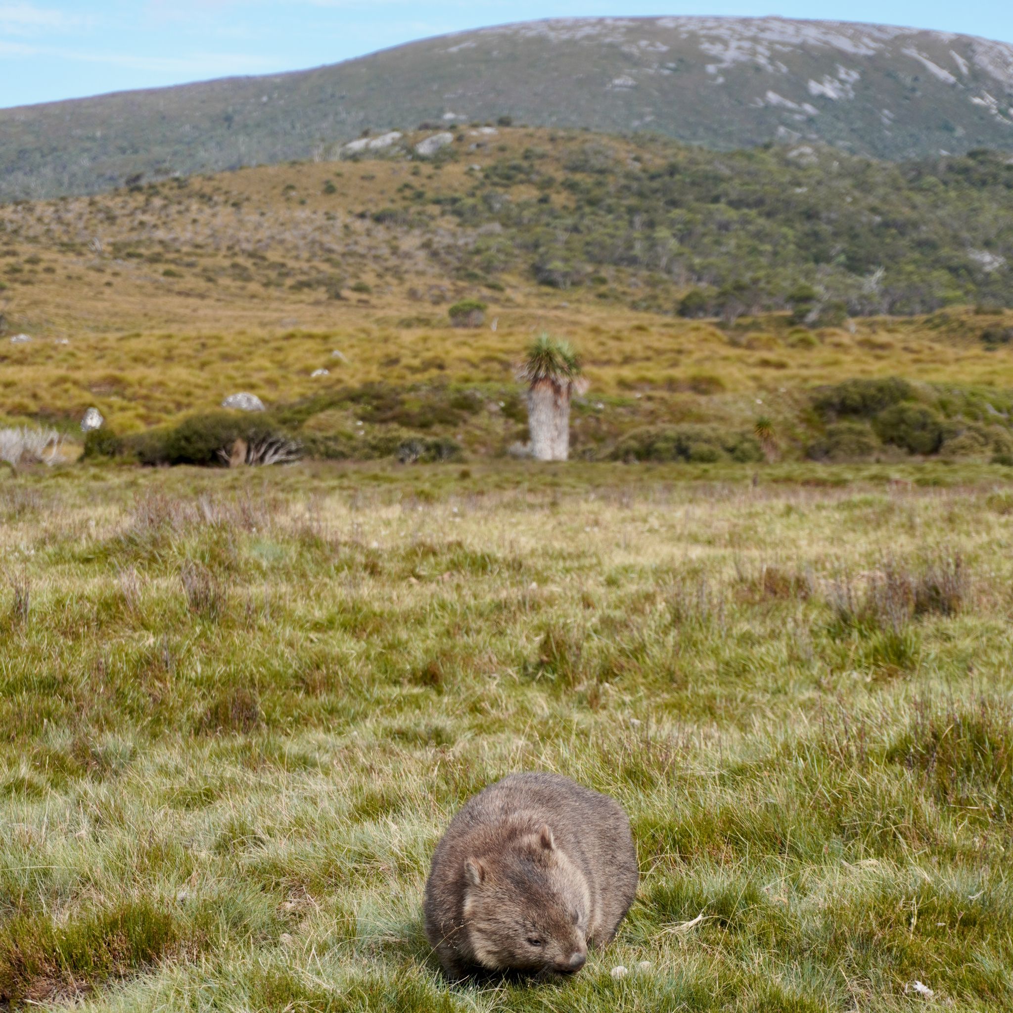
Cradle Mountain stands tall dominating the eponymous National Park. The kind lady at the visitor centre warns us; there is plenty to see and do here, and the two days we have planned won’t be enough. It’s a paradise for hikers and nature lovers. From a gentle stroll around Dove Lake to a steep climb alongside a rocky face to Marion’s Lookout, there is a trail for everyone. But our favourite part has to be watching the wombats at sunset from the boardwalk.
LAKE ST CLAIR, TAS
KM 7,993
Leeawuleena, or “sleeping water”, is nestled in the heart of Tasmania. The deepest freshwater lake in Australia, approximately 215 meters, has been carved out by glaciers over two million years. We walk between the towering eucalyptus and snow-gum woodlands looking for platypus. We were told we could see them here, but not today unfortunately. On our way North, we stop by Yingina, the Great Lake, for lunch; the red soil gives an extraterrestrial appearance to the place.
HOBART, TAS
KM 7,763
Next stop Antarctica. The southernmost state capital is also the second oldest Australian city. The port city was established on the Derwent River, sheltered from the rough Tasman Sea and now serves as a base for scientific expeditions to the South Pole. No matter where you are in Hobart, the gigantic presence of Mount Wellington can always be felt. It stands tall watching over the city.
MUSEUM OF OLD AND NEW ART, TAS
KM 7,758
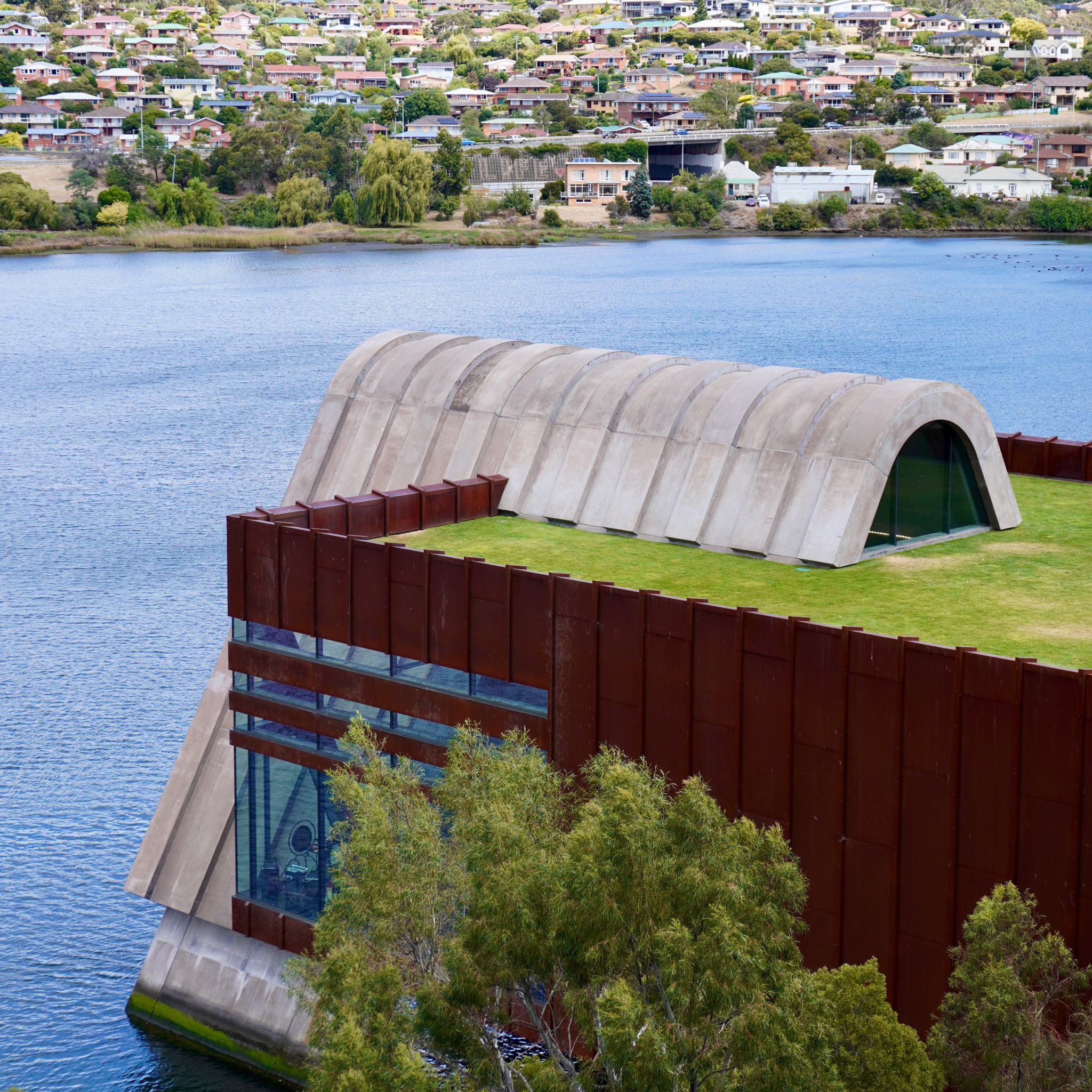
This controversial museum is the brainchild of David Walsh, a local that became rich developing a gambling software. It’s the kind of place where you can watch a robot eat and defecate next to an Egyptian sarcophagus. Luckily, we are visiting during the Faux-Mo festival and heaps of free concerts are organized on the grounds of the museum. There is enough arts and entertainment to keep us busy for the whole day. One thing is sure, the MONA definitely helps keep Tasmania wild!
BRUNY ISLAND, TAS
KM 7,498
An island, Bruny Island, off an island, Tasmania, off another island, Australia. The irony. All those who went there kept telling us how good it was; its rugged scenery, its playful waves, its unique wildlife and its gourmet food. However, we are not overwhelmed by the charms of the island. The landscapes are no better than other places in Tasmania, the surf is average and the oysters are not as good as the ones from home.
SWANSEA, TAS
KM 6,908
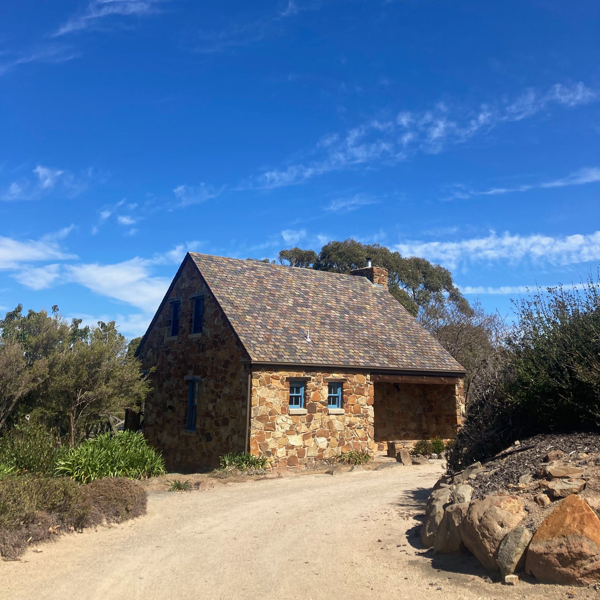
A proper bed with fresh linen, an oven and even a bathtub. We treat ourselves for Olive‘s birthday. The small stone cottage at Piermont Retreat faces the sea. We can watch the sun rising across the bay from our bed. And we spend the next two days enjoying the small luxuries that we are missing on our road trip.
FREYCINET NATIONAL PARK, TAS
KM 6,806
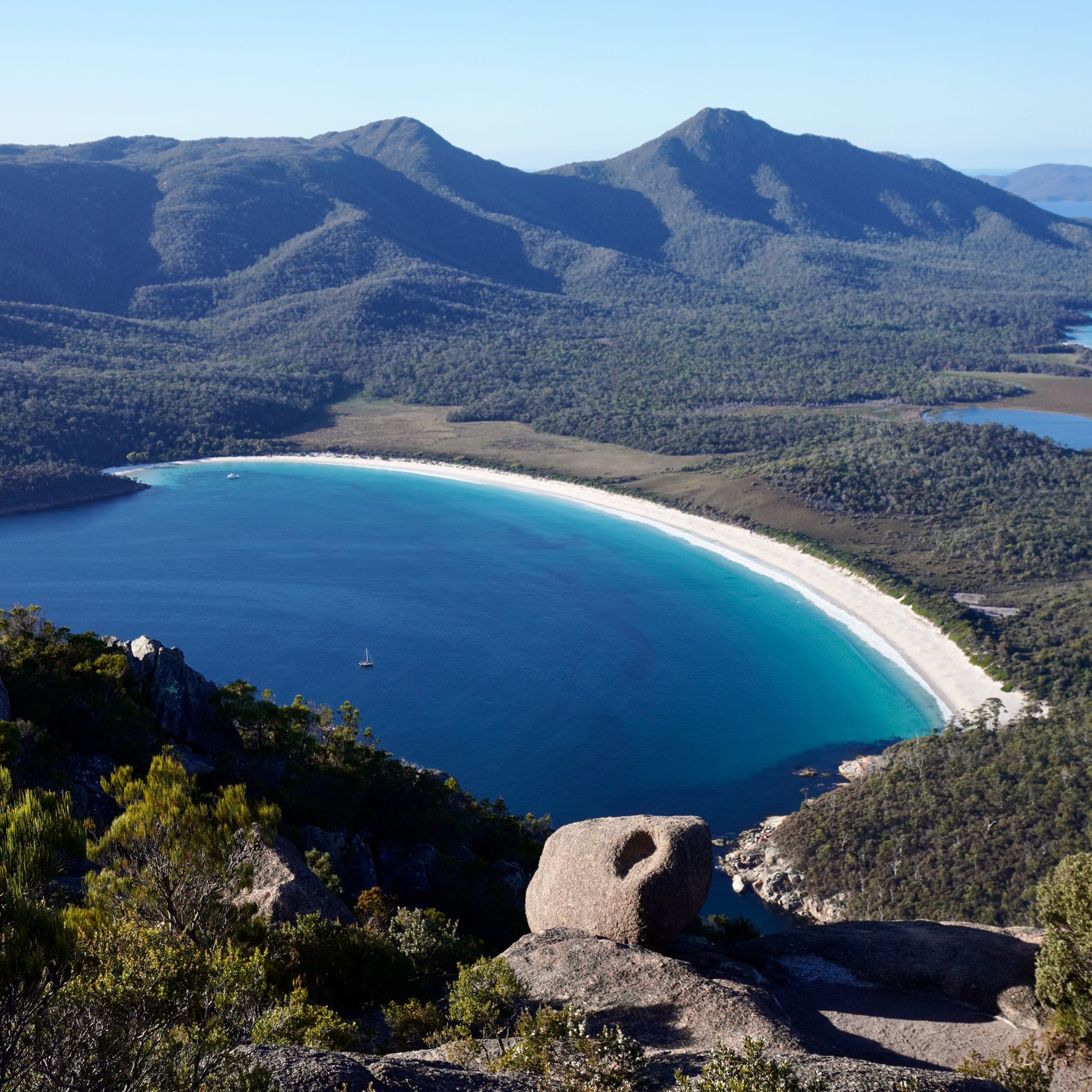
The Mount Amos track is said to be rather difficult but the « Hazard level: Extreme » sign at the beginning might be an overstatement, right? After a gentle slope uphill, the gravel path stops at the foot of a granite wall. The only way forward is on all four, scrambling up some rather big boulders. It is steep, slippery and pretty scary too. But at the top, the panorama of Wineglass Bay and the Hazards further convinces us it was worth it.
BAY OF FIRES, TAS
KM 6,578
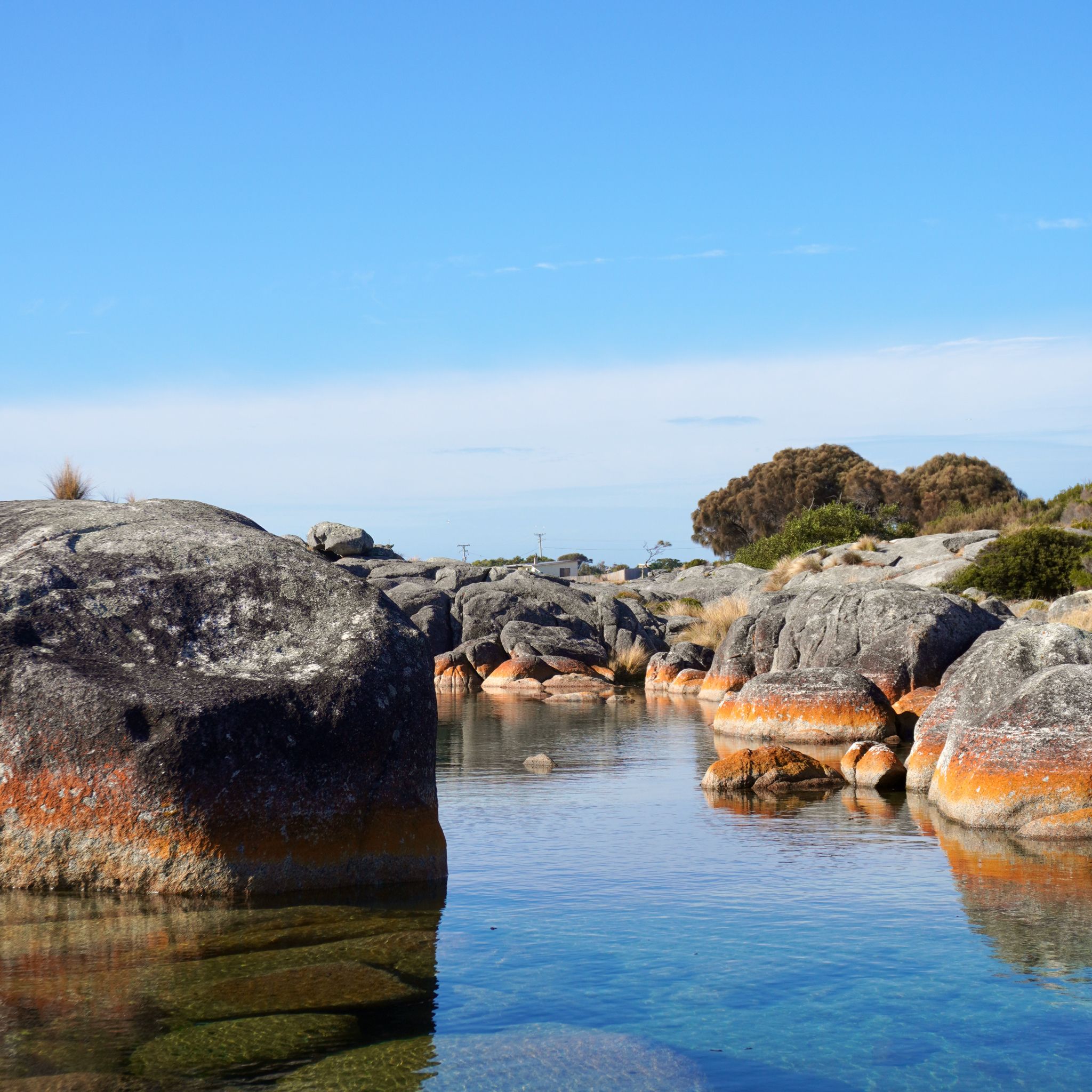
The Bay of Fires, on the Northeast coast of Tasmania, is celebrated for its beaches and is a must-do activity on a big lap. It is true they are picture-perfect with their white sand and pristine waters. One might be forgiven for thinking its name comes from the bright orange lichen covering the granite boulders in the area. It was named in the 18th century when Captain Tobias Furneaux spotted fires along the bay. They were used by the many aboriginal groups in the area to communicate.
SCOTTSDALE, TAS
KM 6,446
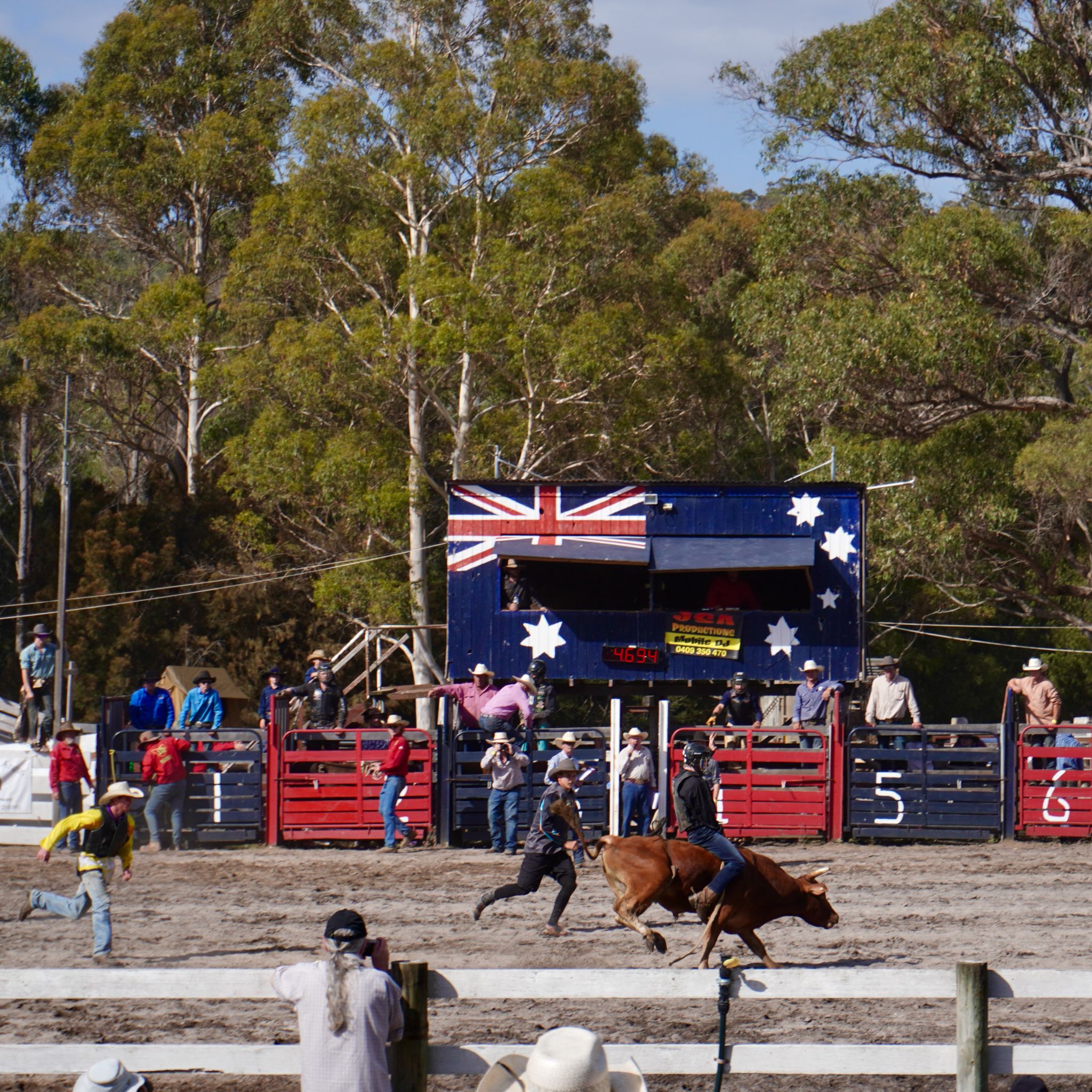
Hundreds of cars, dirty utes, and beaten up 4wds, are lining up to enter the arena. The dust bowl is packed. The first rounds of rope and tie, bareback horse riding, and barrel race warm up the crowd, but everyone is here for the bull riding competition. Reckless cowboys doing their best to remain on top of raging bulls, the show is both scary and impressive. From now on, I can say that it’s not my first rodeo.
LITTLE BLUE LAKE, TAS
KM 6,232
The Little Blue Lake, near Derby, might be one of the most photographed places in Tasmania. Chalky white cliffs and turquoise waters, the contrast is eye-catching. The man-made hole is a result of past mining operations in the region. As inviting as it looks, we cannot swim there. The high content of mineral makes the place unsafe.
SCOTTSDALE, TAS
KM 6,114
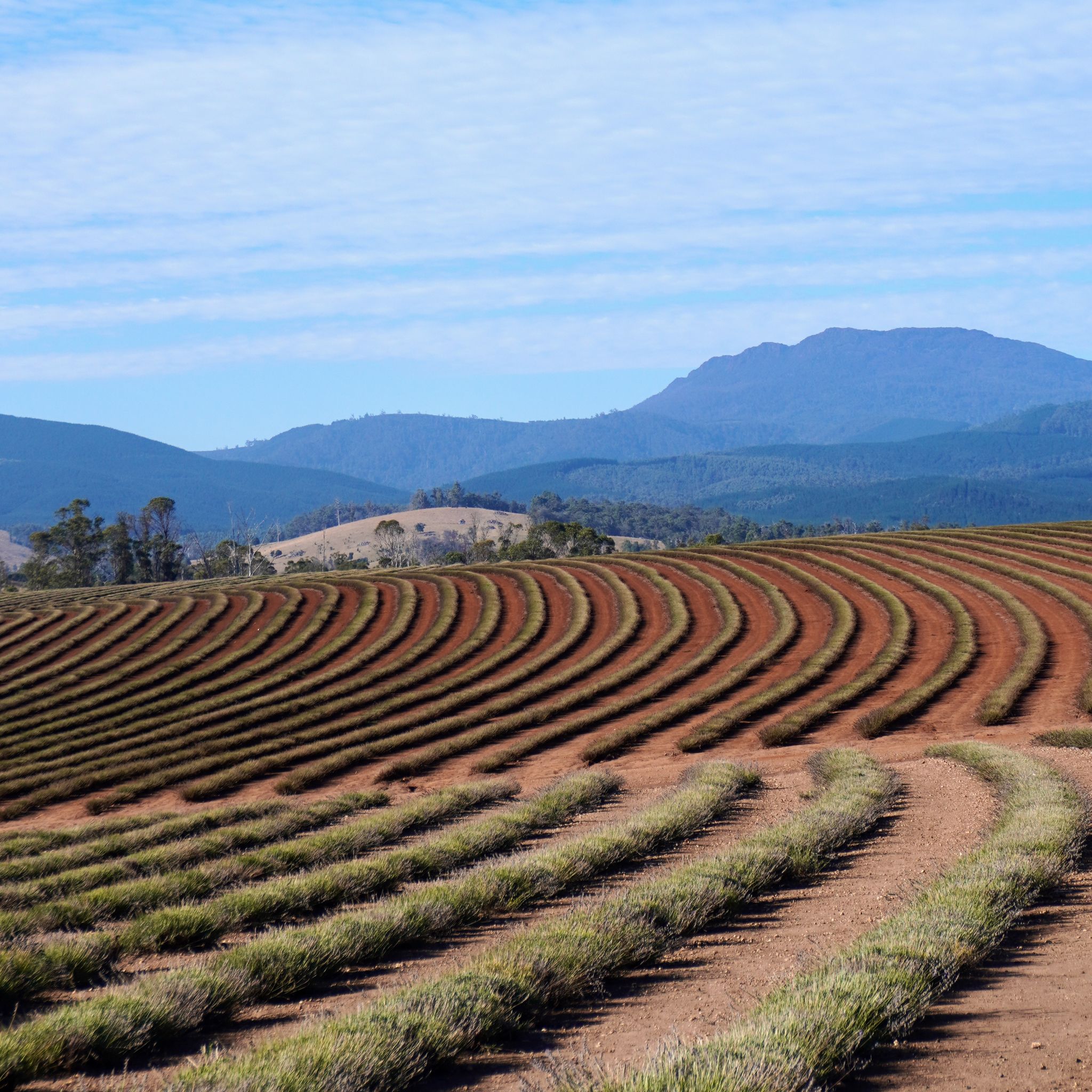
Everyone told us about the Bridestowe Lavender Estate near Scottsdale. So we have to go! The best time visit is from December to early February. We are a bit late . We can only image how good it would have looked with the purple flowers.
LAUNCESTON, TAS
KM 5,918
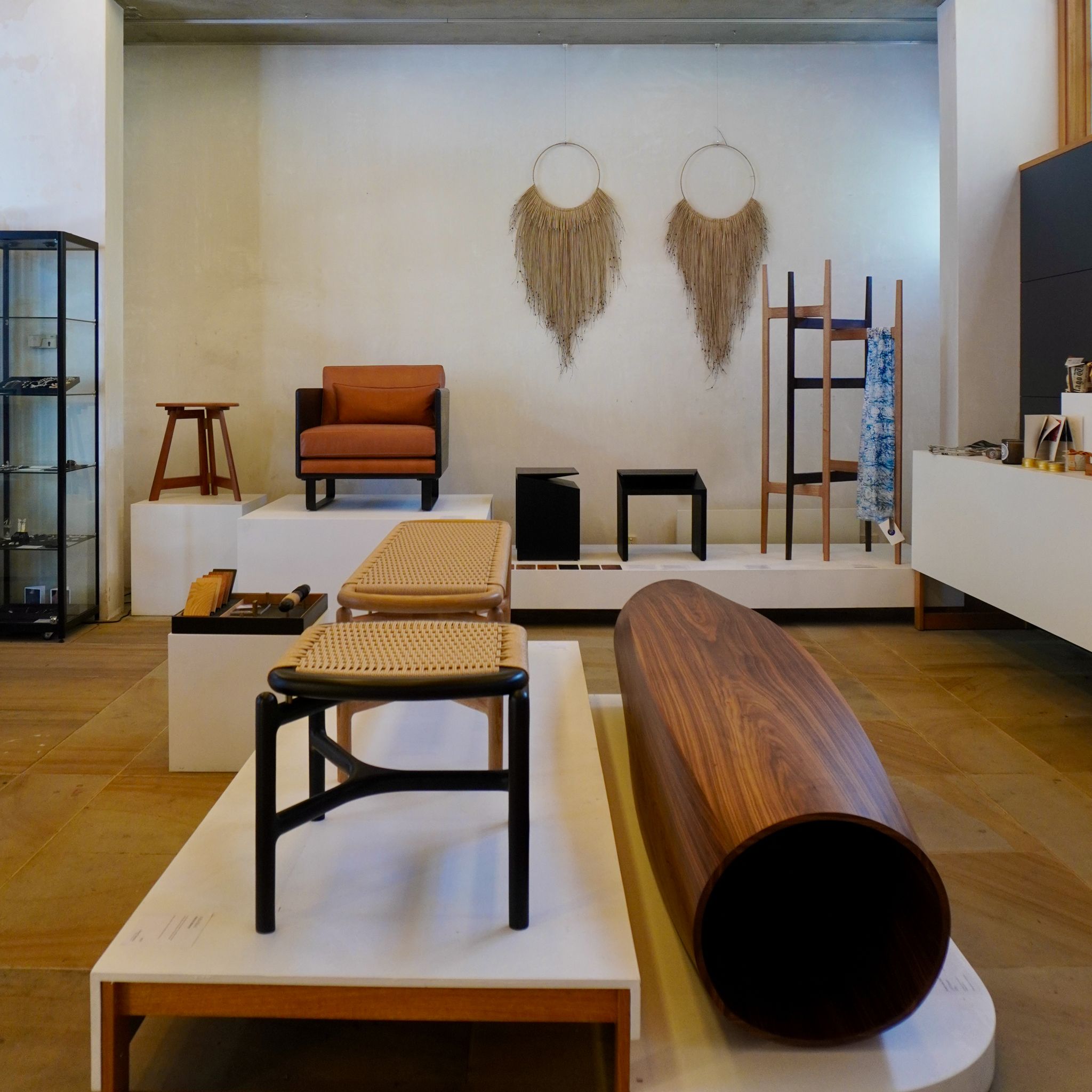
«The best shop in Tasmania», says the gentlemen at the door when we enter Design Tasmania. The design centre, gallery, and shop displays work of local designers and makers. Launceston is lucky to have plenty of galleries and museums. Art ARK for ethical aboriginal artwork, Dada Muse for the Salvador Dali collection, or the Queen Victoria Museum for the Natural Sciences exhibition. Enough to keep us busy for the day.
LAUNCESTON, TAS
KM 5,790
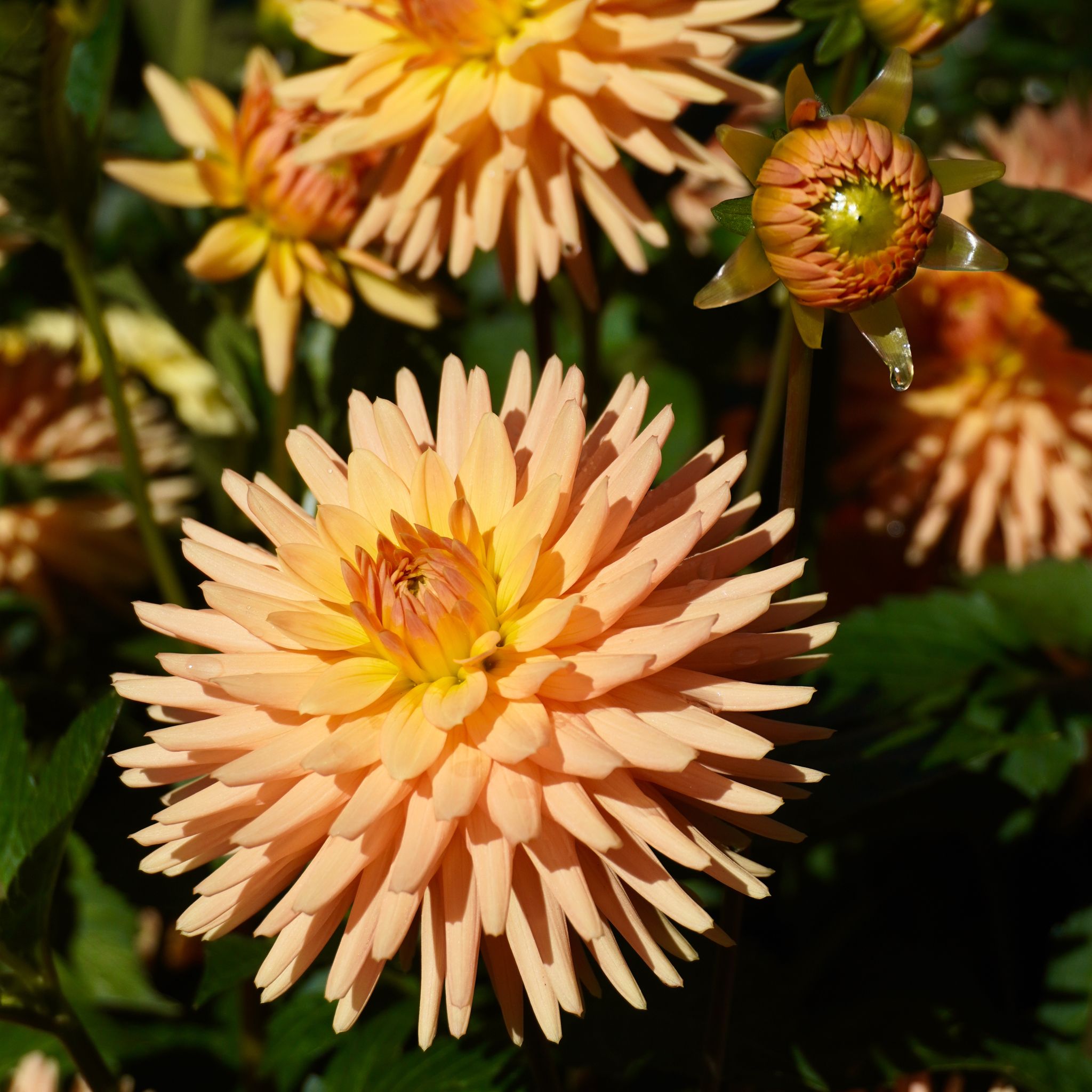
On our road trip along kanamulka / River Tamar, Launceston appears in the distance. Tasmania’s second largest city is welcoming on a warm sunny day. The architecture is elegant, a mix of historic and contemporary buildings. The city park is a green oasis in the heart of the city. We are in luck, the dahlias are blooming.
MONTEZUMA FALLS, TAS
KM 5,612
The Wild West coast of Tasmania is made of roads zigzagging through mountains, sometimes up the crests, sometimes down the bottom of valleys following riverbeds. It offers plenty of opportunities to stop and Montezuma Falls are the perfect break on our way back North. Named after the silver mining company working in the area, these falls are some of the highest on the island. Under the fern canopy, we follow the old tramway line that linked the smelters to the mining operation. We reach a suspended bridge overlooking a gorge and the falls in front of us.
CORRINA, TAS
KM 5,335
To get to Strahan from Marrawah, on Tasmania’s West coast, you have two options. You can either backtrack and go back to Burnie via the highway and then head South. It is faster, but pretty boring. Or you can drive on 100 kilometres of dirt road to reach Corrina and then take a barge to cross the Pieman river and take a barge in Corrina. Of course, we pick the second option.
TABLE CAPE, TAS
KM 5,127
Five kilometres out of Wynyard, on Tasmania’s north coast, Table Cape dominates the landscape. The dead volcano, towering at 180 meters, offers spectacular views on nearby farms. It is also the home of a tulip farm attracting tourists and photographs every spring. When we visit, the flowers are no longer blooming. But it still makes for an interesting picture.
SHEFFIELD, TAS
KM 4,928
Tonight, we sleep on the bank of Lake Barrington. The artificial lake, a reservoir for the Devils Gate power station nearby, is an angler’s dream. The Inland Fisheries Service stocks it for recreational fishing. During the day, boats speed by, families have lunch on the grass, and fishers fish on the shores. At night, the starry sky reflects on the still water.
SPIRIT OF TASMANIA, VIC
KM 4,700
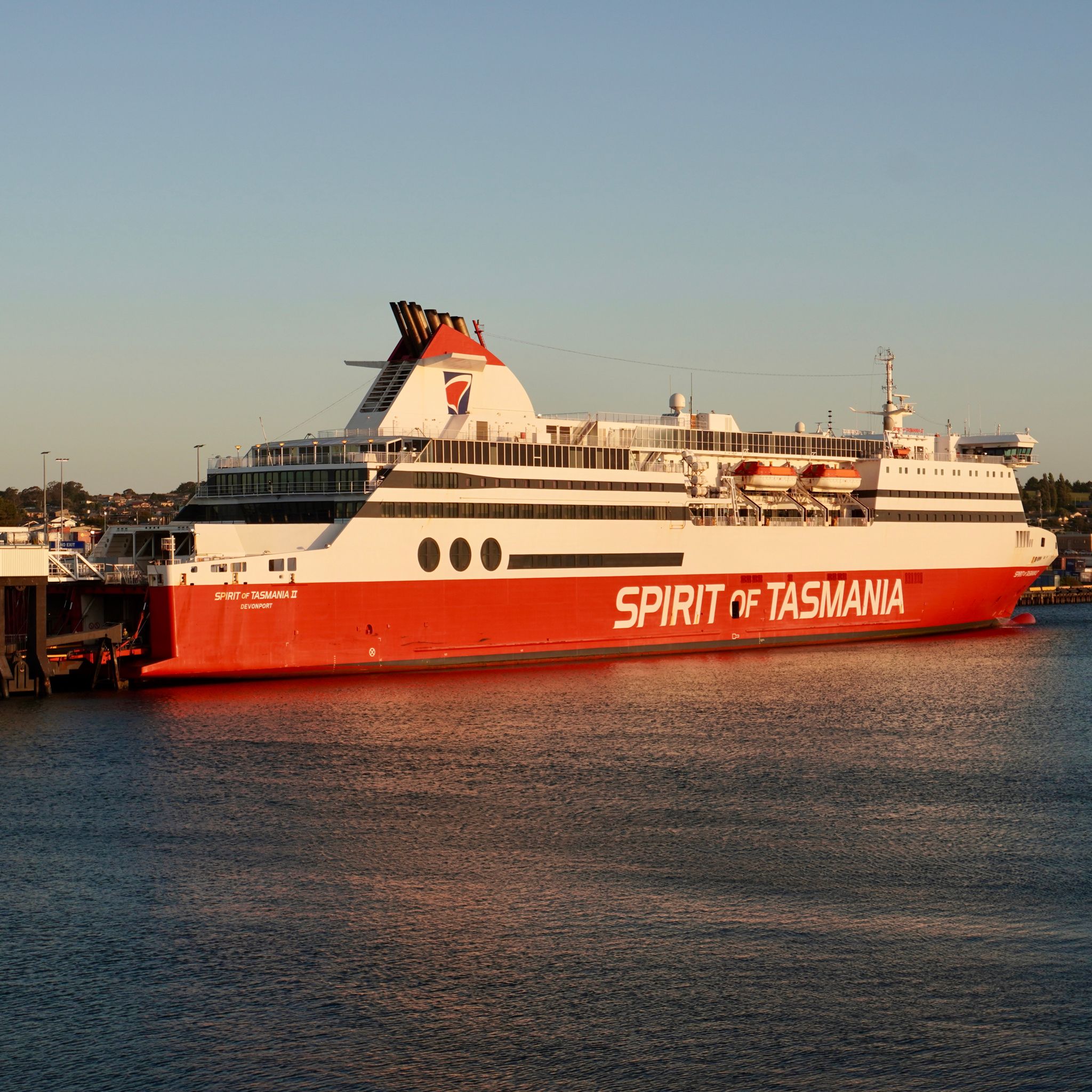
All aboard the spirit of Tasmania. Over 15,000 years ago, Australian sixth state was joined to the mainland. It is now 240km away across the Bass Strait, or a short eight-hour ferry ride. The Spirit of Tasmania connects Devonport to Geelong twice a day. As the vessel leaves port, the wind starts to pick up and so does the swell, it is a rocky crossing for us.
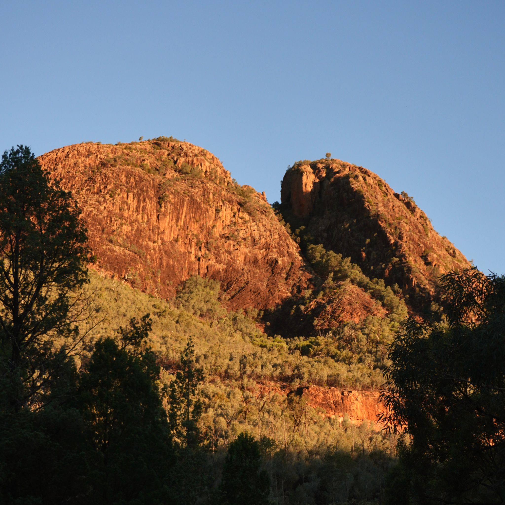
GRAMPIANS, VIC
KM 3,817
As we drive, North from the coast, we can see the shapes of Mount Sturgeon and Mount Abrupt growing in the distance. These two mountains mark the beginning of the Grampians National Park. Gariwerd, the aboriginal name for the mountain range, was created by the great ancestor spirit Bunjil. During the process, he often took the form of Werpil the Eagle to view his work. The region is pivotal for aboriginal communities in Victoria and has the largest number of rock art sites in southern Australia.
CAPE BRIDGEWATER, VIC
KM 3,546
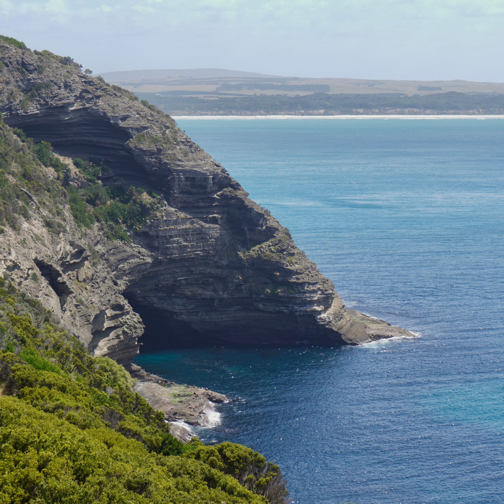
After two weeks in the outback, we catch our first glimpse of the ocean since starting our big lap when we arrive at Cape Bridgewater. The coastal town has a population of 150 inhabitants and more than 650 seals. Two colonies of Australian and New Zealand fur seals share the breeding area. A two-hours trail along the coastline leads to a viewing platform where we can catch sight of a cave that was once used by sailors to protect their boats. The place is now the territory of the seals.
SEA LAKE, VIC
KM 2,947
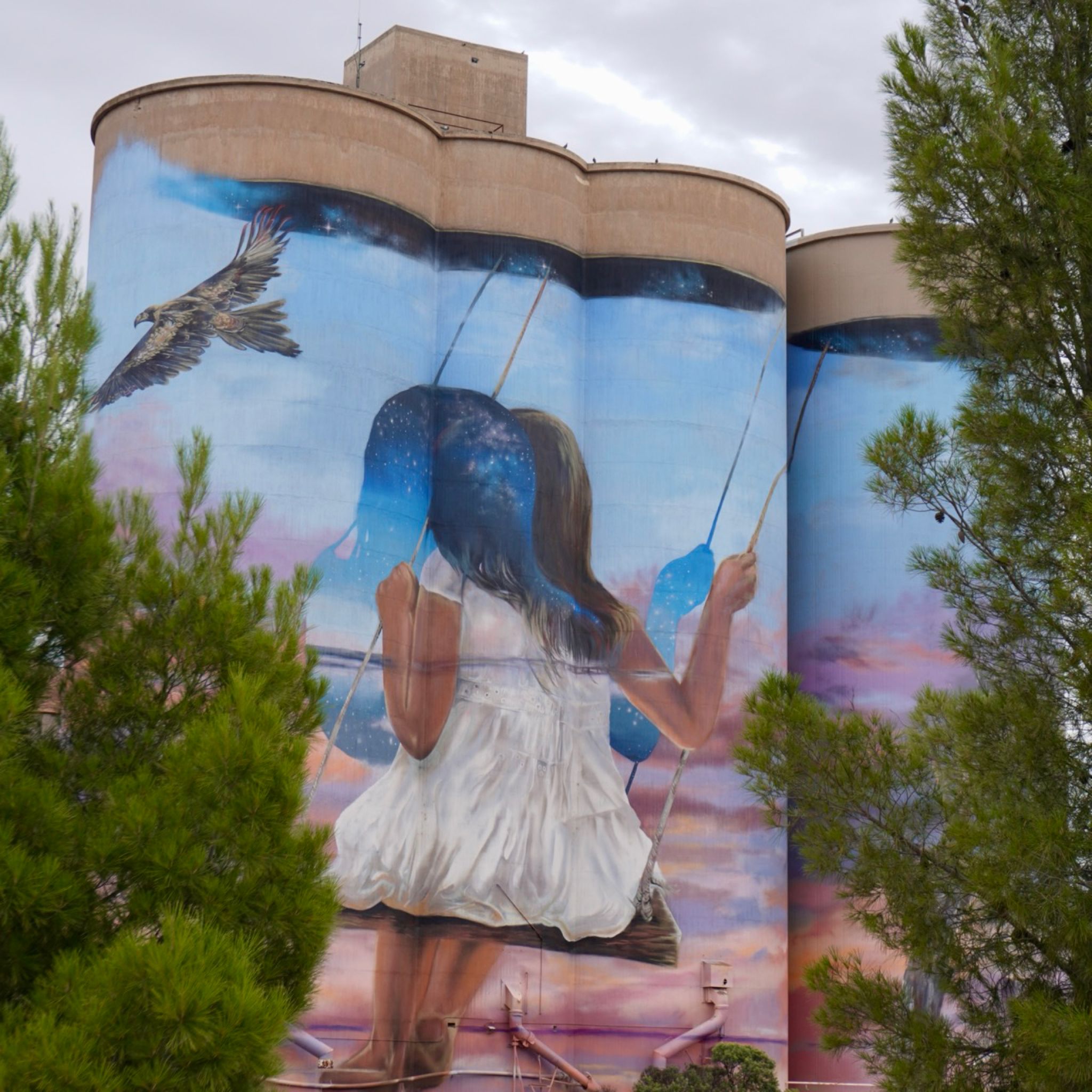
We keep driving South after crossing the Victorian border, following the Silo Art Trail. Various farming silos have been painted by international artists to create a 700km journey connecting 16 rural towns in the Wimmera Mallee. The artworks are varied and celebrate the history of each host town. The piece in Sea Lake, created by Drapl & The Zookeeper, represents a young girl swinging from a Mallee Eucalyptus. It is a celebration to the still and calmness found in outback Victoria.
LAKE MUNGO, NSW
KM 2,503
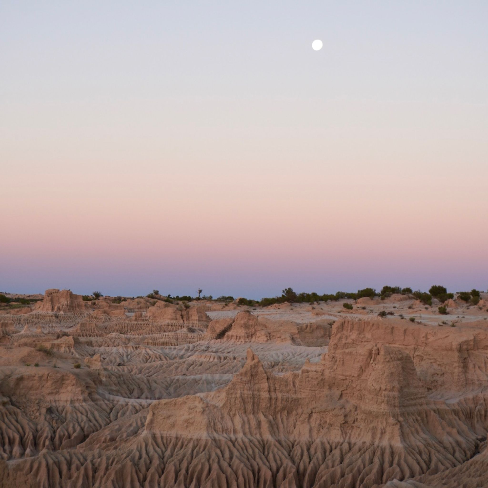
The road to lake Mungo goes through hundreds of kilometers of unsealed road and a thick cloud of dust forms behind the car. The scenery becomes greener; small shrubs turn into fully fledged trees on either side of the road as we get closer to the Willandra lakes region. Once a fertile aquatic environment used by aboriginal tribes to fish, lake Mungo is now dried up and forms a vast grassland. The Walls of China, cliffs of sand and clay eroded by centuries of westerly wind, are located on the eastern shore of the lake. At dusk, the white cliffs turn pink in the setting sunlight.
BROKEN HILL, NSW
KM 1,924
Wild goats are everywhere in the Far West and we see more of them than kangaroos on our road trip to Broken Hill. After hours driving in an ocean of red dust, the mining town appears like an oasis in the desert. The Silver City, is located near the border with South Australia, and despite being in New South Wales, it shares the same time zone as its neighboring state. We visit the Main Street and its heritage listed buildings before going to the outskirts of the city, to the Living Desert park. From there, we watch the sun set over the sculptures made of sandstone.
COBAR, NSW
KM 1,274
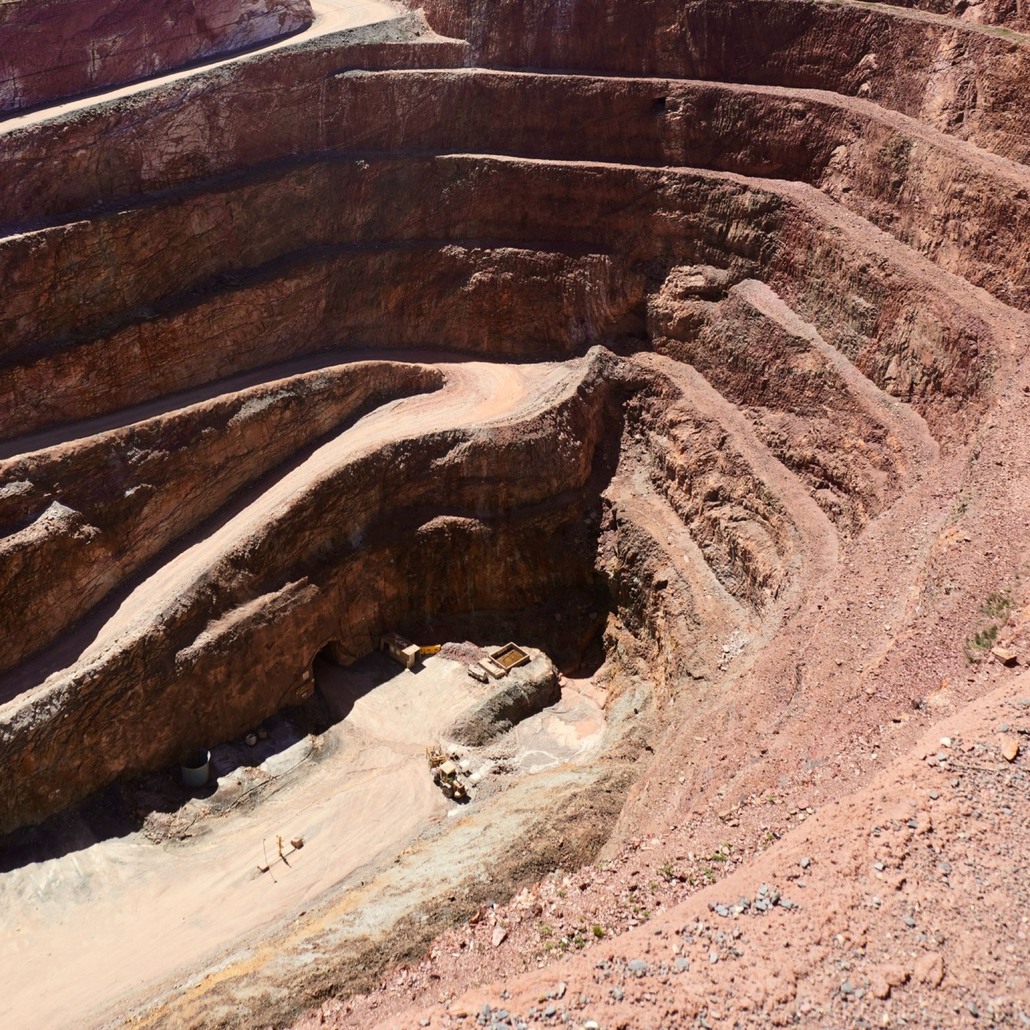
The soil turns a darker shade of red as we get deeper into the great outback. There is no wind and the sun is burning high in the sky, the thermometer shows 43°C. We reach Cobar in the early afternoon. The sign on a massive concrete wall at the entrance of the town is a reminder of the town’s glorious mining history. We drive South to reach Fort Bourke Hill’s lookout overhanging an open gold mine.
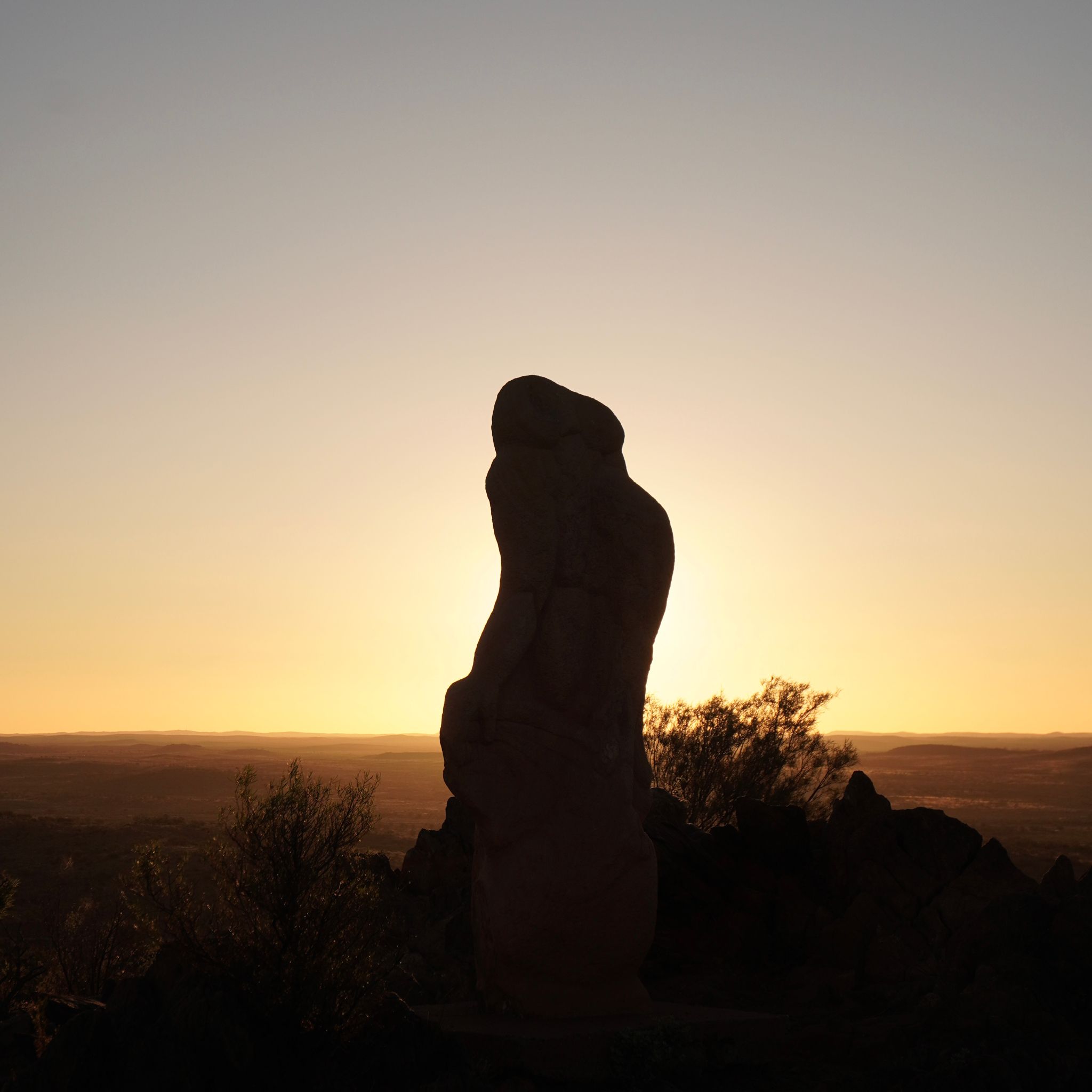
WARRUMBUNGLE, NSW
KM 929
The sun sets on Split Rock in the Warrumbungle National Park. The rocky face changes color as the sun gets lower. The park has a lot to offer. Bush walks during the day and watching the stars at night. Australia’s first Dark Sky Park is renowned for its stargazing opportunities with low light pollution, low humidity and high altitude.
WARRUMBUNGLE, NSW
KM 909
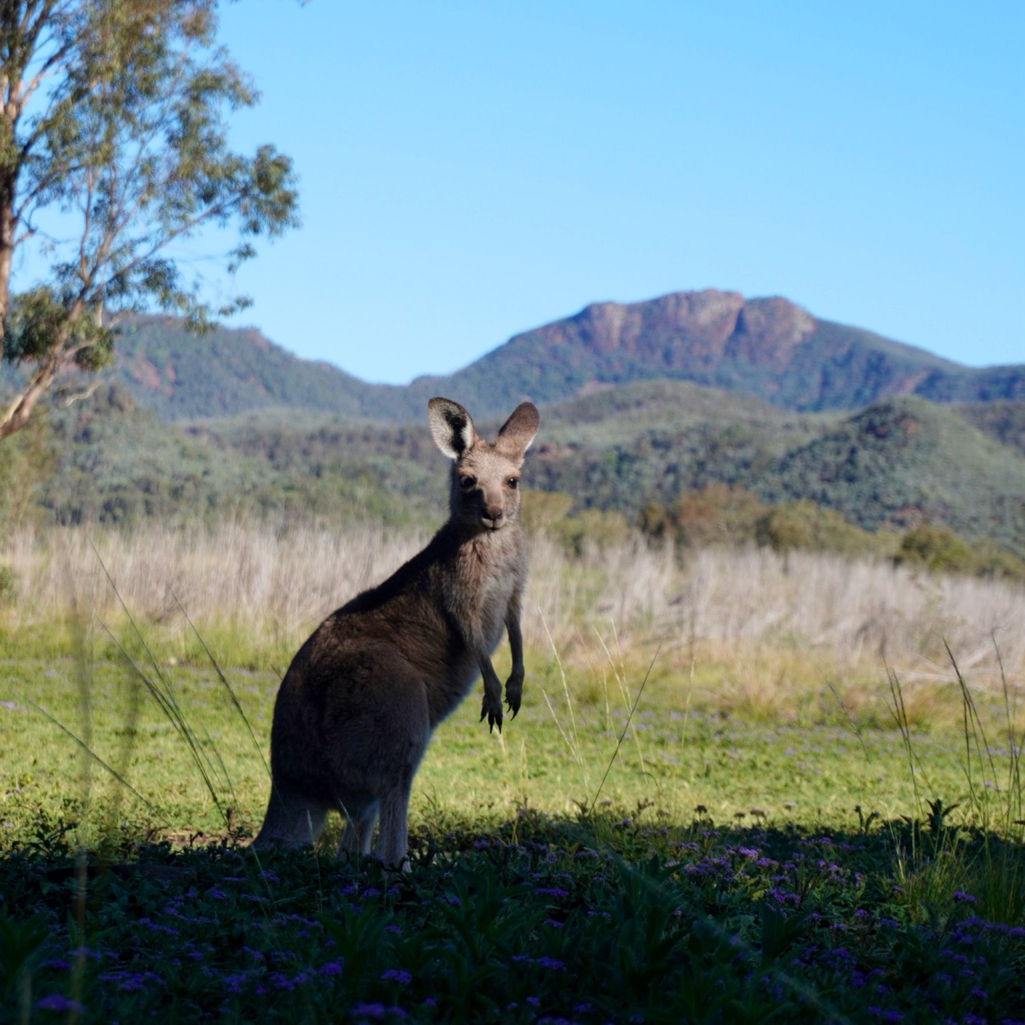
Our last stop before entering the Great Outback. We reach the Warrumbungle National Park on a sunny day. After climbing a thousand steps to reach Fans Horizon and its view on the valley below, we get back to camp. Eastern grey kangaroos are here to welcome us.
PORTLAND, NSW
KM 414
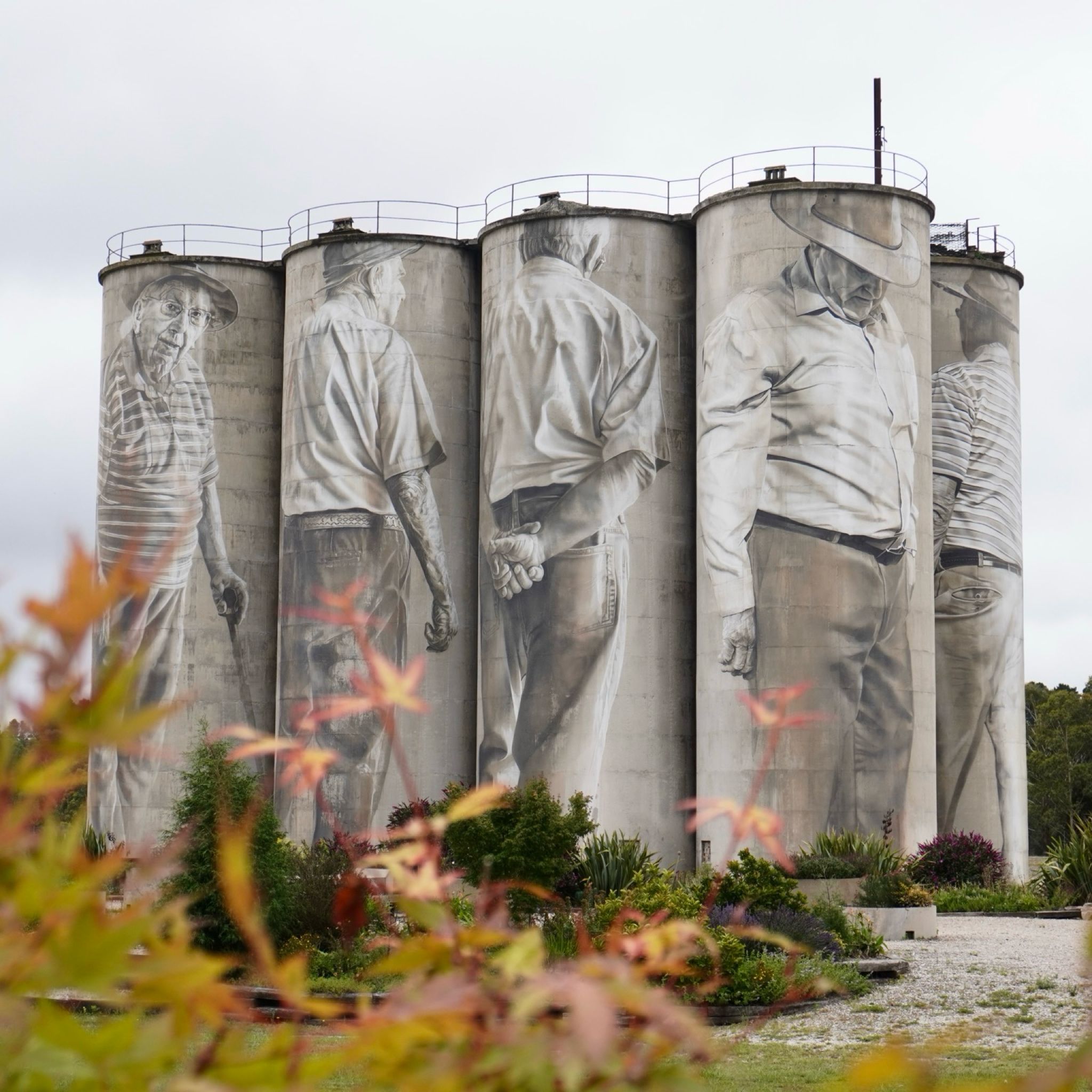
We drive through dirt tracks following the Turon river South. Bob Dylan’s Bloods On Tracks plays on the radio. The road unwinds through gently rolling hills. As we reach Portland, we can see the paintings on the silos from the distance. This piece painted by Guido Van Helten in 2018 is a tribute to Portland’s glorious industrial past.
MANLY, NSW
KM 0
Today, we hit the road. After two years of planning our big lap, the car is packed. We are headed West towards New South Wales’s outback. Our first stop is Sofala on the Turon river. The small town was once famous during the gold rush in the nineteenth century.